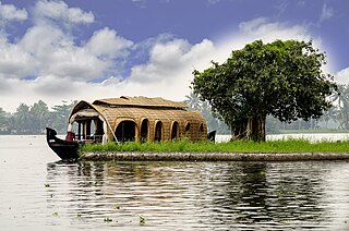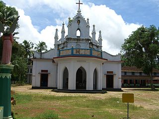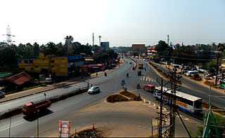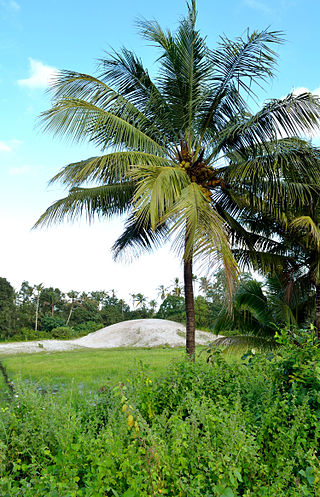
Alappuzha district, is one of the 14 districts in the Indian state of Kerala. It was formed as Alleppey district on 17 August 1957, the name of the district being changed to Alappuzha in 1990. Alappuzha is the smallest district of Kerala. Alleppey town, the district headquarters, was renamed Alappuzha in 2012, even though the anglicised name is still commonly used to describe the town as well as the district.

Kottayam is one of 14 districts in the Indian state of Kerala. Kottayam district comprises six municipal towns: Kottayam, Changanassery, Pala, Erattupetta, Ettumanoor, and Vaikom. It is the only district in Kerala that does not border either the Arabian Sea or another Indian state.

Kokkamangalam also known as Gokkamangalam is a village in Alappuzha district of Kerala state, south India. It is situated in between Cochin and Kumarakom and on the western shore of Vembanad Lake, 5 km east of the town of Cherthala, which has the nearest railway station.

Kumarakom is a tourism destination located near the city of Kottayam, in Kerala, India, known for its backwater tourism. It is set in the backdrop of the Vembanad Lake, the largest lake in the state of Kerala. In January 2023, when Kerala was listed by The New York Times in their "52 places to go in 2023" list, Kumarakom got a special mention for its backwater tourism.
Cherthala is a municipality in the Alappuzha district of Kerala, India and act as satellite town of kochi. It is located 20 km (12.4 mi) north of the district headquarters in Alappuzha and about 146 km (90.7 mi) north of the state capital Thiruvananthapuram. As per the 2011 Indian census, Cherthala has a population of 45,821 people, and a population density of 2,727/km2 (7,060/sq mi).

Alappuzha, also known as Alleppey, is a municipality in the Alappuzha district of Kerala, India. It is the district headquarters of the district, and is located about 130 km (80.8 mi) north of the state capital Thiruvananthapuram. As per the 2011 Indian census, Alappuzha has a population of 240,991 people, and a population density of 3,675/km2 (9,520/sq mi).

Thalayolaparambu is a town situated in Kottayam district in Kerala, India. Spanning over an area of 19.3 square kilometres with a population of 22,571 people, this mini-town is home to some of the well-known personalities such as the former Chief minister of Travancore-Cochin A. J. John, Anaparambil, the late Malayalam novelist/writer Vaikom Muhammed Basheer, the former Chief Justice of India K. G. Balakrishnan, and KK. Thalayolaparambu also hosts the major market established during the administration of Velu Thampi Dalawa, and is one of those few Keralite markets that still retains its old-world charm till date.

Aroor is a town situated in the Alappuzha district in Kerala, India. It lies on either sides of National Highway 66 as well as at the border of Alappuzha and Ernakulam districts. India's longest elevated highway is under construction from Aroor to Thuravoor. Aroor is famous for seafood processing and exporting industries.
Kuzhuppilly is a suburb of Kochi city and a tourist destination in Vypin Island in Kerala, India. The areas in Kuzhuppilly village are Pallathamkulangara, Cheruvaipu, Thundippuram, Manappally, and Ayyampilly.

Pallippuram is a village located 5 kilometres (3.1 mi) from Cherthala in the Alappuzha district of the Indian state of Kerala.

Poochakkal is part of a small island consisting Arookutty, Panavally, Thycattusserry and Pallippuram Panchayaths close to the Kerala Backwaters in Kerala, India. Until the 2006 Kerala Assembly Elections, Poochakkal was part of the Cherthala LAC. After delimitation from the 2011 elections, it became a part of Aroor LAC.
Karunagappally is a municipality in the Kollam district of Kerala, India. It is 24 km north of Kollam and 60 km (37 mi) south of Alappuzha. Karunagappally taluk consists of Alappad, Ochira, Adinad, Karunagappally, Thazhava, Pavumba, Thodiyoor, Kallalibhagom, Thevalakkara, Chavara, Neendakara, Clappana, Kulasekharapuram, Thekkumbhagam, Ayanivelikulangara, Panmana, Ponmana and Vadakumthala. The taluk is bound on the north by Kayamkulam, on the east by Kunnathur taluk, on the south by Kollam and on the west by the Arabian Sea. It is one of the fastest developing towns in Kerala and is part of Kollam metropolitan area.

Kuthiathode is a gram panchayat in Alappuzha district in the Indian state of Kerala. It is only 20 minutes away from Kochi city.
Mannancherry is a village in Alappuzha district in Kerala, India. It is situated about 10 km north of Alappuzha town. Vembanad Lake forms the eastern boundary of the village. In governance, Mannancherry is a Panchayat. In parliamentary representation, it is part of the Alappuzha Assembly constituency, as well as the Alappuzha LokSabha constituency. The primary occupation of the village's inhabitants has been coir-making for the past several decades.

Vechoor is a village in Vaikom taluk, Kottayam district in the state of Kerala, India. Vechoor is a short drive away from one of Kerala's tourist destinations, Kumarakom. The Vechur Cow breed of cattle is named after this village.

Thuravoor is a Gram Panchayat in Aluva Taluk of Ernakulam District in the South Indian state of Kerala. Thuravoor Grama Panchayath is nearly 5 km from Angamaly Town. The Panchayat covers 12.13 km2 in area. The borders of this panchayat are Mookkannoor and Manjapra Panchayat in the north, Manjapra, Malayattoor-Neeleeswaram Panchayat in the East. Kalady panchayat and Angamaly Municipality in the south, and Karukutty and Mookkannoor Panchayat on the west.

Thuravoor is a gram panchayat in the Pattanakkad Block of Cherthala Taluk of the Alappuzha District, State of Kerala, India. It comes under Aroor Assembly constituency. Thuravoor lies under Kochi UA in future. A four lane(six lane is progressing) National Highway 66 passes through the village, which along with a railway station gives it excellent connectivity with the remainder of the state. Thuravoor is famous for the Narasimha Swamy temple which is dedicated to the fourth incarnation (avatara) of Vishnu, the Narasimha. The temple has two main deities, the Vadakkanappan and the Tekkanappan, which is rare among the temples of Kerala. The new 6 lane elevated highway is from Thuravoor to Aroor. Upon completion, it will become the longest elevated highway in the country. Thuravoor is a rapid developing town. It lies in Aroor Assembly constituency. Thuravoor Kumbalangi road is a main road parallel to NH 66. Thuravoor is the major entry to Kochi city.
Parayakad, Alappuzha is a village in Kuthiathode gram panchayat, India. in Cherthala Taluk in Alappuzha district in the Indian state of Kerala. There is another place known as Parayakad or Parayad in Ernakulum District. This is a small area / block (muri) in Chittattukara Village in North Paravoor. Parayakad Village in Alleppey district is listed in the Central Government Indian Village Directory. Kuthiathode comes under the Pattanakad Block in Aroor Assembly constituency.
The following are some of the industries in Cherthala, Kerala, India.


