This article needs additional citations for verification .(March 2016) |
Vythiri | |
|---|---|
town | |
 Veterinary University | |
 Vythiri Location in Kerala, India  Vythiri Vythiri (India) | |
| Coordinates: 11°32′59″N76°02′11″E / 11.54966°N 76.03638°E | |
| Country | |
| State | |
| District | Wayanad |
| Languages | |
| • Official | Malayalam, English |
| Time zone | UTC+5:30 (IST) |

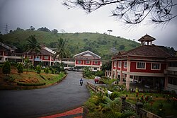
Vythiri is a town and a taluk located in Wayanad district in the Indian state of Kerala. [1] Along with Mananthavady and Sulthan Bathery, it is one of the three taluks in the district. Vythiri spans a total area of 2.084 sq. km.


