Varada

Last updated

Varada River
Banavasi varadariver side.jpg
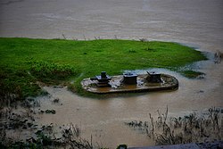
Varada river at Banavasi
Location
CountryFlag of India.svg  India
StateFlag of India.svg  Karnataka
Region Malenadu
Districts Uttara Kannada
Shivamogga
Haveri
Cities Banavasi
Sagara
Physical characteristics
SourceVaradaMoola
Mouth Tungabhadra River
  location
Galaganatha

The Varada River [1] (Verada River [2] ) is a river in central Karnataka, India. It is a tributary of the Tungabhadra River.

Contents

Geography

The Varada river originates near Vardamoola in Sagara of Karnataka. It flows through the Western Ghats and enters the central districts of Karnataka, (Haveri and Bellary). The river joins the Tungabhadra River at Galaganath. [3]

It is important to the wellbeing of the Kannada people along its course. Dams have been constructed along the river's course, providing water for irrigation and domestic purposes during summer. There are, however, no major irrigation projects on this river, although the government is considering one.

Cultural significance

The river has divine association for Indians.

Shringarishi was once in deep penance, praying for forgiveness, from Lord vishnu, for committing the Bramhahatyadosha. Sriman Narayana appeared before him and poured gangajal on the rishi's head. This gangajal formed the Varada river.

Notes

  1. Varada (Approved) at GEOnet Names Server, United States National Geospatial-Intelligence Agency
  2. Verada (Variant) at GEOnet Names Server, United States National Geospatial-Intelligence Agency
  3. Topographic map "Davangere, India, ND-43-07, 1:250,000" Series U502, Army Map Service, November 1958

Coordinates: 14°55′47″N75°40′56″E / 14.92972°N 75.68222°E / 14.92972; 75.68222

Related Research Articles

<span class="mw-page-title-main">Tungabhadra River</span> River in southern India

The Tungabhadra River is a river in India that starts and flows through the state of Karnataka during most of its course, before flowing along the border between Telangana, Andhra Pradesh and ultimately joining the Krishna River near Gundimalla village in Jogulamba Gadwal district of Telangana.

<span class="mw-page-title-main">Wardha River</span> River in India

The Wardha River, also known as the Varada River, is a major river in Vidarbha, Maharashtra, which originates in the Satpura Range and flows into the Wain ganga river to form the Pranhita river which finally joins the Godavari river.

Varzob is a settlement in Varzob District, Districts of Republican Subordination, Tajikistan, in central Asia. It is the administrative center for the Varzob District.

<span class="mw-page-title-main">Lakshmana Tirtha</span>

The Lakshmana Tirtha is a river of Karnataka, India. It rises in Kodagu district and flows eastward. It joins the Kaveri in the Krishna Raja Sagara lake.

<span class="mw-page-title-main">Hemavati River</span>

The Hemavati is a river in southern India near Karnataka and an important tributary of the Kaveri.

<span class="mw-page-title-main">Chelif River</span> River in Algeria

Chelif River is a 700-kilometre-long (430 mi) river in Algeria, the longest in the country. It rises in the Saharan Atlas near the city of Aflou, flows through the Tell Atlas and empties into the Mediterranean Sea north of the city of Mostaganem. The water level in the river often fluctuates. The river is being used for irrigation.

<span class="mw-page-title-main">Bilagi</span> Town in Karnataka, India

Bilagi is a panchayat town and taluka in the Bagalkot district of Karnataka, India. It is located at a distance of 30 km from the district headquarters of Bagalkote. The main occupation of people in this taluka is agriculture. Most of the farmers grow sugarcane.

<span class="mw-page-title-main">Mudigere</span> Taluk in Karnataka, India

Mudigere is a Town Panchayath and Taluk in Chikkamagaluru district in the Indian state of Karnataka. It is 30 km from the district headquarters.

Lal (La'l) sometimes called Lal wa Sarjangal is a town and the administrative center of Lal wa Sarjangal District, Ghor province in central Afghanistan.

<span class="mw-page-title-main">Kali River (Karnataka)</span> River in Karnataka, India

The Kali River or Kaali Nadi is a river flowing through Uttara Kannada district of Karnataka state in India. The river rises near Kushavali, a small village in Uttar Kannada district. The river is the lifeline to some 400,000 people in the Uttara Kannada district and supports the livelihoods of tens of thousands of people including fishermen on the coast of Karwar. There are many dams built across this river for the generation of electricity. One of the important dams build across Kali river is the Supa Dam at Ganeshgudi. The river runs 184 kilometers before joining Arabian Sea.

Dandavati (ದಂಡಾವತಿ) is a river that flows through Sorab, India. It originates from a reservoir in Kattinakere. The Kattinakere reservoir's overflow canal turns into a creek gathering strength on its way to become the river Dandavati. The river flows via Kuppe and joins the Varada river at a place called Bankasana near Anavatti. Varada, in turn, joins Tungabhadra and later Krishna River which finally joins the Bay of Bengal in the East coast of India. Sorab's Sri Ranganatha Temple is built on the bank of the Dandavati river.

<span class="mw-page-title-main">Chiloango River</span> River between the Democratic Republic of the Congo and the Republic of Congo

The Chiloango River is a river in western Central Africa. It forms the westernmost part of the border between the Democratic Republic of the Congo and the Republic of Congo, and then forms approximately half of the border between the DRC and Cabinda, Angola passing just south of the town of Necuto. The river then bisects Cabinda, making it the most important river in the province. It enters the Atlantic Ocean just north of the town of Cacongo.

Kodekal (Kodigal) is a panchayat village in the southern state of Karnataka, India. It is located in the Shorapur Taluka of Yadgir district in Karnataka. Kodekal is 8.5 km by road north-northeast of Jogandabhavi, and 4 km by road northwest of Bardevanhal, across the Dhon River.

<span class="mw-page-title-main">Kanmaw Kyun</span>

Kanmaw Kyun or Kanmaw Island is an island in the Andaman Sea along the coast of southeastern Burma (Myanmar), and is part of the Mergui Archipelago. Administratively, it is located in Kyunsu Township, Myeik District, in the Taninthayi Region. On the northeastern side of the island is the town of Kyunsu, which is the administrative seat for the township. The island covers a total area of 409 km2.

Gunadal is a panchayat village in the state of Karnataka, India. Administratively it is under Bijapur Taluka of Bijapur district, Karnataka. Located in the far southwestern corner of the district, Gunadal is nearly 45 km by road from the district headquarters, the city of Bijapur. In Gunadal there is a Government Ayurvedic Hospital, Government Veterinary Hospital, Post Office, Police Station and gram panchayat headquarters.

Wajjal is a village in the Shorapur taluk of Yadgir district in Karnataka state, India. Wajjal is 4 km by road east of Hunasagi. The nearest railhead is in Yadgir.

Kanhalli is a village in the southern state of Karnataka, India. Administratively, Kanhalli is under Baichabal gram panchayat, Hunasagi Taluka of Yadgir District in Karnataka. The village of Kanhalli is 2.3 km by road east of the village of Baichbal and 9 km by road west of the village of Peth Ammapur. The nearest railhead is in Yadgir.

The Yagachi River is a river in Karnataka, India. It arises in the Western Ghats near the city of Chickmagaluru, flows through Belur Taluka, Hassan District, where it becomes a tributary of the Hemavati River, which it enters near Gorur. It has a small tributary called Votehole or Watehole. Votehole dam is built on the stream (1.36TMCft) near Rajanahalli.

<span class="mw-page-title-main">Winyaw River</span> River in Myanmar

The Winyaw River is a river in southern part of Myanmar. It originates in Tenasserim Range and empties into the Ataran River at the village of Chaunghanakwa. Death Railway crosses the river near Anankwin village.

Barin Township, also spelled Baren, is a township of Akto County (Aketao), Kizilsu Kyrgyz Autonomous Prefecture (Kezilesu), Xinjiang Uygur Autonomous Region, China. The township is located on the western edge of the Taklamakan Desert at the foot of the Pamir Mountains. Located in the middle west of the northeastern part of the county, the township covers an area of 1,087 square kilometers with a population of 38,706. It has 19 administrative villages under its jurisdiction. Its seat is at Barin Village (巴仁村).