The South Pennar River is a river in India. Bangalore, Hosur, Tiruvannamalai, and Cuddalore are the important cities on the banks of South Pennar river. This is the second longest river in Tamil Nadu, with a length of 497 km, after the Kaveri. Chandapura, Anekal, Hosur, Bagalur and Chengam are the major industrial settlements on its banks. The river is severely polluted by industrial waste as it flows through major industrial areas in the eastern suburbs of Bangalore, Industrial parks of Hosur and Chengam.

The Tungabhadra River is a river in India that starts and flows through the state of Karnataka during most of its course, before flowing along the border between Telangana, Andhra Pradesh and ultimately joining the Krishna River near Gundimalla village in Jogulamba Gadwal district of Telangana.

Karwar is a seaside city, taluka, and administrative headquarters of Uttara Kannada district lying at the mouth of the Kali river on the Kanara coast of Karnataka state, India.

The Netravati River or Netravathi Nadi has its origins at Bangrabalige valley, Yelaneeru Ghat in Kudremukh in Chikkamagaluru district of Karnataka, India. This river flows through the famous pilgrimage place Dharmasthala and is considered one of the holy rivers of India. It merges with the Kumaradhara River at Uppinangadi before flowing to the Arabian Sea, south of Mangalore city. This river is the main source of water to Bantwal and Mangalore. The Netravati railway bridge is one of the known bridges which serve as the gateway to Mangalore.

The Payette River is an 82.7-mile-long (133.1 km) river in southwestern Idaho and is a major tributary of the Snake River.

Sharavati is a river which originates and flows entirely within the state of Karnataka in India. It is one of the few westward flowing rivers of India and a major part of the river basin lies in the Western Ghats. The famous Jog Falls, located about 25 km from Siddapura, are formed by this river. The river itself and the region around it are rich in biodiversity and are home to many rare species of flora and fauna.

The MeenachilRiver or Meenachilaar, also known as Kavanar, Valanjar, is a river in Kerala. It is one of the most treacherous rivers in Kerala due to its flash floods, heavy undercurrents and woods and debris it carries from the mountains. It flows through the heart of Kottayam district, Kerala state in southern India. 78km long, originates in the Western Ghats main tributaries are Theekoy aaru from Vagamon hills, Poonjar Aaru and Chittar, flowing westward through the city of Kottayam and other towns like Poonjar, Teekoy, Aruvithura, Bharananganam, Pala, Mutholy, Cherpunkal, Kidangoor and Kumarakom before emptying into the Vembanad Lake on the shore of the Indian Ocean.
The Indus River Delta forms where the Indus River flows into the Arabian Sea, mostly in the southern Sindh province of Pakistan with a small portion in the Kutch Region of India. The delta covers an area of about 41,440 km2, and is approximately 210 km (130 mi) across where it meets the sea. The active part of the delta is 6,000 km2 in area (2,300 sq mi). The climate is arid, the region only receives between 25 and 50 centimetres of rainfall in a normal year. The delta is home to the largest arid mangrove forests in the world, as well as many birds, fish and the Indus dolphin.

Chikkodi is a taluka and Town Municipal Council in the Belagavi district of Karnataka, India. It is a Subdivision of the district. Chikodi, Athani, Hukkeri, Raybag, Nipani and Kagwad are the taluks that come under Chikodi Subdivision. It is 75 kilometers from the city of Belgaum, 65 kilometers from Kolhapur, 51 kilometers from Miraj, 160 kilometers from Hubballi, and 570 kilometers from the capital of Karnataka state, Bengaluru. Chikodi has many district level offices but it is not designated as a district by the Government of Karnataka. It is one of the major cities that lies in the border between Karnataka and Maharashtra states.official language is Kannada.
Hukkeri is a Town Municipal Council and taluka in Belgavi district in the Indian state of Karnataka.
Mulki is a panchayat town located at Mangalore taluk in Dakshina Kannada district in the Indian state of Karnataka. It is on the banks of Shambhavi River. It was earlier known as Moolikapur, turned to Mulki. A small town with people of diverse religions, it is 10 km north of Suratkal. Karnad is a locality within Mulki. Nearest railway station is Mulki railway station

Maravanthe is a village and a beach in Byndoor Taluk, Udupi District, Karnataka, India.

The Indian State of Karnataka is located between 11°30' North and 18°30' North latitudes and between 74° East and 78°30' East longitude.It is situated on a tableland where the Western Ghats and Eastern Ghats converge into the complex, in the western part of the Deccan Peninsular region of India. The State is bounded by Maharashtra and Goa States in the north and northwest; by the Lakshadweep Sea in the west; by Kerala in the south-west and Tamil Nadu in the south and south-east, Andhra Pradesh in the south-east and east and Telangana in the north-east. Karnataka extends to about 850 km (530 mi) from north to south and about 450 km (280 mi) from east to west.

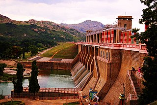
The Kali River or Kaali Nadi is a river flowing through Uttara Kannada district of Karnataka state in India. The river rises near Kushavali, a small village in Uttar Kannada district. The river is the lifeline to some 400,000 people in the Uttara Kannada district and supports the livelihoods of tens of thousands of people including fishermen on the coast of Karwar. There are many dams built across this river for the generation of electricity. One of the important dams build across Kali river is the Supa Dam at Ganeshgudi. The river runs 184 kilometers before joining Arabian Sea.

The state of Maharashtra in India has several major river systems including those of the Narmada, Tapti, Godavari and Krishna rivers. The ecology of these rivers and associated wetlands is covered in this article.

Gangavalli River is one of the many small rivers that originates and flows entirely within the western part of state of Karnataka in India. The National Highway 17 (India) continues on the Hosur Bridge the bridge built over Gangavali River and the road continues to split the Ankola and Kumta regions to connect Uttar Kannada district to Dharwar and Mangalore area.

Gavali is a small village located in the Belgaum district, Karnataka state in India, southwest of the city of Belgaum. The village is surrounded by forests, waterways and falls, which are subject to illegal mining, removal of medicinal plants and deforestation.

The Chitravathi is an inter-state river in southern India that is a tributary of the Penna River. Rising in Karnataka, it flows into Andhra Pradesh and its basin covers an area of over 5,900 km2. The pilgrim town of Puttaparthi is located on its banks.

Suvarnavathi Reservoir also called as Suvarnavathi Dam is located near Chamarajanagar, Karnataka, 14 km from Chamarajanagara town. The Dam is built across Suvarnavathi river which is a sub-river of Kaveri river. The dam is adjacent to the Punajanur state forest which serve as border between Karnataka and Tamil Nadu states.

