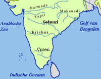
The Krishna River in the Deccan plateau is the third-longest river in India, after the Ganges and Godavari. It is also the fourth-largest in terms of water inflows and river basin area in India, after the Ganges, Indus and Godavari. The river, also called Krishnaveni, is 1,400 kilometres (870 mi) long and its length in Maharashtra is 282 kilometres. It is a major source of irrigation in the Indian states of Maharashtra, Karnataka, Telangana and Andhra Pradesh.

The Tungabhadra River starts and flows through the state of Karnataka, India, during most of its course, then through Andhra Pradesh, and ultimately joins the Krishna River near Murvakonda in Andhra Pradesh.

Bagalkot district, is an administrative district in the Indian state of Karnataka. The district headquarters is located in the town of Bagalkot. The district is located in northern Karnataka and borders Belgaum, Gadag, Koppal, Raichur and Bijapur. The new Bagalkot district was carved out of Vijayapura in 1997 via Government of Karnataka directive Notification RD 42 LRD 87 Part III. The bifurcated Bagalkot district consists of ten taluks — Badami, Bagalkot, Bilagi, Guledgudda, Rabkavi Banhatti, Hunagund, Ilkal, Jamakhandi and Mudhol, Teradal.

Sharavati is a river which originates and flows entirely within the state of Karnataka in India. It is one of the few westward flowing rivers of India and a major part of the river basin lies in the Western Ghats. The famous Jog Falls, located about 25 km from Siddapura, is formed by this river. The river itself and the regions around it are rich in biodiversity and are home to many rare species of flora and fauna.

The Kabini River (Kapila River) is one of the major tributaries of the river Cauvery in southern India, It originates near Kavilumpara in Kozhikode district of Kerala state by the confluence of the Panamaram River and the Mananthavady River. It flows eastward through Wayanad district, entering Mysore district of Karnataka, to join the Kaveri River in Mysore district of Karnataka.

The Mettur Dam is one of the largest dams in India and also the largest in Tamil Nadu, located across the river Kaveri where it enters the plains. Built in 1934, it took 9 years to complete. Maximum height and width of the dam are 214 and 171 feet, respectively. The dam receives inflows from its own catchment area, Kabini Dam and Krishna Raja Sagara Dams located in Karnataka. There is a park at the base of the dam. It provides irrigation and drinking water facilities for more than 12 districts of Tamil Nadu and hence is revered as the life and livelihood-giving asset of Tamil Nadu.
Bhadravati or Bhadravathi is an industrial city or Steel Town and taluk in the Shivamogga District of the Indian state of Karnataka. It is situated at a distance of about 255 kilometres (158 mi) from the state capital Bengaluru and at about 20 kilometres (12 mi) from the district headquarters, Shivamogga. The town is spread over an area of 67.0536 square kilometres (25.8895 sq mi) and has a population of 151,102 as per the census held in 2011.
Khanapur known as Khanapura is a panchayat town in Belagavi district, Karnataka, India. It is about 26 km from Belagavi, the administrative capital of the district. The Khanapur Municipal Council governs the town. Khanapur is the headquarters for Khanapur taluk. The town is on the Belgaum-Panaji National Highway, NH 4A. Khanapur is well connected by train and road to important cities in Karnataka, Goa, and Maharashtra. Kannada is the official language.
The Malaprabha River is a tributary of the Krishna River and flows through the state of Karnataka in India. It rises in the Western Ghats at an elevation of 792.4 m (2,600 ft) in the state's Belagavi district. The river joins Krishna River at Kudalasangama in Bagalkot district.

Karnataka, the sixth largest state in India, has been ranked as the third most popular state in the country for tourism in 2014. It is home to 507 of the 3600 centrally protected monuments in India, second only to Uttar Pradesh. The State Directorate of Archaeology and Museums protects an additional 752 monuments and another 25,000 monuments are yet to receive protection.

Supa Dam is built across Kalinadi (Kannada) or Kali river in state of Karnataka in India and is the tallest dam in Karnataka. The 101 meters high and 332 meters long dam has 3 gates of 15x10 meters. The dam's gross capacity is 4.178 cubic km or 147 tmc ft. It is situated at GaneshaGudi, which is in Joida taluk of Uttara Kannada district. The dam forms the main storage reservoir to all the power houses in Kalinadi hydro power project of total installed capacity of 1180MW, which includes main Nagzari power house of 810 MW capacity. The power house at the foot of the dam has two 50 MW electricity generators. The electricity generated is supplied to different parts of Karnataka. The dam was built by Hindustan Steel Works Construction Limited and is designed, owned and operated by Karnataka Power Corporation Limited. The power house was commissioned in 1985. The dam is basically used for generation of hydro electricity.

Naviluteertha is a village in Savadatti taluk of Belagavi district, Karnataka,India. It is a well-known picnic spot. The place derives its name as so many peafowls are found here. It has a dam that was built in 1974 across Malaprabha river. This is the shortest dam in Karnataka with a height of 155 m and 41 m length with four gates.
Hampiholi is a village on the banks of river Malaprabha in Belgaum district, 14 kilometres (8.7 mi) from Ramdurga taluk in the southern state of Karnataka, India.
Mohare is a village in Bailhongal Taluk, Belagavi District of Karnataka, India. It is located near the state border with Maharashtra, about 26 kilometres east of the district seat Belgaum, and 16 kilometres northwest of the taluk seat Bailhongal. As of 2011, it has a total population of 2,365.

The Bhadra Dam or Lakkavalli Dam, which has created the Bhadra Reservoir, is located on the Bhadra River a tributary of Tungabhadra River. Bhadra Dam is located in the border of Bhadravathi and Tarikere, in the western part of Karnataka in India. The benefits derived from the reservoir storage are irrigation with gross irrigation potential of 162,818 hectares, hydro power generation of 39.2 MW, drinking water supply and industrial use. The dam commissioned in 1965 is a composite earth cum masonry structure of 59.13 metres (194.0 ft) height with length of 1,708 metres (5,604 ft) at the crest level, which submerges a land area of 11,250.88 hectares.

The Pazhassi Dam also called Kulur Barrage is a stone masonry diversion structure in Kannur district, Kerala, India. It is named after king Pazhassi Raja, a patriot who died a heroic death in the war. The dam is constructed across the west flowing Bavali river near Veliyambra. It was commissioned by Prime Minister Morarji Desai in 1979. It mainly functions as an irrigation dam, serving a command area of 11,525 hectares in Iritty taluk of the Kannur District. The water from this dam also meets the drinking water requirement of Kannur district. The dam site and the reservoir are known for their scenery.

Raja Lakhamagouda dam, also known as Hidkal dam, is a dam constructed across the Ghataprabha River in the Krishna River basin. It is situated at Hidkal village in Hukkeri Taluk of Belagavi district in North Karnataka, India. The dam with the height of 62.48 metres and 10 Vertical Crest Gates, impounds a large reservoir with a gross surface area of 63.38 Square kilometres, and storage capacity of 51.16 Tmcft. It is an earthen and masonry dam which caters to the irrigation needs for over 8,20,000 acres, and hydel power generation. It was constructed as a part of the Ghataprabha Irrigation project which was completed in three phases and finished in 2009. The dam is named after Raja Lakhamagouda Sardesai, philanthropist and Zamindar of Vantamuri.
Markandeya is a river of southern India. It rises in the Bailur in Khanapur Taluk of Belgaum district, Karnataka state, enters Belagavi taluk on southern side and flows towards western side of the Belagavi city and flows 66 kilometres (41 mi) in Belgaum district forming beautiful Godchinamalaki Falls before reaching its confluence into the Ghataprabha River at Gokak about 60 kilometres (37 mi) from Belgaum.