Karimnagar district

Last updated

Karimnagar district
Chikati Gudi, Kothapali Haveli, Telangana - 69.jpg
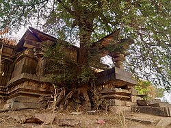
Chikati Gudi, Kothapalli
Karimnagar in Telangana (India).svg
Location in Telangana
Karimnagar district
Karimnagar district
Coordinates(Karimnagar): 18°26′13″N79°07′27″E / 18.43694°N 79.124167°E / 18.43694; 79.124167
Country India
State Telangana
Headquarters Karimnagar
Mandalas 16
Government
   District collector RV Karnan
Area
  Total2,128 km2 (822 sq mi)
Population
 (2011)
  Total1,005,711
  Density470/km2 (1,200/sq mi)
   Urban
30.72%
Demographics
   Literacy 69.16%
  Sex ratio993
Time zone UTC+05:30 (IST)
Vehicle registration TS–02 [1]
Website karimnagar.telangana.gov.in

Karimnagar district is one of the 33 districts of the Indian state of Telangana. Karimnagar city is its administrative headquarters. [2] The district shares boundaries with Peddapalli, Jagityal, Sircilla, Siddipet, Jangaon, Hanamkonda district and Jayashankar Bhupalapally districts.

Contents

Etymology

Karimnagar was originally called Elagandala. [3] Later Kannada kingdoms such as Western Chalukyas ruled it. It was part of the great Satavahana Empire. Later, the ruling Nizams of Hyderabad changed the name to Karimnagar, derived from the name of Shahenshah E Karimnagar Syed Kareemullah Shah Quadrii nithinvasi.

History

After the districts re-organisation in October 2016, 3 new districts were carved out from the erstwhile Karimnagar district to form three new districts of Jagtial district, Peddapalli district and Rajanna Sircilla district. [4] Few mandals were merged into other newly formed districts of Warangal Urban, Siddipet, Jayashankar Bhupalpally.

Geography

The district is spread over an area of 2,128 square kilometres (822 sq mi). Karimnagar is the fifth smallest district in Telangana by area. [4] Karimnagar shares it boundaries with Jagtial to its north, Peddapalli district on north-east, Hanamkonda district towards South, Siddipet district on south-west, Rajanna Sircilla to the West and Jayashankar Bhupalapally on East.

Demographics

Religion in Karimnagar district (2011) [5]
Hinduism
90.08%
Islam
8.48%
Christianity
0.73%
Other or not stated
0.71%

As of 2011 Census of India, the district has a population of 10,05,711. Karimnagar has a sex ratio of 993 females per 1000 males and a literacy rate of 69.16%. 89,079 (8.86%) were under 6 years of age. Total urban population of the district is 3,08,984, (30.72%) of total population. Scheduled Castes and Scheduled Tribes make up 186,648 (18.56%) and 12,779 (1.27%) of the population respectively. [6] It has a single municipal corporation (Karimnagar) and four municipalities under the new municipalities act (Huzurabad, Jammikunta, Choppadandi and Kothapalli). The population of the Satavahana Urban Development Authority has a population of over 4,80,000 in Karimnagar and its urban agglomeration.

Languages of Karimnagar district (2011) [7]

   Telugu (90.44%)
   Urdu (7.94%)
  Others (1.62%)

At the time of the 2011 census, 90.44% of the population in residual Karimnagar district spoke Telugu and 7.94% Urdu as their first language. [7]

Administrative divisions

The district is divided into two revenue divisions of Karimnagar and Huzurabad. These are sub-divided into sixteen mandals. There are 210 revenue villages and 276 Gram-Panchyats in the district. [4] R.V Karnan is the present collector of the district. [8]

Mandals

Karimnagar District Revenue divisions Karimnagar District Revenue divisions.png
Karimnagar District Revenue divisions

The below table categorizes 16 mandals into their respective revenue divisions in the district: [9]

S.No.Karimnagar revenue divisionHuzurabad revenue division
1Kothapalli Veenavanka
2 Karimnagar V.Saidapur
3Karimnagar (rural) Shankarapatnam
4 Manakondur Huzurabad
5 Timmapur Jammikunta
6 Ganneruvaram Ellanthakunta
7Gangadhara
8 Ramadugu
9 Choppadandi
10 Chigurumamidi

Economy

Granite industry of the district include, Tan Brown and Maple Red variety of granite. In Karimnagar district, there are over 600 stone quarries spread over several mandals such as Karimnagar, Manakondur, Mallial, Kesavapatnam etc.[ citation needed ]

In 2006, the Indian government named undivided Karminagar district as one of the country's 250 most impoverished districts (out of 640). [10] It is one of the nine earlier integrated districts in Telangana currently receiving funds from the Backward Regions Grant Fund Programme (BRGF). [10]

Notable people

See also

Related Research Articles

<span class="mw-page-title-main">Karimnagar</span> City in Telangana, India

Karimnagar is also known as Elagandula is a city and District Headquarters in the Indian state of Telangana. Karimnagar is a major urban agglomeration and third largest city in the state. It is governed by the Municipal Corporation and is the headquarters of the Karimnagar district It is situated on the banks of Manair River, which is a tributary of the Godavari River. It is the third largest and fastest growing urban settlement in the state, according to 2011 census. It has registered a population growth rate of 45.46% and 38.87% respectively over the past two decades between 1991 and 2011, which is highest growth rate among major cities of Telangana. It serves as a major educational and health hub for the northern districts of Telangana. It is a major business center and widely known for its agricultural and granite industries, earning the nickname "City of Granites."

<span class="mw-page-title-main">Vemulawada, Rajanna Sircilla district</span> Town Hindu Pilgrimage in Telangana, India

Vemulawada is an ancient historical and a famous pilgrimage census town in Rajanna Sircilla district of the Indian state of Telangana. It is the headquarters of Vemulawada Mandal and Revenue Division. The place is notable for Sri Raja Rajeswara Swamy temple,which is also known as “ Dakshinakashi” constructed between 760 and 973 CE, and a site of pilgrimage for Hindu worshipers. It also has ancient temples of Bheemeswara, Nagareswara and Pochamma nearby the main temple of Sri Raja Rajeswara Swamy. It was the capital of Vemulawada Chalukyas, that ruled present day Telangana, parts of Andhra Pradesh, Karnataka and Maharashtra between 7 and 10 century CE. The town attracts large number of pilgrims from South India as well as Maharashtra, Odisha and Chhattisgarh. Huge number of devotees throng the place during Maha Shivaratri and Sri Rama Navami. The famous floral festival of Telangana, Bathukamma is believed to have originated from this place.

<span class="mw-page-title-main">Jagtial</span> City in Telangana, India

Jagtial is a city in and the district headquarters of Jagtial district of Telangana state, India. Located about 190 kilometres (118 mi) north of the state capital Hyderabad, it has an average elevation of 293 metres (961 ft). In 2011 the population was about 104,000

<span class="mw-page-title-main">Medak district</span> District of Telangana in India

Medak district is in the Indian state of Telangana. Medak is the district headquarters. The district shares boundaries with Sangareddy, Kamareddy, Siddipet and Medchal districts.

<span class="mw-page-title-main">Nizamabad district</span> District of Telangana in India

Nizamabad district is a district located in the north-western region of the Indian state of Telangana. The city of Nizamabad is the district headquarters. The district share boundaries with Jagtial, Sircilla, Nirmal, Kamareddy districts and with Nanded district of the state boundary of Maharashtra.

<span class="mw-page-title-main">Hanamkonda district</span> District of Telangana in India

Hanumakonda district, is a district located in the northern region of the Indian state of Telangana. The district headquarters are located at Hanumakonda. The district borders the districts of Jangaon, Karimnagar, Warangal, Bhupalpally and Siddipet.

<span class="mw-page-title-main">Sircilla</span> Town in Telangana, India

Siricilla is a town and the district headquarters of Rajanna Siricilla district in the Indian state of Telangana. It is located on the banks of Manair river in the Siricilla mandal of Siricilla revenue division. It is popularly known as Textile Town due to the presence of large number of power looms, textile processing and dyeing units. It is the biggest textile hub in the state of Telangana with over 40,000 power looms. Siricilla, along with Warangal is proposed to be developed as a mega textile zone by the Telangana government. The first Visalandhra Mahasabha in Telangana was held at Siricilla during the Visalandhra movement.

Gambhiraopet is a village in Gambhiraopet mandal of Rajanna Sircilla district And territory district KARIMNAGAR in the state of Telangana in India. and there are 18 villages under gambhiraopet mandal and mixed religious people live there i.e. Hindu, Muslim, Christians and it has to be taluka before but it has remains as mandal and

<span class="mw-page-title-main">Mancherial district</span> District in Telangana, India

Mancherial district is a district located in the northern region of the Indian state of Telangana. The district comprises 18 mandals and two revenue divisions – Mancherial and Bellampalli. The district headquarters is located at Mancherial town. It is surrounded by Komaram Bheem, Nirmal, Jagtial, Peddapalli and Bhupalpally districts of Telangana and with Maharashtra state.

<span class="mw-page-title-main">Kamareddy district</span> District in Telangana, India

Kamareddy district is a district located in the northern region of the Indian state of Telangana. The district shares boundaries with Medak, Nizamabad, Sangareddy, Siddipet and Rajanna Sircilla districts and with the state boundary of Maharashtra and Karnataka.

<span class="mw-page-title-main">Siddipet district</span> District of Telangana in India

Siddipet district is a district located in the northern region of the Indian state of Telangana. Its headquarters is Siddipet. This district contains a part of the Hyderabad Metropolitan Region(Markook Mulugu Wargal) The district shares boundaries with Jangaon, Sircilla, Karimnagar, Kamareddy, Hanamkonda, Yadadri, Medhchal and Medak districts.

<span class="mw-page-title-main">Warangal district</span> District of Telangana in India

Warangal district, formerly Warangal Rural district, is a district in the Indian state of Telangana. The district shares boundaries with Mahabubabad, Jangaon, Hanamkonda, Mulugu and Bhupalpally districts.

<span class="mw-page-title-main">Wanaparthy district</span> District of Telangana in India

Wanaparthy district is a district in the Indian state of Telangana. Its headquarters is Wanaparthy. The district shares boundaries with Gadwal, Mahabubnagar, Narayanpet, Nagarkurnool districts and, ws well ash the state boundary of Andhra pradesh.

<span class="mw-page-title-main">Jayashankar Bhupalpally district</span> District of Telangana in India

Jayashankar Bhupalpally district is a district in the Indian state of Telangana. The district headquarters are located at Bhupalpally. It was a part of the erstwhile Warangal district and Karimnagar district prior to the re-organisation of districts in the state. The district share boundaries with Karimnagar, Mancherial, Peddapalli, Hanamkonda, Warangal, and Mulugu districts and with the state boundary of Maharashtra and Chhattisgarh. The world's largest multi-stage lift irrigation project Kaleshwaram Lift Irrigation Project is in Jayashankar Bhupalpally District and Jayashankar Bhupalpally District falls Under naxal affected district as per Red corridor.

<span class="mw-page-title-main">Jagtial district</span> District of Telangana in India

Jagtial district is a district located in the northern region of the Indian state of Telangana. Its headquarters is Jagtial. The district shares boundaries with Nirmal, Mancherial, Karimnagar, Peddapalli, Sircilla and Nizamabad districts.

<span class="mw-page-title-main">Peddapalli district</span> District of Telangana in India

Pedapalli district is a district located in the northern region of the Indian state of Telangana. Its administrative headquarters is at Peddapalli and Commissionerate is at Ramagundam. The district shares boundaries with Mancherial, Karimnagar, Jagtial and Jayashankar Bhupalpally districts. This district covers Ramagundam city which is situated in the Godavari valley coalfields and has one of the India's largest thermal power stations in south region under NTPC. Mostly industries are connected with Godavarikhani - NTPC - Ramagundam.

<span class="mw-page-title-main">Rajanna Sircilla district</span> District of Telangana in India

Rajanna Sircilla district is a district in the Indian state of Telangana. Sircilla is the district headquarters. The district shares boundaries with Karimnagar, Siddipet, Jagtial, Kamareddy, and Nizamabad districts.

<span class="mw-page-title-main">Jangaon district</span> District of Telangana in India

Jangaon district is a district in the Indian state of Telangana. It was a part of the erstwhile Warangal district prior to the re-organisation of districts in the state. The district shares boundaries with Suryapet, Yadadri, Warangal, Hanamkonda, Siddipet and Mahabubabad districts.

<span class="mw-page-title-main">Kothapalli (Haveli)</span> Village in Telangana, India

Kothapalli (Haveli) (Telugu: కొత్తపల్లి), or Kothapalli, is a Revenue Village and a semi-town in Kothapalli Mandal, Karimnagar district, Telangana, India. The village used to be in the Karimnagar mandal of the old Karimnagar district. Following the district reorganization of Telangana, it was included in the newly formed Kothapalli Mandal. Kothapalli was formed as a municipal corporation on 2 August 2018, as part of the Municipal Amendment Bill by the Government of Telangana.

References

  1. "Telugu States Latest News, Breaking News, News Headlines, Live Updates, Today Top News".
  2. "Telangana gets 31 districts to spruce up adminstration [sic]". 11 October 2016.
  3. "District Census Handbook – Adilabad" (PDF). Census of India. p. 9. Retrieved 20 November 2015.
  4. 1 2 3 "New districts". Andhra Jyothy.com. 8 October 2016. Retrieved 8 October 2016.
  5. "Table C-01 Population By Religious Community: Andhra Pradesh". censusindia.gov.in. Registrar General and Census Commissioner of India.
  6. "Sakshi Telugu Daily Karimnagar District epaper dated Sun, 30 Oct 16".
  7. 1 2 "Table C-16 Population by Mother Tongue: Andhra Pradesh". Census of India . Registrar General and Census Commissioner of India.
  8. "K Chandrasekhar Rao appoints collectors for new districts". Deccan Chronicle. 11 October 2016. Retrieved 13 October 2016.
  9. "Clipping of Andhra Jyothy Telugu Daily – Hyderabad". Andhra Jyothy. Retrieved 8 October 2016.
  10. 1 2 Ministry of Panchayati Raj (8 September 2009). "A Note on the Backward Regions Grant Fund Programme" (PDF). National Institute of Rural Development. Archived from the original (PDF) on 5 April 2012. Retrieved 27 September 2011.
  11. "Archived copy" (PDF). Archived from the original (PDF) on 19 January 2010. Retrieved 19 January 2010.{{cite web}}: CS1 maint: archived copy as title (link)