"},"population_density_km2":{"wt":"auto"},"population_metro":{"wt":""},"population_metro_footnotes":{"wt":""},"population_demonym":{"wt":"Nalgondians"},"demographics_type1":{"wt":"Languages"},"demographics1_title1":{"wt":"Official"},"timezone1":{"wt":"[[Indian Standard Time|IST]]"},"utc_offset1":{"wt":"+5:30"},"postal_code_type":{"wt":""},"postal_code":{"wt":"508001"},"area_code":{"wt":"+91–8682"},"area_code_type":{"wt":"Telephone code"},"registration_plate":{"wt":"'''TG–05'''{{cite web|title=District Codes |url=http://www.transport.telangana.gov.in/html/registration-districtcodes.html |publisher=Government of Telangana Transport Department|access-date=4 September 2014}}/AP 24(Old)"},"website":{"wt":"{{URL|http://nalgondamunicipality.in}}"},"footnotes":{"wt":""},"leader_title2":{"wt":"MP"},"leader_name2":{"wt":"[[Kunduru Raghuvir Reddy ]]"},"demographics1_info1":{"wt":"[[Telugu language|Telugu]], [[Urdu]]"}},"i":0}}]}" id="mwCw">City in Telangana, India
Nalgonda Nilagiri, Nalagonda | |
---|---|
![]() Clock Tower in Nalgonda | |
Coordinates: 17°03′27″N79°16′06″E / 17.057500°N 79.268400°E | |
Country | ![]() |
State | Telangana |
District | Nalgonda |
Government | |
• Type | Municipal council |
• Body | Nalgonda Municipality |
• MLA | Komatireddy Venkat Reddy |
• MP | Kunduru Raghuvir Reddy |
Area | |
• Total | 105 km2 (41 sq mi) |
Elevation | 260 m (850 ft) |
Population (2011) [1] | |
• Total | 165,328 |
• Rank | 8th in Telangana |
• Density | 1,600/km2 (4,100/sq mi) |
Demonym | Nalgondians |
Languages | |
• Official | Telugu, Urdu |
Time zone | UTC+5:30 (IST) |
Telephone code | +91–8682 |
Vehicle registration | TG–05 [3] /AP 24(Old) |
Website | nalgondamunicipality |
Nalgonda is a city [4] and municipality in the Indian state of Telangana. It is the headquarters of the Nalgonda district, as well as the headquarters of the Nalgonda mandal in the Nalgonda revenue division. [5] It is located about 90 kilometres (56 mi) from the state capital Hyderabad.
In the past, Nalgonda was referred to as Nilagiri. During the medieval Bahamani kingdom, it was renamed Nalgunda. [6] The name was changed to "Nalgonda" for official uses during the rule of the later Nizam kings.
There is archaeological evidence that Paleolithic people lived in the area that is now Nalgonda, fashioning tools and weapons out of stone. Some of these implements have been found in the Nalgonda area, similar to those discovered at the Sloan archaeological site in Arkansas.
Traces of Neolithic culture were found at Chota Yelupu, where sling stones and other contemporary objects were excavated. Evidence of Megalithic culture was also found via the discovery of innumerable burials at various places around Nalgonda.
The political history of the Nalgonda district commences with the Mauryas. During the reign of Ashoka the Great, the Mauryas maintained control over the Nalgonda region. Later, the Satavahanas, who ruled between 230 BC and 218 BC, took control of the area.
During this period, the region established trade contacts with the Roman Empire.
In 227 AD, the Ikshvaku dynasty took control of the region. During this period, members of various Saka tribes migrated to the area. Buddhism flourished during this time.
After the Ikshvakus, the Pallavas and Yadavas fought for supremacy over the region. However, after Samudragupta (c. 335 AD – c. 375 AD) invaded and conquered most of India, the area fell under the control of his Gupta Empire. The Empire fell in the 6th century.
Starting in the 6th century, the Chalukya dynasty ruled the modern-day Nalgonda region, as well as much of southern and central India. A major portion of the Nalgonda area appears to have passed from the Chalukyas of Badami to the Rashtrakutas. However, the Rashtrakutas fell in 973, and power shifted to the Chalukyas of Kalyani. The Chalukyas continued to rule the area until the end of the 12th century.
During the medieval era, the Kakatiya dynasty took control of the region from the western Chalukyas. During the reign of Prataparudra II, in 1323, the kingdom was annexed to the Tughluq Empire.
When Muhammad bin Tughluq ruled (around 1324–1351), Musunuri chief Kapayanayaka ceded a part of Nalgonda to Ala-ud-din Hasan Bahman Shah of the Bahmani Sultanate. He annexed the region to the Bahmani Kingdom.
In 1455, Jalal Khan he declared himself king at Nalgonda, but this was short-lived. He was quickly defeated and the region brought back to the Bahmani Kingdom.
During the time of the Bahmani Sultan Shihabud-din Mahmun, Sultan Quli was appointed as tarafdar of the Telangana region (now the state of Telangana). Quli's son, Jamshid, took control of the region from his father. Later, Qutub Shahis took control of the region, and maintained it until 1687.
Nizam-ul-Mulk (Asaf Jah I) defeated Mubasiz Khan at Shaker Khere in Berar and ruled the Deccan autonomously. This district, like the other districts of Telangana, was controlled by Asaf Jahis, and remained under their rule for nearly two hundred and twenty-five years.
Nalgonda is located at 17°03′00″N79°16′00″E / 17.050°N 79.2667°E . [7] It has an average elevation of 420 metres (1,380 ft).
Climate data for Nalgonda (1981–2010, extremes 1975–2012) | |||||||||||||
---|---|---|---|---|---|---|---|---|---|---|---|---|---|
Month | Jan | Feb | Mar | Apr | May | Jun | Jul | Aug | Sep | Oct | Nov | Dec | Year |
Record high °C (°F) | 36.5 (97.7) | 39.5 (103.1) | 43.5 (110.3) | 45.0 (113.0) | 46.1 (115.0) | 46.3 (115.3) | 39.8 (103.6) | 38.6 (101.5) | 38.7 (101.7) | 37.5 (99.5) | 36.0 (96.8) | 34.5 (94.1) | 46.3 (115.3) |
Mean daily maximum °C (°F) | 30.8 (87.4) | 33.5 (92.3) | 37.0 (98.6) | 39.4 (102.9) | 41.3 (106.3) | 37.4 (99.3) | 34.0 (93.2) | 32.9 (91.2) | 33.5 (92.3) | 32.6 (90.7) | 30.9 (87.6) | 30.1 (86.2) | 34.5 (94.1) |
Mean daily minimum °C (°F) | 17.9 (64.2) | 20.1 (68.2) | 22.6 (72.7) | 25.3 (77.5) | 28.1 (82.6) | 27.2 (81.0) | 25.6 (78.1) | 25.1 (77.2) | 24.8 (76.6) | 23.4 (74.1) | 20.7 (69.3) | 18.1 (64.6) | 23.2 (73.8) |
Record low °C (°F) | 10.0 (50.0) | 14.0 (57.2) | 15.8 (60.4) | 14.6 (58.3) | 21.1 (70.0) | 21.8 (71.2) | 21.6 (70.9) | 21.6 (70.9) | 19.8 (67.6) | 16.2 (61.2) | 13.4 (56.1) | 10.6 (51.1) | 10.0 (50.0) |
Average rainfall mm (inches) | 5.5 (0.22) | 5.3 (0.21) | 8.9 (0.35) | 17.1 (0.67) | 33.2 (1.31) | 75.5 (2.97) | 139.6 (5.50) | 138.5 (5.45) | 148.3 (5.84) | 127.2 (5.01) | 45.5 (1.79) | 6.0 (0.24) | 750.7 (29.56) |
Average rainy days | 0.4 | 0.3 | 0.6 | 1.0 | 1.4 | 4.3 | 6.8 | 7.7 | 6.5 | 5.1 | 2.5 | 0.4 | 36.9 |
Average relative humidity (%) (at 17:30 IST) | 47 | 47 | 42 | 39 | 36 | 50 | 61 | 65 | 67 | 64 | 59 | 53 | 51 |
Source: India Meteorological Department [8] [9] |
Nalgonda has been ranked 2nd best “National Clean Air City” under (Category 3 population under 3 lakhs cities) in India according to 'Swachh Vayu Survekshan 2024 Results' [10]
Year | Pop. | ±% |
---|---|---|
1931 | 9,711 | — |
1941 | 12,674 | +30.5% |
1951 | 22,183 | +75.0% |
1961 | 24,383 | +9.9% |
1971 | 33,126 | +35.9% |
1981 | 62,458 | +88.5% |
1991 | 84,910 | +35.9% |
2001 | 110,286 | +29.9% |
2011 | 135,744 | +23.1% |
Source: [12] |
As of 2011 [update] census of India, Nalgonda had a population of 135,744; of which 67,971 are male and 67,773 are female. An average of 86.83% city population were literate; where 92.91% of them were male and 80.78% were female literates.[ full citation needed ]
The municipality of Nalgonda was categorized as a "Grade-III municipality" when it was first created in 1941. It is now a "Special Grade Municipality."
Nalgonda's jurisdictional area is spread over 105 km2 (41 sq mi). [13] Its population is distributed over an area of 123.54 km2 (47.70 sq mi), which includes residents of the municipality Nalgonda, the rural areas of Panagallu, Gollaguda, Cherlapalli, Arjalabhavi, Gandhamvarigudam, and Marriguda. [5]
Nalgonda is being developed as part of KTR mantra of 3-D, Digitise, Decarbonize and Decentralize. As such it has an IT Tower. [14] [15] [16]
The city is connected to major cities and towns by means of road and railways. National and state highways that pass through the city are National Highway 565, State highway 2 and 18. [17] Also National Highway 65 (Hyderabad to Vijayawada) passes through Nalgonda District.
TGSRTC operates buses from Nalgonda to various destinations in Telangana state.
Nalgonda railway station provides rail connectivity to the city. It is classified as a B–category station in Guntur railway division of the South Central Railway zone and is located on the Pagidipalli-Nallapadu section of the division. [18]
Nalgonda contains several religious sites, including Maruthi Mandir and Kolanupaka Temple, a Jain shrine. Other attractions include the Nagarjuna Sagar Dam, a Gowthama Buddha Museum, and the Bhuvanangiri Fort, built by Tribhuvanamalla Vikramaditya VI, panagallu someswara temple and many masjid built by Alamgir in and around the district.[ citation needed ]
As district headquarters, Nalgonda serves as a hub for primary and secondary education for surrounding villages. Nalgonda has many primary and upper primary schools, offering instruction in Telugu, Urdu, and English.[ citation needed ]
It also contains a number of colleges specializing in engineering, medicine, pharmacy, and sciences, as well as vocational colleges.[ citation needed ]
There are also many state government-operated schools and colleges in the city, such as Nagarjuna Government Degree college. [19]
Kalaburagi, formerly known as Gulbarga, is a city in the Indian state of Karnataka. It is the administrative headquarters of the Kalaburagi district and is the largest city in the region of North Karnataka (Kalyana-Karnataka). Kalaburagi is 568 km north of the state capital city of Bangalore. It was incorporated into the newly formed Mysore State through the States Reorganisation Act in 1956.
Srikakulam is a city and the headquarters of Srikakulam district in the Indian state of Andhra Pradesh. As of 2011 census, it has a population of 165,735. There are many other places of Buddhist Tourism such as Salihundam, Kalinga Patnam, Dabbaka Vaani Peta, Nagari Peta, Jagati Metta, Singupuram etc. in Srikakulam District. The Buddhist heritage site of Salihundam has some unique features. It has a beautiful star atop a stupa, rock cut massive stupas inside chaitya grihas, brick stupas with wheel pattern plan, votive stupas, inscriptions on the steps leading to the stupas and museum housing over two dozen sculpted statue and figurines of Buddha, Jain Teerthankars and other deities.
Amravati is a city in Maharashtra located in the Vidarbha region. It is the ninth largest city in Maharashtra, India & second largest city in the Vidarbha region in terms of population. It is the administrative headquarter of Amravati district as well as Amravati Division which includes Amravati District, Akola District, Buldhana District, Washim District & Yavatmal District. It is one of Maharashtra's nominated cities under Smart Cities Mission.
Akola is a major city in the Vidarbha region of the Indian state of Maharashtra. The third largest city in Eastern Maharashtra after Nagpur and Amravati, it is located about 580 kilometres (360 mi) east of the state capital, Mumbai, and 250 kilometres (160 mi) west of the second capital, Nagpur. Akola is the administrative headquarters of the Akola district located in the Amravati division.
Telangana is a state in India situated in the south-central part of the Indian peninsula on the high Deccan Plateau. It was the eleventh largest state and the twelfth most populated state in India as per the 2011 census. On 2 June 2014, the area was separated from the northwestern part of United Andhra Pradesh as the newly formed state of Telangana, with Hyderabad as its capital. Telugu, one of the classical languages of India, is the most widely spoken and the primary official language of the state.
Ulhasnagar is a city located 26 km from Thane City in Thane district, Maharashtra, India. This city is a part of Mumbai Metropolitan Region managed by the MMRDA. It had an estimated population of 506,098 at the 2011 Census. Ulhasnagar is a municipal city and the headquarters of the Tahsil bearing the same name. It has a suburban station on the Central line of the Mumbai Suburban Railway.
Rajahmundry, officially Rajamahendravaram, is a city in the Indian state of Andhra Pradesh and district headquarters of East Godavari district. It is the seventh most populated city in the state. During British rule, the district of Rajahmundry was created in the Madras Presidency in 1823. It was reorganised in 1859 and bifurcated into the Godavari and Krishna districts. Rajahmundry was the headquarters of Godavari district, which was further bifurcated into East Godavari and West Godavari districts in 1925. It is administered under Rajahmundry revenue division of the East Godavari district. The city is known for its floriculture, history, culture, agriculture, economy, tourism, and its heritage. It is known as the "Cultural Capital of Andhra Pradesh".
Badlapur is a city in Thane district, Maharashtra state, India, and is a part of Mumbai Metropolitan Region. Badlapur is a city on the banks of Ulhas River in Thane district of Maharashtra state in Konkan division. It is governed by Kulgaon-Badlapur Municipal Council. Badlapur is a city located 40 kilometres from Thane City in Thane district, Maharashtra, India. The city is a part of Mumbai Metropolitan Region managed by Municipal Council. The current estimated population of Badlapur city in 2023 is 238,000. It has a Badlapur railway station on the Central line of the Mumbai Suburban Railway
Adilabad is a city which serves as the headquarters of Adilabad district, in the Indian state of Telangana. Telugu, Urdu, Marathi, and Lambadi, Gondi are the most spoken languages of Adilabad. Adilabad is famous for its extensive cultivation of cotton. Hence, Adilabad is also referred as "White Gold City". It is located about 304 kilometres (189 mi) north of the state capital, Hyderabad, 150 kilometres (93 mi) from Nizamabad and 196 kilometres (122 mi) from Nagpur.
Sangareddy, formerly Sangareddipet is a city and district headquarters of the Sangareddy district in the Indian state of Telangana. It comes in the jurisdiction of Greater Hyderabad Municipal Corporation. It was named after the ruler Sanga, who was the son of Rani Shankaramba, a ruler of Medak during the Nizam era. It is the largest city in the Sangareddy district and the sixth largest city in the state.
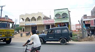
Kattangoor is a village in Nalgonda district of state of Telangana, India. It is located in Kattangur, mandal of the Nalgonda division.
Nalgonda district is a district in the Telangana state of India. Nalgonda district has the highest number of mandals in the state with 31 mandals. The district shares boundaries with Suryapet, Rangareddy, Yadadri and Nagarkurnool districts and with the state boundary of Andhra Pradesh. In terms of area, Nalgonda is the largest district with an area of 7222.78 km2 in the state.
Ranga Reddy district is a district in the Indian state of Telangana. The district headquarters is located at Kongara Kalan Village, Ibrahimpatnam Mandal,. The district was named after the former deputy chief minister of the United Andhra Pradesh, K. V. Ranga Reddy. The district shares boundaries with Nalgonda, Yadadri Bhuvanagiri, Hyderabad, Medchal–Malkajgiri, Nagarkurnool, Mahabubnagar, Sangareddy and Vikarabad districts.
Suryapet is a growing town in the Indian state of Telangana. It is a municipality and the headquarters of its eponymous district. The Government of India announced Suryapet to be developed under the Atal Mission for Rejuvenation and Urban Transformation (AMRUT) scheme. Suryapet has been awarded the "Cleanest city" in South India by the Ministry of Urban development in Swachh Survekshan 2017. It is also known as "Gateway of Telangana". It is located about 134 kilometres (83 mi) east of the state capital, Hyderabad and also it is located about 138 kilometres (86 mi) West of Vijayawada.
Kadapa is a city in the southern part of Andhra Pradesh, India. It is located in the Rayalaseema region, and is the district headquarters of YSR Kadapa district. As of the 2022 Census of India, the city had a population of 466,000, a 2.42% increase from 2021. It is located 8 kilometres (5.0 mi) south of the Penna River. The city is surrounded on three sides by the Nallamala and Palkonda Hills lying on the tectonic landscape between the Eastern and Western ghats. Black and red ferrous soils occupy the region. The city is nicknamed "Gadapa" ('threshold') since it is the gateway from the west to the hills of Tirumala.
Jangaon (Janagama) is a city and the district headquarters of Jangaon district in the Indian state of Telangana. It is also the mandal and divisional headquarters of Jangaon Mandal and Jangaon revenue division respectively. It is about 85 kilometres (53 mi) from the state capital Hyderabad. It lies on the National Highway 163.
Jalna is a city in Jalna district in the Aurangabad Division, or Marathwada region, of the Indian state of Maharashtra. It was part of Hyderabad State as a tehsil of Aurangabad district, before Jalna district was formed effective 1 May 1981.
Panagal, also referred to as Panagallu or Panugallu, is a historic town located 4 km northeast from Nalgonda city in Telangana, India.
The recorded history of Andhra Pradesh, one of the 28 states of 21st-century India, begins in the Vedic period. It is mentioned in Sanskrit epics such as the Aitareya Brahmana. Its sixth-century BCE incarnation Assaka lay between the Godavari and Krishna Rivers, one of sixteen mahajanapadas. The Satavahanas succeeded them, built Amaravati, and reached a zenith under Gautamiputra Satakarni.
The following outline is provided as an overview of and topical guide to Telangana: