Telangana was carved out with 10 districts from Andhra Pradesh. Seven mandals of Bhadrachalam division were given back to East Godavari district.[5][6] 21 new districts were created on 11 October 2016, which led to 31 districts in Telangana. All districts were divided into minimum 2 to maximum 5 except Hyderabad district which was untouched.[7] Two new districts, Mulugu and Narayanpet were created on 17 February 2019, taking the total number of districts to 33.[8]
District statistics
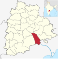
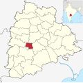
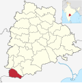
In terms of area, Bhadradri Kothagudem is the largest district with an area of 7,483km2 (2,889sqmi) and Hyderabad is the smallest with 217km2 (84sqmi). Hyderabad district is the most populated district with a population of 39,43,323 and Mulugu district is the least populated with 2,94,671. Telangana consist of 74 Revenue Divisions and 594 Revenue Mandals (Tehsil).[9]
This page is based on this Wikipedia article Text is available under the CC BY-SA 4.0 license; additional terms may apply. Images, videos and audio are available under their respective licenses.