Mahabubnagar district

Last updated

Mahabubnagar district
Mallela theertham 1.jpg
Mallela Theertham waterfall
Mahabubnagar in Telangana (India).svg
Location in Telangana
Mahabubnagar district
CountryFlag of India.svg  India
State Flag placeholder.svg Telangana
Headquarters Mahabubnagar
Mandalas 16
Government
   District collector Ravi Gugulothu IAS
Area
  Total2,738 km2 (1,057 sq mi)
Population
 (2011) [1]
  Total919,903
  Density340/km2 (870/sq mi)
Time zone UTC+05:30 (IST)
Vehicle registration TS–06 [2]
Website mahabubnagar.telangana.gov.in

Mahabubnagar district is a district in the Indian state of Telangana. Mahabubnagar is the district headquarters which is popularly known as Palamoor. [3] The district shares boundaries with Narayanapet, Vikarabad, Rangareddy, Nagarkurnool, Wanaparthy and Jogulamba Gadwal districts. The district was formed during the period of the 6th Nizam of Hyderabad State – Nawab Mir Mahbub Ali Khan and hence named after him.

Contents

Etymology

Mahabubnagar was formerly known as Palamoor, meaning "land of milk" due to its milk production. [4] The name was changed to Mahabubnagar on 4 December 1890, in honour of Mir Mahbub Ali Khan Asaf Jah VI, the Nizam of Hyderabad (1869–1911 AD).

History

The area that forms current Mahabubnagar district has historic significance. It was under Janapada rule by 6th century BCE, and later was Maurya territory. The region was at the core of the Satavahana dynasty from 221 B.C.E. to 218 C.E., and also a large part of the Chalukya dynasty from the 7th to the 11th century CE, also part of the Kakatiya dynasty from 11th to the 14th century CE, The region was later part of the Kingdom of Golkonda (c.  – 1512), with its capital city Golkonda located near Hyderabad.

In 1518, the region came under control of the Qutb Shahi dynasty, which reigned until 1687. The region was then a part of Hyderabad State, ruled by the Asaf Jahi Dynasty, from 1724 to 1948.

Geography

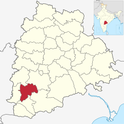
Mahabubnagar district is spread over an area of 2,737.00 square kilometres (1,056.76 sq mi). [5] The Krishna river flows through the district, as well as the Tungabhadra. They merge at Sangameswaram.

Demographics

Religion in Mahabubnagar district (2011) [6]
Hinduism
86.26%
Islam
12.41%
Christianity
0.74%
Other or not stated
0.59%

As of the 2011 census of India, the district has a population of 919,903. Mahbubnagar district has a sex ratio of 987 females per 1000 males and a literacy rate of 63.35%. 122,189 (13.28%) were under 6 years of age. 319,346 (34.72%) lived in urban areas. Scheduled Castes and Scheduled Tribes make up 129,340 (14.06%) and 105,547 (11.47%) of the population respectively. [1]

Languages of Mahabubnagar district (2011) [7]

   Telugu (76.23%)
   Urdu (12.23%)
   Lambadi (10.57%)
  Others (0.97%)

At the time of the 2011 census, 76.23% of the population spoke Telugu, 12.23% Urdu and 10.57% Lambadi as their first language. [7]

Jain temple

The oldest terracotta style Jain temple is in Alvanpalli village of Mahabubnagar district. This temple was built between 7th and 8th century. This temple is one of the two such structures in India other built during Gupta period is located at Bhitargaon under Kanpur district, Uttar Pradesh. This temple was built using bricks made of burnt clay. The large bricks of the temple were plaster using the limestone. The principal deity of the temple was Mahavira. [8] The temple was around 18th century, since no efforts were being made to conserve it the rare structure the sculptures of Mahavira, Parsvanatha and few other historical importance had been moved to a local museum in Pillalamarri and some to the State Museum in the city. [9]

Economy

In 2006, the Indian government named Mahabubnagar one of the country's 250 most backward districts (out of 640 total). [10] It is one of the nine districts in Telangana currently receiving funds from the Backward Regions Grant Fund Programme (BRGF). [10]

Koilsagar project Koilsagar project.jpg
Koilsagar project
Many Pre Historic sites of Mid Krishna-Tungabhadra Valley are present in the erstwhile Mahabubnagar district and now in Jogulamba, Wanaparthy and Nagarkurnool districts Pre Historic Mid Krishna-Tungabhadra Valley sites.jpg
Many Pre Historic sites of Mid Krishna-Tungabhadra Valley are present in the erstwhile Mahabubnagar district and now in Jogulamba, Wanaparthy and Nagarkurnool districts

Administrative divisions

The district has one revenue divisions of Mahabubnagar. These are sub-divided into 16 mandals. [5] Ravi Gugulothu IAS is the present collector of the District. [11]

#mandals in District
1 Addakal
2 Balanagar
3 Bhoothpur
4 CC Kunta
5 Devarakadra
6 Gandeed
7 Hanwada
8 Jadcherla
9 Koilkonda
10 Mahabubnagar(Urban)
11 Mahabubnagar(Rural)
12 Midjil
13 Moosapet
14 Nawabpet
15 Rajapur
16 Koukuntla
17mahmadabad

Notable people

Education

Mahabubnagar district falls under the jurisdiction of Osmania University and Palamuru University. [12] The district has many government and private medical college, junior, undergraduate and graduate colleges.

See also

Related Research Articles

<span class="mw-page-title-main">Hyderabad State</span> Princely state in South India (1724–1948)

Hyderabad State was an independent monarchy/princely state/country located in the south-central Deccan region of Indian Subcontinent with its capital at the city of Hyderabad. It is now divided into the present-day state of Telangana, the Kalyana-Karnataka region of Karnataka, and the Marathwada region of Maharashtra in India.

<span class="mw-page-title-main">Mahbubnagar</span> City in Telangana, India

Mahabubnagar, formerly known as Rukmammapeta and Palamooru is a city in Mahabubnagar District of the Indian state of Telangana named after the 6th Nizam, Mahboob Ali Khan. It is the headquarters of Mahabubnagar mandal in Mahabubnagar revenue division. The city is also the largest in the district with an area of 39.64 km2 (15.31 sq mi) and 7th most populous in the state.

<span class="mw-page-title-main">Karimnagar</span> City in Telangana, India

Karimnagar is also known as Elagandula is a city and District Headquarters in the Indian state of Telangana. Karimnagar is a major urban agglomeration and third largest city in the state. It is governed by the Municipal Corporation and is the headquarters of the Karimnagar district It is situated on the banks of Manair River, which is a tributary of the Godavari River. It is the third largest and fastest growing urban settlement in the state, according to 2011 census. It has registered a population growth rate of 45.46% and 38.87% respectively over the past two decades between 1991 and 2011, which is highest growth rate among major cities of Telangana. It serves as a major educational and health hub for the northern districts of Telangana. It is a major business center and widely known for its agricultural and granite industries, earning the nickname "City of Granites."

<span class="mw-page-title-main">Coastal Andhra</span> Geographic region of Andhra Pradesh, India

Coastal Andhra or Kostandhra is a geographic region in the Indian state of Andhra Pradesh. Vijayawada is the largest city in this region. Region share borders with Uttarandhra, Rayalaseema and Telangana. It was part of Madras State before 1953 and Andhra State from 1953 to 1956. According to the 2011 census, it has an area of 91,915 square kilometres (35,489 sq mi) which is 57.99% of the total state area and a population of 34,193,868 which is 69.20% of Andhra Pradesh state population. This area includes the coastal districts of Andhra Pradesh on the Circar Coast between the Eastern Ghats and the Bay of Bengal, from the northern border with Odisha to Rayalaseema in the south.

<span class="mw-page-title-main">Telangana</span> State in southern India

Telangana is a state in India situated in southern part of the Indian peninsula on the high Deccan Plateau. It is the eleventh-largest state and the twelfth-most populated state in India as per 2011 census. On 2 June 2014, the area was separated from the northwestern part of United Andhra Pradesh as the newly formed state of Telangana, with Hyderabad as its capital.

Reddy is a caste that originated in India, predominantly settled in Andhra Pradesh and Telangana. They are classified as a forward caste.

<span class="mw-page-title-main">Telangana High Court</span> High Court for the Indian State Telangana

The Telangana High Court is the High Court for the Indian state of Telangana. Founded by the 7th Nizam Mir Osman Ali Khan, initially, it was set up as High Court of Hyderabad for the then Princely State of Hyderabad Deccan and later renamed High Court of Andhra Pradesh, as it was set up on 5 November 1956 under the States Reorganisation Act, 1956. The Andhra Pradesh High Court was renamed as High Court of Judicature at Hyderabad in view of the bifurcation of Andhra Pradesh state.

<span class="mw-page-title-main">Karimnagar district</span> District of Telangana in India

Karimnagar district is one of the 33 districts of the Indian state of Telangana. Karimnagar city is its administrative headquarters. The district shares boundaries with Peddapalli, Jagityal, Sircilla, Siddipet, Jangaon, Hanamkonda district and Jayashankar Bhupalapally districts.

<span class="mw-page-title-main">Ranga Reddy district</span> District of Telangana in India

Ranga Reddy district is a district in the Indian state of Telangana. The district headquarters is located at Kongara Kalan Village, Ibrahimpatnam Mandal,. The district was named after the former deputy chief minister of the United Andhra Pradesh, K. V. Ranga Reddy. The district shares boundaries with Nalgonda, Yadadri Bhuvanagiri, Hyderabad, Medchal–Malkajgiri, Nagarkurnool, Mahabubnagar, Sangareddy and Vikarabad districts.

<span class="mw-page-title-main">Alampuram (Hemalapuram)</span> Mandal in Telangana, India

Alampuram (Hemalapuram) is a town situated in Jogulamba Gadwal district in the Indian state of Telangana. Alampur is a popular Hindu pilgrimage site in Shaktism and is also home to the Navabrahma Temples, a group of nine temples dedicated to Shiva built in the seventh and eighth century CE. It is the meeting point of the rivers Tungabhadra and Krishna and is referred to as Dakshina Kasi and is also considered the western gateway to Srisailam. The sacredness of Alampur is mentioned in the Skanda Purana. It is surrounded by the Nallamala hills and is situated on the left bank of the Tungabhadra river. Alampur was ruled by badami chalukyas they built 9 cluster of shiva temples. After them rashtrakutas of manyakheta and western chalukyas of karnataka built papanasi temples. Alampur is home to multiple Telugu and old Kannada inscriptions .Alampur contains numerous Hindu temples, the prominent ones being Jogulamba temple, Navabrahma temples, Papanasi temples, and Sangameswara Temple.

<span class="mw-page-title-main">Tank Bund Road</span> Road in Secunderabad, India

The Tank Bund Road is a road in Secunderabad, Hyderabad, India. The Tank Bund dams Hussain Sagar lake on the eastern side and connects the twin cities of Hyderabad and Secunderabad. It has become an attraction with 33 statues of famous people from the region.

<span class="mw-page-title-main">North Andhra</span> Geographic region of Andhra Pradesh in India

North Andhra or Uttarandhra, also known as Kalinga Andhra, is a geographic region in the Indian state of Andhra Pradesh. It is between the Eastern Ghats and the coast of the Bay of Bengal. It comprises six northern districts of the state, Srikakulam, Parvathipuram Manyam, Vizianagaram, Visakhapatnam, Alluri Sitharama Raju and Anakapalli. As of 2011 census of India, the region with six districts has a population of 9,338,177.

<span class="mw-page-title-main">History of Andhra Pradesh</span>

The recorded history of Andhra Pradesh, one of the 28 states of 21st-century India, begins in the Vedic period. It is mentioned in Sanskrit epics such as the Aitareya Brahmana. Its sixth-century BCE incarnation Assaka lay between the Godavari and Krishna Rivers, one of sixteen mahajanapadas. The Satavahanas succeeded them, built Amaravati, and reached a zenith under Gautamiputra Satakarni.

Hyderabad was the capital of the Indian states of Telangana and Andhra Pradesh. It is a historic city noted for its many monuments, temples, mosques and bazaars. A multitude of influences has shaped the character of the city in the last 400 years.

<span class="mw-page-title-main">History of Telangana</span>

The history of Telangana, located on the high Deccan Plateau, includes its being ruled by the Satavahana Dynasty, the Kakatiya Dynasty (1083–1323), the Musunuri Nayaks (1326–1356), the Delhi Sultanate, the Bahmani Sultanate (1347–1512), Golconda Sultanate (1512–1687) and Asaf Jahi dynasty (1724-1950).

<span class="mw-page-title-main">Culture of Telangana</span> Cultural history of an Indian state

The Culture of Telangana in India has a cultural history of about 5,000 years. The region emerged as the foremost centre of culture in Indian subcontinent during the rule of Kakatiyas, the Qutb Shahis and Asaf Jahi dynasties—. The rulers patronage and interest for culinary, arts and culture transformed Telangana into a multi-cultural region where two different cultures coexist together, thus making Telangana the representative of the Deccan Plateau and its heritage with Warangal and Hyderabad being its epicenter. Hyderabadi cuisine and Kakatiya architecture both from Telangana, are on the list of UNESCO creative city of gastronomy and UNESCO World Heritage Site. The regions major cultural events celebrated are "Kakatiya Festival" and Deccan Festival along with religious festivals Bonalu, Bathukamma, Dasara, Ugadi, Sankranthi, Milad un Nabi and Ramadan.

<span class="mw-page-title-main">Wanaparthy district</span> District of Telangana in India

Wanaparthy district is a district in the Indian state of Telangana. Its headquarters is Wanaparthy. The district shares boundaries with Gadwal, Mahabubnagar, Narayanpet, Nagarkurnool districts and, ws well ash the state boundary of Andhra pradesh.

<span class="mw-page-title-main">Narayanpet district</span> District of Telangana in India

Narayanpet district is a district in the Indian state of Telangana. Narayanpet is the district headquarters. The district shares boundaries with Mahbubnagar, Vikarabad, Wanaparthy and Jogulamba Gadwal districts and with the Karnataka state.

Kaulas Fort is a historic fort in western Telangana in India. It was constructed by Rashtrakutas in the 9th century CE. It later came under the rule of Chalukyas of Badami, the Kakatiyas, Musunuri Nayaks, Bahmani Sultanate, Qutub Shahis, Mughals, Marathas and, finally, the Asaf Jahi rulers of the Hyderabad State. It is in the Kamareddy district, near the trijunction of Telangana, Karnataka and Maharashtra states. It has historically served as a strategic outpost contested by many kingdoms.

References

  1. 1 2 "At A Glance | Mahabubnagar District,Telangana | India" . Retrieved 15 September 2020.
  2. "Vehicle Registration Codes For New Districts In Telangana". Sakshipost. Retrieved 16 February 2019.
  3. "Official website of Mahabubnagar district". National Informatics center. Retrieved 14 August 2015.
  4. "Mahabubnagar-NIC". mahabubnagar.nic.in.
  5. 1 2 "New districts". Andhra Jyothy.com. 8 October 2016. Retrieved 8 October 2016.
  6. "Population by Religion - Andhra Pradesh". Census of India . Registrar General and Census Commissioner of India. 2011.
  7. 1 2 "Table C-16 Population by Mother Tongue: Andhra Pradesh". Census of India . Registrar General and Census Commissioner of India.
  8. "The last of the 2 brick temples". Deccan Chronicle . 30 September 2018. Retrieved 15 November 2020.
  9. "Unique Jain temple in Telangana lies in ruins". The Hans India. 30 April 2017. Retrieved 16 February 2019.
  10. 1 2 Ministry of Panchayati Raj (8 September 2009). "A Note on the Backward Regions Grant Fund Programme" (PDF). National Institute of Rural Development. Archived from the original (PDF) on 5 April 2012. Retrieved 27 September 2011.
  11. "K Chandrasekhar Rao appoints collectors for new districts". Deccan Chronicle. 11 October 2016. Retrieved 13 October 2016.
  12. "Palamuru University". palamuruuniversity.ac.in.