Adilabad district | |
|---|---|
 | |
 | |
| Coordinates(Adilabad): 19°40′12″N78°31′48″E / 19.670000°N 78.530000°E | |
| Country | |
| State | |
| Established | 1905 |
| Headquarters | Adilabad |
| Mandalas | 18 |
| Government | |
| • District collector | Rajarshi Shah [1] |
| • Parliament Constituencies | Adilabad |
| • Assembly constituencies | Adilabad, Boath (ST), Khanapur (ST) |
| • MP | Godam Nagesh (BJP) |
| Area | |
• Total | 4,153 km2 (1,603 sq mi) |
| Elevation | 264 m (866 ft) |
| Population (2011) | |
• Total | 708,972 |
| • Density | 170.7/km2 (442.1/sq mi) |
| Demographics | |
| • Literacy | 63.46% |
| • Sex ratio | 989 |
| Languages | |
| • Official | Telugu, Urdu |
| Time zone | UTC+05:30 (IST) |
| Vehicle registration |
|
| Website | adilabad |
Adilabad district is a administrative district in the most northern area of Telangana, India. It is known as the gateway district to South India. [3] The district is the named after its headquarters, Adilabad city. [4]
Contents
- History
- Geography
- Demographics
- Religions
- Language
- Ethnicities
- Economy
- Administrative divisions
- Mandals
- See also
- References
- External links
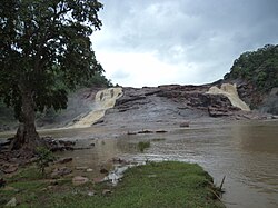
Adilabad district is bounded by Asifabad district to the east, Nirmal district to the south, and the state of Maharashtra to the north and west. As of 2022, it is a part of the red corridor. [5]


