This article is written like a travel guide rather than an encyclopedic description of the subject. Please help improve it by rewriting it in an encyclopedic style. If a travel guide is intended, use of Wikivoyage is strongly suggested.(October 2019)
Damanjodi is a town located in the Koraput district of Odisha, India. As of 2001[update] census, its population was 8,469.[1] The town was founded as a residential area for employees of the National Aluminium Company (NALCO), a company that was established to harness the bauxite-rich deposits of the Panchpatmali Range.[2] Damanjodi contains the NALCO Township, a residential area for NALCO employees, Mathalput, a semi-urban neighborhood with shops, and Bhejaput, a shopping complex. The population is considered cosmopolitan in nature with employees from all over India and locals from the tribal region.
Damanjodi is located on the foothills of the Panchapatmali mountain range. The soil is rich with bauxite and has a reddish appearance. The topography is mountainous, and the river Kerandi runs nearby, serving as a source of clean water.
The local agrarian community produces rice, millets, vegetables, and mustard.
NALCO Township
The NALCO township is composed of three sectors of housing quarters for the employees of the firm. Facilities include a water supply and treatment plant, NALCO's captive power plant, a hospital, banks with networked ATMs, three large co-operative stores, two market complexes, clubs, community centers, temples, a church, and a mosque. The firm also has some housing in different locations around the township for employees displaced from the main complex. The township also has stadiums, parks, avenues, walking tracks, gardens, plantations, and waterfalls.
Demographics
According to the 2001 Indian census,[1] Damanjodi has a population of 8,469. Males constitute 54% of the population and females 46%. The average literacy rate was 83%, higher than the national average of 59.5%. Male literacy was 85% and female literacy was 81%. 14% of the population was under 6 years of age.
Places of worship
Damanjodi has a cosmopolitan culture and acknowledges several major religions. Places of religious importance include a number of temples, a church and a mosque.
Shree Jagannath temple
The Shree Jagannath Temple is a major Hindu temple complex. It includes the Mausi Maa Temple, which serves as the center of attention during the annual Ratha-Yatra festival. All major annual festivals and occasions are celebrated in the temple in association with the Shree Jagannath temple at Puri.
Maa Kantabausini temple
Located near one of the main entrance gates of the township, the Maa Kantabausini Temple is a local tourist destination. The presiding deity of Damanjodi Maa Kantabaunsini dwells in the natural sacred grove of bamboo trees.
Shree Shiridi Sai Baba temple
The town's newest temple complex comprises the Dwarka Mayi and Shiridi temples. It hosts all major festivals and rituals in association with the Sai Baba of Shirdi temple.
Shree Hanuman temple
The Shree Hanuman temple complex contains a 108ft tall statue of Lord Hanuman, which can be seen from any part of the town, as well as a temple with an ashtadhatu idol of Hanuman.
Shree Satya Sai Baba temple
This temple is located in the foothills near Sabari Lake.
Union church
Union church is situated on a small hill near the Ambedkar Stadium and serves the Christian community, .
Damanjodi mosque
The Damanjodi mosque is an example of Muslim style and architecture. It hosts a large gathering during the month of Ramadan for the Muslim Community.
Parks and recreation areas
Sabari lake
This artificial lake was originally created by NALCO for water disposal and has become a park including walkways, gardens and sculptures and an artificial waterfall, Sudarshan Jhara. It is popular for picnics in winter.
Biju Patnaik park
One of the oldest parks in the town, Biju Patnaik park is close to Sabari lake. It has a statue of Odisha politician Biju Patnaik near its entrance. The park contains a children's play area and an area dedicated to science.
Nehru Sishu Udyan park
A park mainly dedicated to children.
Saraswati Sishu Udyan park
Located in Saraswati Vihar, this park serves as a central area for children to play.
The NALCO club
This club contains a canteen, swimming pool, badminton court, tennis court, skating ground, indoor games section (table tennis, carom, chess, billiards), gymnasium and library.
NALCO Community Center
A major place of public gathering in the town, the complex hosts all the major trade fairs around the year as well as providing a venue for celebrations, competitions and other events.
Dr. B.R. Ambedkar Stadium
This stadium hosts all the major sporting events as well as the annual Ravan Podi festival, the largest annual gathering in the town.
Pendal amphitheatre
The town's amphitheater is the focus of the annual Panchpatmali Natya Mahotsav theatre festival.
Education
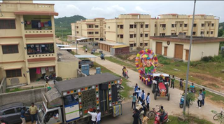
Aerial view of DPS Damanjodi
The Saraswati Vidya Mandir school and Delhi Public School are the two main schools within the township. Both institutions were set up with the help of NALCO and provide students with state-of-the-art education amenities.
In addition, the Sri Aurobindo Study Circle, Alumina Girls High School, and Malushanta High School are located outside the township.
Healthcare
NALCO supports a hospital complex within the town for company employees, including an occupational health centre and a pharmacy. The Government Health facility is located near Mathalput serves as the main hospital for locals who are not employed by NALCO.
Transportation
Roads: National Highway 26 (Visakhapatnam-Raipur) is 9km away from Damanjodi and connected through a service road. The District Headquarters, Koraput, is 36km away and Jeypore is 52km. Semilguda and Sunabeda are 9km and 11km away respectively. There is a government-run bus service connecting Damanjodi to all major local towns, including Visakhapatnam, Vizianagram, Bhubaneswar, Cuttack, Brahmapur, Jagdalpur, Durg, Raipur, Bhilai, Bolangir, Sambalpur, Baragarh, Bhawanipatna, and Anugul. Private cab and shared taxi services are also available from Damanjodi to all major locations across Odisha and nearby cities like Visakhapatanam, Vizianagram, Jagdalpur and Raipur.
Air. Visakhapatnam Airport (200km away) is the nearest airport used by locals for scheduled domestic flights. There is an airport under development at Jeypore, 54km away.
Related Research Articles
Koraput is a district of India in southern Odisha, with headquarters at Koraput. The district is located in the Eastern Ghats and is known for its hilly terrain, rich and diverse types of mineral deposits and its tribal culture and traditions. The district headquarters of Koraput and its largest city, Jeypore are major centres of trade and commerce for South Odisha and fall on an important road connecting Visakhapatnam to Raipur.
Sunabeda is an industrial town and a municipality in the state of Odisha, India, located in the valleys of the Koraput region. The Engine division and Sukhoi division of the aircraft manufacturing company Hindustan Aeronautics Limited (HAL), a public sector undertaking (PSU) of Ministry of Defence is in Sunabeda.
Nabarangpur is a town and a municipality in Nabarangapur district in the Indian state of Odisha. It is the headquarters of Nabarangpur district.
National Aluminium Company Limited, abbreviated as NALCO, is a government company having integrated and diversified operations in mining, metal and power under the ownership of the Ministry of Mines and Government of India. Presently, the government of India holds a 51.5% equity in NALCO.
Jagdalpur is a city in Bastar district in the Indian state of Chhattisgarh. Jagdalpur is the administrative headquarters of Bastar District and Bastar Division. It was earlier the capital of the former princely state of Bastar. It is the fourth largest city of Chhattisgarh.The city is commercial, financial and political center of hub for South Chhattisgarh.
Koraput is a town and a Municipality in Koraput district in the Indian state of Odisha. Koraput town is the district headquarter of Koraput district.
Jagatsinghpur is a city and a municipality in Jagatsinghpur district in the Indian state of Odisha. It is also the headquarters of Jagatsinghpur district. It got the recognition as a new district on 1 April 1993 formerly it was a sub-division of cuttack district. Paradip Port, Oil refinery and fertilizer factory are located in Jagatsinghpur district. Devi, Alaka, Biluakhai, Kusumi, Hansua, Kuanria and Lunijhara rivers belong to this district.
Asika or Aska is a town and a Notified Area Council in Ganjam district in the state of Odisha, India. Fondly known as the Sugar city of Odisha. Asika is a major commercial and transportation hub of Ganjam district.
Gunupur is a Municipality and one of the sub-divisional headquarters of Rayagada district in the Indian state of Odisha. It is the second biggest town in Rayagada district.
Karanjia is a town in the eastern Indian state of Odisha, about 221 kilometres (134 mi) north of the state capital Bhubaneswar. It is the sub-divisional headquarter of Panchpir sub-division and a Notified Area Council in Mayurbhanj district. It is bounded on its South-East by Deo river which forms the natural district border for Mayurbhanj.
Nalconagar is a census town in Angul district in the Indian state of Odisha. Nalconagar, Angul is a suburb of Angul, Odisha.
Umerkote, also known as Umarkot and Amarkot, is a town of Nabarangpur district, Odisha, in eastern India. Umerkote is an urban area and the name of a Municipality declared on 3 March 2014 and a Subdivision declared by State Cabinet on 3 November 2015. The town is a prominent business place of the Nabarangpur District.
Borigumma is a town in Koraput district of Odisha state of India. It is located strategically between 3 of the major towns of undivided Koraput district - Jeypore, Nabarangpur and Kotpad and because of its location advantage, it is known for its business activities.
Hanuman Vatika, or the garden belonging to Lord Hanuman, is situated in Civil Township, Rourkela. The garden houses one of the world's tallest statue of Hanuman.
Tikiri is a village in Rayagada district of Orissa state in India. Tikiri is a small Industrial town located in Rayagada District in the State of Odisha. It is 50 kilometers away from Rayagada District Headquarter and 80 kilometers away from Koraput District Head quarter. It is 20 kilometers away from Rupkona Junction. It is approachable by NH 326A till Rupkona and subsequently diverting another 20 kilometers in Rupkona –Kashipur State Highway. Being situated at high sea-level, it almost brings pleasant climate throughout the year and the summer days are not that much hot like other parts of Odisha. Utkal Alumina International Limited – a flagship of Hindalco group is situated at Tikiri. Utkal Alumina is an Alumina Refinery of capacity 2 MTPA with its bauxite mine at Rayagada/Kalahandi District. Tikiri is basically a Panchyat, having its Panhayat Samiti at Kashipur (20 kilometers away from Tikiri towards Kalahandi District. It has population of five thousands including local and employees working in Refinery plant.
The Jharsuguda–Vizianagaram line is a railway line in eastern India. It connects Jharsuguda,516 km (321 mi) from Howrah on the Howrah–Nagpur–Mumbai line, and Titlagarh, which in turn is connected with Vizianagaram, 820 km (510 mi) from Howrah on the Howrah–Chennai main line, and Raipur Junction, 830 km (516 mi) from Howrah on the Howrah–Nagpur–Mumbai line. There are several branch lines, like the 176 km (109 mi) line connecting Rayagada with Koraput on the Kothavalasa–Kirandul line. The line traverses Western Odisha and connects the Howrah–Nagpur–Mumbai line with the Howrah–Chennai main line. It covers small portions of Chhattisgarh and Andhra Pradesh.
Chandahandi is a town and Block in Nabarangpur District in Odisha State in India.
Kashipur is a block & tahasil in Rayagada district in the Indian state of Odisha. It is known for the Utkal Aluminium International Limited (UAIL)
Durgi is a census village & Panchayat Headquarter of Bissam Cuttack Block in Rayagada district of Odisha, India. There are total 439 families residing in this village. The wards/ villages comes under Durgi Panchayat are:- Durgi, Bhaleri, Kundanpadar, Rengabai, Barangpadar, Thambalpadhu, Budhanagar, Kachapai, Kalipadar, Kurankul, Tentili Kalipadar, Mulipada, Dharamguda, Balipadar, Haduguda, Huruguda, Khariguda and IAY Colony.
Jagannath Temple,(Odia: ଶ୍ରୀ ଜଗନ୍ନାଥ ମନ୍ଦିର) Gunupur, stands at the eastern end of the town Gunupur in the Old Gunupur area. The old temple was built by the Jeypore Maharaja Vikramadeb more than 100 years back.
↑ Babu, P. Suman; Majumdar, T. J.; Bhattacharya, Amit K. (28 May 2015). "Study of spectral signatures for exploration of Bauxite ore deposits in Panchpatmali, India". Geocarto International. 30 (5): 545–559. doi:10.1080/10106049.2014.973066. ISSN1010-6049. S2CID129488521.
This page is based on this Wikipedia article Text is available under the CC BY-SA 4.0 license; additional terms may apply. Images, videos and audio are available under their respective licenses.