Odisha, formerly Orissa, is an Indian state located in Eastern India. It is the 8th largest state by area, and the 11th largest by population. The state has the third largest population of Scheduled Tribes in India. It neighbours the states of West Bengal and Jharkhand to the north, Chhattisgarh to the west, Andhra Pradesh to the south, and a very negligible border with Telangana to the southwest. Odisha has a coastline of 485 kilometres (301 mi) along the Bay of Bengal. The region is also known as Utkala and is mentioned in India's national anthem, "Jana Gana Mana". The language of Odisha is Odia, which is one of the Classical Languages of India.

Harda is a town and a municipality in Harda district in the Indian state of Madhya Pradesh. Harda is the administrative headquarters of Harda. Betul city is 125 km far from main city.

Baripada is a city and a municipality in Mayurbhanj district in the state of Odisha, India. Located along the east bank of the Budhabalanga river, Baripada is the cultural centre of north Odisha. In recent years, it has emerged as an educational hub with the opening of numerous professional colleges.

Rayagada is a district in southern Odisha, a state in India, which became a separate district in October 1992. Its population consists mainly of tribes, primarily the Khonds and the Soras. In addition to Odia, Kui and Sora are spoken by the district's indigenous population. It was founded by Maharajah Vishwanath Dev Gajapati of the Suryavansh dynasty of Jeypore.

Rourkelapronunciation (help·info) is a planned city located in the northern part of Odisha, India. It is the third-largest Urban Agglomeration in Odisha. It is situated about 328 kilometres (204 mi) north of state capital Bhubaneswar and is surrounded by a range of hills and encircled by rivers Koel, Sankha, & Brahmani. The city also popularly known as Ispat Nagar and Steel City of Odisha as well. One of the largest integrated steel plant set up with German collaboration Known as Rourkela Steel Plant, of Steel Authority of India Limited (SAIL). It also has one of the premier national level technical institute known as National Institutes of Technology (NIT Rourkela). Every year, on 3 March Rourkela Day has been celebrated.

Mayurbhanj district is one of the 30 districts in Odisha state in eastern India. It is the largest district of Odisha by area. Its headquarters are at Baripada. Other major towns are Rairangpur, Karanjia and Udala. As of 2011, it is the third-most-populous district of Odisha, after Ganjam and Cuttack.

Khordha district is an administrative division of the state of Odisha, India. It was formed on April 1, 1993, by the division of former Puri District into Puri, Khordha and Nayagarh districts. In the year 2000 the district name was changed to Khordha. The district headquarters is Khordha Town. The capital city of Bhubaneswar is located in this district. Khordha is the most urbanized of all the districts of Odisha.

Chakradharpur is a city with a municipality in West Singhbhum district in the state of Jharkhand, India. It is the railway divisional headquarters of Chakradharpur (CKP) division of the South Eastern Railway. The city stands at an elevation point of 227 metres and has urban area of 10 square kilometres bounded on the east by Jamshedpur (Tatanagar), on the west by Rourkela (Odisha), on the north by Ranchi and on the south by Chaibasa. Chakradharpur is close to boundaries of two neighbouring states, Odisha and West Bengal.

Balasore District also known as Baleswar District or Baleshwar District, is an administrative district of Odisha state, in eastern India. Balasore is one of the coastal districts of Odisha and lies on the northernmost part of the state.

Chhatrapur is a town and a Notified Area Council in Ganjam district in the state of Odisha, India. It is the district headquarters town of Ganjam district. Chhatrapur is a Tehsil / Block (CD) in the Ganjam District of Odisha. According to Census 2011 information the sub-district code of Chhatrapur block is 03085. Total area of Chhatrapur is 124 km2 (48 sq mi) including 119.92 km2 (46.30 sq mi) rural area and 4.40 km2 (1.70 sq mi) urban area. Chhatrapur has a population of 94,683 people. There are 20,415 houses in the sub-district. There are about 46 villages in Chhatrapur block.

Bhawanipatna is a city, and district headquarters of the Kalahandi district, in the Indian state of Odisha. Bhawanipatna is a city of numerous temples dedicated to different deities of Hindu pantheon. It is named after the presiding deity, Bhawani-Shankar and Patna which means place in Odia like "Padaa". Bhawanipatna municipality is the administrative head of the city, which is divided into twenty wards with different sub-areas called pada. Originally, these padaas were inhabited by people of different communities, but over the last few decades, these padaas have become homogeneous. Bhawanipatna has more than forty padaas.

Sambalpur is the fifth largest city in the Indian State of Odisha. It is located on the banks of river Mahanadi, with a population of 335,761 . Sambalpur is one of the ancient places of India, with recorded settlements in the prehistoric age. It is the home of Sambalpuri Saree from which the world famous textile derives its name.

Gunupur is a Municipality and one of the sub-divisional headquarters of Rayagada district in the Indian state of Odisha. It is the second biggest town in Rayagada district.

Jaleswar is a town located in the Balasore district of Odisha, in India. It consists of 144 villages, with four major areas: Bada Bazar, Nua Bazar, Station Bazar, and Purana Bazar. Jaleswar is considered one of the new municipalities in the state, and Jaleswar forms a state assembly constituency along with Balipal Block.

Kantabanji (KBJ) is a town and a notified area committee in Balangir district in the Indian state of Odisha.

Kuchinda is a town and a notified area council in Sambalpur district in the Indian state of Odisha. It is located about 80 kilometres from the district headquarters of Sambalpur and about 48 km away from Jharsuguda. Kuchinda is famous for its "dushera." Kuchinda is more famous for the Gudguda waterfall. Most of the people of Kuchinda sub-division depends on farming. Kuchinda is more of a tribal area.

Titilagarh is a town and Municipality in Balangir district in the Indian state of Odisha.
Chakradharpur railway division is one of the four railway divisions under South Eastern Railway zone of Indian Railways. This railway division was formed on 14 April 1952 and its headquarter is located at Chakradharpur in West Singhbhum district of the state of Jharkhand of India.
Rajsunakhala(ରାଜସୁନାଖଳା) is a census town in Nayagarh district of Indian state Odisha. It was declared a census town in the 2011 census. It is 60 km away from Bhubaneswar, the capital of Odisha. This is the gateway of Nayagarh district for Khurda road - Bolangir railway line. This serves as a major trading point in the region.

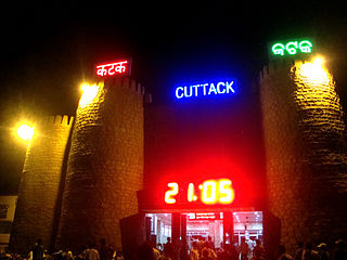
The Cuttack–Sambalpur line is a railway line connecting the cities of Cuttack with the Sambalpur, in the Indian state of Odisha.


