Jharsuguda

Last updated

Jharsuguda
Town/City
Jharsuguda Railway Station, Odisha.JPG
Nickname: 
JSG
India Odisha location map.svg
Red pog.svg
Jharsuguda
Location in Odisha, India
India location map.svg
Red pog.svg
Jharsuguda
Jharsuguda (India)
Asia laea location map.svg
Red pog.svg
Jharsuguda
Jharsuguda (Asia)
World location map (equirectangular 180).svg
Red pog.svg
Jharsuguda
Jharsuguda (Earth)
Coordinates: 21°51′N84°02′E / 21.85°N 84.03°E / 21.85; 84.03
CountryFlag of India.svg  India
State Orissa Flag(INDIA).png Odisha
District Jharsuguda
Established1951
Government
  TypeMunicipality Corporation
Area
  Total45 km2 (17 sq mi)
Elevation
218 m (715 ft)
Population
 (2011) [1]
  Total124,500
  Density2,800/km2 (7,200/sq mi)
Demonym Jharsugudia
Languages
  Official Odia, English
  Local Sambalpuri
Time zone UTC+5:30 (IST)
PIN
768201
Vehicle registration OD-23 (Previously OR-23)
Website jharsuguda.nic.in

Jharsuguda is a city and district headquarters of Jharsuguda district of Odisha, India. It is an industrial hub, consisting mainly of metallurgical industries. It is well connected to major cities of India through the rail network, and a recently inaugurated Jharsuguda Airport, now renamed as Veer Surendra Sai Airport. It is popularly known as the "Powerhouse of Odisha" due to its Mega Steel, Aluminium & Power Projects. Its First Industrialist in SSI Steel Sector of the Region was Jayprakash Badhan. Jharsuguda has often been referred as "Little India" as well because of its diverse demography, language and culture. One of the oldest bar and hotel in region is Kalinga Bar.

Contents

Major Tribes

This district has the major tribal populations among them important tribes are Sabara, Kisan, Kurukh, Bhuiyan, Munda, Santal. This district has unique[ citation needed ] diversity in terms of tribal culture, language and other focal culture. Kurukh people speak their mother tongue Kurukh language with Sadri language. Munda people speak their Ho language and Kisan people speak their Kisan dialect and Kharia speak their Kharia. Sadri and local Odia dialect is also quite popular among tribal communities.

Geography and Climate

The Ib River Basin of IB river my fav12.jpg
The Ib River
Autumn view of the Ib river Autumn view of IB river.jpg
Autumn view of the Ib river

Jharsuguda is located at 21°51′N84°02′E / 21.85°N 84.03°E / 21.85; 84.03 . [2] It has an average elevation of 218 metres (715 ft). It is located in Western Odisha. State highway 10 and National Highway 49 (NH-49) pass through this place. The Ib river flows along the Western side of Jharsuguda town and the river Bheden flows in the south. The area of the town is 70.47 km2, and has a population of 579,499. [3]

The town is situated at 21.82° north longitude and 84.1° latitude and at a height of 700–750 feet above mean sea level. The highest temperature recorded during the summer months is 48.0 °C. It has an average rainfall of 1,527 mm.

Climate data for Jharsuguda (1981–2010, extremes 1951–2012)
MonthJanFebMarAprMayJunJulAugSepOctNovDecYear
Record high °C (°F)35.0
(95.0)
38.4
(101.1)
42.7
(108.9)
46.1
(115.0)
48.0
(118.4)
47.1
(116.8)
41.7
(107.1)
36.2
(97.2)
37.1
(98.8)
36.2
(97.2)
35.6
(96.1)
32.8
(91.0)
48.0
(118.4)
Mean daily maximum °C (°F)27.8
(82.0)
30.8
(87.4)
35.7
(96.3)
40.1
(104.2)
41.0
(105.8)
36.8
(98.2)
31.9
(89.4)
31.2
(88.2)
32.0
(89.6)
32.2
(90.0)
30.2
(86.4)
27.8
(82.0)
33.1
(91.6)
Mean daily minimum °C (°F)12.6
(54.7)
15.4
(59.7)
19.7
(67.5)
24.4
(75.9)
26.9
(80.4)
26.5
(79.7)
25.0
(77.0)
24.8
(76.6)
24.4
(75.9)
21.4
(70.5)
16.5
(61.7)
12.6
(54.7)
20.9
(69.6)
Record low °C (°F)5.6
(42.1)
7.2
(45.0)
11.1
(52.0)
15.8
(60.4)
18.7
(65.7)
16.3
(61.3)
17.4
(63.3)
16.6
(61.9)
16.7
(62.1)
12.1
(53.8)
8.4
(47.1)
6.1
(43.0)
5.6
(42.1)
Average rainfall mm (inches)19.0
(0.75)
19.5
(0.77)
14.6
(0.57)
24.5
(0.96)
37.9
(1.49)
221.2
(8.71)
421.7
(16.60)
386.3
(15.21)
233.3
(9.19)
64.8
(2.55)
15.7
(0.62)
8.7
(0.34)
1,467.2
(57.76)
Average rainy days1.31.31.62.23.59.816.617.011.33.70.90.669.9
Average relative humidity (%) (at 17:30 IST)43342623295477817664534751
Source: India Meteorological Department [4] [5]

Culture

Religions in Jharsuguda
ReligionPercent
Hinduism
89.73%
Islam
5.78%
Christianity
3.69%
Others
0.8%
Kanaka Durga Mandir Kanak Durga Gadi Mandir, Jharsuguda 2.JPG
Kanaka Durga Mandir

Jharsuguda is a cosmopolitan city housing people from various regions of India. Major festivals celebrated in the town are:

Transport

Since the Colonial era, the city has had a relatively developed transportation network. Primary modes of transport are auto rickshaws, taxi and private and state operated buses.

The Jharsuguda Airport is operational since 2019 at Durlaga. It had an airstrip since British times, which is currently upgraded to a full-fledged airport. First flight from Jharsuguda took off in September 2018 after Prime Minister of India, Narendra Modi, inaugurated VSS Airport (Veer Surendra Sai Airport) on 22 September 2018. [7]

On 28 February 2019, low cost airline Spicejet announced regional connectivity from Jhasurguda to various state capitals such as Kolkata, Hyderabad as well as with New Delhi under the UDAN (Ude Desh ka Aam Nagrik) regional connectivity scheme. [8] [ circular reference ]

Jharsuguda railway station is an important railway junction on the Tatanagar–Bilaspur section of the Howrah-Nagpur-Mumbai line and the Jharsuguda-Vizianagaram line. The railway station comes under South Eastern Railway.

Jharsuguda Railway Station Jharsuguda Railway Station, Odisha 1.JPG
Jharsuguda Railway Station

Jharsuguda is connected to various towns of the states by State Highway 10 (now a part of Biju Expressway) and National Highway 49.

Politics

The current Member of the Legislative Assembly from Jharsuguda Assembly Constituency is Tankadhar Tripathy, who won the seat in 2024. [9] [10] Jharsuguda is currently under Bargarh constituency of the Lok Sabha. This constituency came into existence in 2008 as a part of delimitation of parliamentary constituencies based on the recommendations of the Delimitation Commission of India in 2002. Jharsuguda was previously under the Deogarh constituency of the Lok Sabha. The current Member of Parliament from Bargarh is Suresh Pujari from the Bharatiya Janta Party, taking office in 2019.

Education

The pre-collegiate medium of instruction in schools is predominantly English, Sambalpuri, Hindi and Odia. The medium of instruction in educational institutions after matriculation in colleges is English. Other medias of instruction also exist in Jharsuguda. Schools and colleges in Jharsuguda are mostly government-run, but schools run by private trusts and individuals also exist. The schools are affiliated with either the Odisha State Board under the Board of Secondary Education (BSE), Central Board of Secondary Education or Council of Higher Secondary Education (CHSE), Indian Certificate of Secondary Education. After completing 10 years of schooling in secondary education, students enroll in higher secondary school, specialising in one of three streams – arts, commerce or science.

In November 2016, the professional accounting body Institute of Chartered Accountants of India opened a branch at Jharsuguda.[ citation needed ] The biggest name in Jharsuguda district is Laxminarayan Mishra, who was a freedom fighter, writer, a nationalist during British raj and a politician from western Odisha.

See also

Related Research Articles

<span class="mw-page-title-main">Bargarh</span> Town in Odisha, India

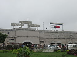
Bargarh is one of the major towns of Western Odisha and a municipality in Bargarh district in the state of Odisha in India. It is the administrative headquarters of Bargarh District and is one of the most important towns of Odisha because it is known as the "rice bowl of Odisha" due to its intense rice production, it is a agroindustrial hub and is also known as "city of handloom" because sambalpuri sari originated from here."Dhanujatra" of Bargarh is world famous and is known as the "world's largest open theatre". Bargarh was awarded with the "fastest moving city" award under the 50k-100k category in Swachh Sarbekhyan 2022 in the east zone.

<span class="mw-page-title-main">Sambalpur district</span> District of Odisha in India

Sambalpur District is a district in the western part of state of Odisha, India. The historic city of Sambalpur is the district headquarters.

<span class="mw-page-title-main">Burla, India</span> Locality in Odisha, India

Burla is a locality in Sambalpur city in the state of Odisha, India. It earlier had a Notified Area Council (NAC) until 2014 after which it was included in Sambalpur city under Sambalpur Municipal Corporation (SMC). It was earlier a small town on the banks of Mahanadi. One can reach this place by road with National Highway 6 which is one of the busiest trunk routes in India as it connects Hazira to Kolkata. Hirakud Railway Station is at one end of the town and a walking distance from the Mahanadi Coal Limited (MCL).

<span class="mw-page-title-main">Bhadrak district</span> District of Odisha in India

Bhadrak is a district of Odisha state in eastern India. Bhadrak city is the headquarters and the largest city of the district.

<span class="mw-page-title-main">Jharsuguda district</span> District in Odisha, India

Jharsuguda is a district in Odisha, India with Jharsuguda town as its headquarters. This region is rich in coal and other mineral reserves. Of late, many small and medium scale iron and steel units have been set up in the vicinity of Jharsuguda town, giving impetus to the industrial growth of the district.

<span class="mw-page-title-main">Sundergarh district</span> District of Odisha in India

Sundargarh District is a district in the northwestern part of Odisha state in eastern India.

<span class="mw-page-title-main">Kharia language</span> Munda language

The Kharia language is a Munda language of the Austroasiatic language family, that is primarily spoken by the Kharia people of eastern India.

<span class="mw-page-title-main">Bhadrak</span> City in Odisha, India

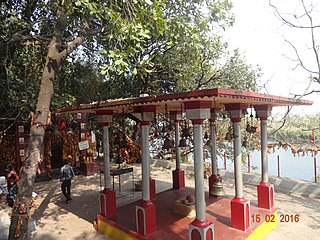
Bhadrak is a city of Odisha state in eastern India. The city is the district headquarters of Bhadrak district. According to legend, the city derives its name from the Goddess Bhadrakali, whose temple is on the banks of the Salandi River.

<span class="mw-page-title-main">Balangir</span> City in Odisha, India

Balangir also known as Bolangir, is a town and municipality, the headquarters of Balangir district in the state of Odisha, India. Balangir has one of the best cultural heritage in India. It is also known as one of the finest places for tourists in Odisha. Balangir municipality is divided into twenty-one wards. It is spread over an area of 12,200 acres (4,900 ha).

Rajgangpur is an industrial town situated in the Sundargarh District of Odisha. It is located 400 km to the north-west of the capital city, Bhubaneswar. It is located 30 km west of Rourkela. It is accessible by both road and rail. Rajgangpur Railway Station is on Mumbai-Rourkela line. Regular buses are available to Bhubaneswar, Cuttack, Rourkela and Angul. RGP Main Road is the main road of the town. The nearest functional airport is Veer Surendra Sai Airport, Jharsuguda which is approximately 95 km from Rajgangpur. Places of tourist interest in the vicinity of Rajgangpur include Mandira Dam, Chhatri Hill, Darjeeng, Vedvyas and Khandahar.

Barpali is a small town and a block (Tehsil) within the Bargarh district in the state of Odisha, India. Barpali is largely famous for renowned Odia Poet Swabhaba Kabi Gangadhar Meher who was born here. However, there are several other cultural notations which have made Barpali famous nationally and internationally, like: the indigenous sambalpuri saree weaving art and the earthen pottery handicrafts (Terracotta) etc, creations from the native inhabitants of Barpali. Among others, the name Barpali also draws attention towards the past studies, wide usage and then outward expansion of preliminary versions of sanitary toilets started by foreigners here, known as 'Barpali Toilets' nearly 40 years ago.

Biramitrapur is a town and a municipality in Sundargarh district in the state of Odisha, India.

Brajrajnagar is a town and a municipality in Jharsuguda district in the state of Odisha, India. Popular legend says the town was named after Braj Mohan Birla after he set up Orient Paper Mills in 1936. It is a small sleepy town on rocky terrain, built on the banks of IB river, with temples mostly built by the Birlas. Later it became famous for MCL-owned coal mines after Orient Paper Mills of Birlas managed by dulichand Hanuman Prasad shah closed down in 1999.

<span class="mw-page-title-main">Junagarh, Kalahandi</span> Town in Odisha, India

Junagarh is a town and a notified area council in Kalahandi district in the Indian state of Odisha. MLA of Junagarh is Captain Dibya Sankar Mishra. It was the capital of the former state of Kalahandi. Junagarh is 26 km from Bhabanipatna, connecting National Highway 201.This highway recently has been termed as National Highway 26.

This article lists the traditional festivals and other cultural events in the Odisha region of India. Odisha celebrates 13 festivals in 12 months as the saying goes Bāra Māsare Tera Parba.

Loisingha is a town in Bolangir district, Odisha, India.

Papadahandi is a small town located in Nabarangpur district of Odisha, India. It is the block headquarters of Papadahandi block. Papadahandi is situated on National Highway number 201. It is famous for the Ancient Shiva temple and the Champa garden having hundreds of Champa tree. The Sahid Minar located on the bank of Turi river is a memorial.

Bhikampali is a medium-sized village in the Jharsuguda district of Odisha, India. It is situated on the banks of Saan-kelo River in the foothill of Chhelia Pahad. The village is located at a distance of 60 km from the district headquarter of Jharsuguda. It is within the Brajarajnagar assembly constituency, and the Bargarh Parliament constituency. As of 2011 census, its population is 920.

Kurumgram is an old village located in Nalhati I CD Block in Rampurhat subdivision of Birbhum district in West Bengal State of India.

References

  1. "District Census Handbook - Jharsuguda" (PDF). Directorate of Census Operations, Odisha. 2011. Retrieved 26 January 2019.
  2. Falling Rain Genomics, Inc – Jharsuguda
  3. 2001 Census
  4. "Station: Jharsuguda Climatological Table 1981–2010" (PDF). Climatological Normals 1981–2010. India Meteorological Department. January 2015. pp. 369–370. Archived from the original (PDF) on 5 February 2020. Retrieved 10 January 2021.
  5. "Extremes of Temperature & Rainfall for Indian Stations (Up to 2012)" (PDF). India Meteorological Department. December 2016. p. M164. Archived from the original (PDF) on 5 February 2020. Retrieved 10 January 2021.
  6. "Important Fairs and Festival of Jharsuguda district".
  7. "P.M Modi visit to Jharsuguda District". Archived from the original on 22 September 2018. Retrieved 22 September 2018.
  8. UDAN
  9. "Reports on Election 2014" (PDF). ceoorissa.nic.in. 6 June 2017. p. 124. Archived from the original (PDF) on 6 June 2017. Retrieved 19 February 2019.
  10. "CEO ODISHA". archive.is. 19 February 2019. Archived from the original on 19 February 2019. Retrieved 19 February 2019.