
Odisha, formerly Orissa, is an Indian state located in Eastern India. It is the eighth-largest state by area, and the eleventh-largest by population, with over 41 million inhabitants. The state also has the third-largest population of Scheduled Tribes in India. It neighbours the states of Jharkhand and West Bengal to the north, Chhattisgarh to the west, and Andhra Pradesh to the south. Odisha has a coastline of 485 kilometres (301 mi) along the Bay of Bengal in the Indian Ocean. The region is also known as Utkaḷa and is mentioned by this name in India's national anthem, Jana Gana Mana. The language of Odisha is Odia, which is one of the Classical languages of India.

Baripada is a city and a municipality in Mayurbhanj district in the state of Odisha, India. Located along the east bank of the Budhabalanga river, Baripada is the cultural centre of north Odisha. In recent years, it has emerged as an educational hub with the opening of numerous professional colleges.

Puri, also known as, Jagannath Puri, is a coastal city and a municipality in the state of Odisha in eastern India. It is the district headquarters of Puri district and is situated on the Bay of Bengal, 60 kilometres (37 mi) south of the state capital of Bhubaneswar. It is home to the 12th-century Jagannath Temple and is one of the original Char Dham pilgrimage sites for Hindus.

Konark is a medium town in the Puri district in the state of Odisha, India. It lies on the coast by the Bay of Bengal, 65 kilometres from the capital of the state, Bhubaneswar. It is the site of the 13th-century Sun Temple, also known as the Black Pagoda, built in black granite during the reign of Narasinghadeva-I. The temple is a World Heritage Site. The temple is now mostly in ruins, and a collection of its sculptures is housed in the Sun Temple Museum, which is run by the Archaeological Survey of India.

Paradeep, also spelled Paradip, is a major industrial seaport town and municipality, nearly 80 km from Cuttack city, in Jagatsinghpur district of Odisha, India. Paradeep was constituted as an NAC on 27 September 1979 and converted into a municipality on 12 December 2002. The nearest commercial airport is Biju Patnaik International Airport.

Cuttack district is one of the 30 districts of Odisha state in India. It is located in the coastal part of the state and its administrative headquarters are located in the city of Cuttack. As of 2011 Census, after Ganjam, it is the second most populous district of Odisha, with a population of 2,624,470. The name is an anglicized form of Kataka or Katak meaning Fort – referring to the Barabati Fort. The district is bisected by the river Mahanadi and its numerous distributaries and occupies a large portion of the river's delta. It is bounded by the Angul, Dhenkanal, Nayagarh and Khurda districts to the west while its southern and eastern boundaries touch Puri, Jagatsinghpur, Kendrapara and Jajpur districts.

Khordha district is an administrative division of the state of Odisha, India. It was formed on April 1, 1993, by the division of former Puri District into Puri, Khordha and Nayagarh districts. In the year 2000 the district name was changed to Khordha. The district headquarters is Khordha Town. The capital city of Bhubaneswar is located in this district. Khordha is the most urbanized of all the districts of Odisha.
Konark Beach or Chandrabhaga Beach is situated in Odisha on the eastern coast of India and is considered to be India's finest beach. It is situated three km east of the Sun temple of Konark, in the Puri district in the state of Odisha, India. It is 30 km from the city of Puri. Formerly Chandrabhaga Beach was considered a place of natural cure for lepers. The beach on the coast of Konark becoming India's first to get the Blue Flag certification — a tag given to environment-friendly clean beaches, equipped with amenities of international standards for tourists.

Puri district is a coastal district of the Odisha state of India. It has one sub-division, 11 tahasils and 11 blocks and comprises 1722 revenue villages. Puri is the only municipality of the district. Konark, Pipili, Satyabadi, Gop, Kakatpur and Nimapada are the NACs in this district while Brahmagiri being a semi-urban town.
Nimapada is a town and a Notified Area Council (NAC) in Puri district on the way to Konark and 40 km from the state capital Bhubaneswar in the Indian state of Odisha.
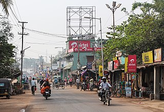
Pipili is a town and a NAC under jurisdiction of Puri district in the Indian state of Odisha. It is famous for designing beautiful Applique handicrafts. It is a town of artisans famous for their colourful fabrics.
Konark Sun Temple is a 13th-century CE Hindu Sun temple at Konark about 35 kilometres (22 mi) northeast from Puri city on the coastline in Puri district, Odisha, India. The temple is attributed to king Narasingha Deva I of the Eastern Ganga dynasty about 1250 CE.
Astaranga is a fishing and agricultural village and a community development block in Puri district in the Indian state of Odisha. It was a part of 'Lavana Satyagraha', a nonviolent civil disobedience in colonial India led by Mahatma Gandhi. It is a major exporter of betel leaves, mainly to North India and other countries. The most visited tourist place, known as Pir Jahania, is situated at the shore of Bay of Bengal. Casuarina trees are planted in a vast area to give shades to the tourists. Astaranga also has two other picnic spots like Ganga Devi muhana & Nuagarh jethi. The government has planned for a marine drive road along the seashore. In Astaranga, there is a nodal primary school above a century old, a high school above 50 years old whose first headmaster was 'Sarala puraskar' winner for his poetry Kulamani Swain, a Saraswati Sishu Vidya Mandir, Anganbadi for small children and three CBSE schools.
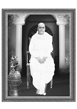
Durga Charan Mohanty (Odia:ଦୁର୍ଗାଚରଣ ମହାନ୍ତି, was an Odia Indian spiritual writer born in 1912 at Biratunga, a village under block Gop, near Konark, Odisha. The Odia Sahitya Akademi has been awarded to him in 1956–58 due to his active involvement in development of Odia language and literature Being a disciple of Swami Nigamananda, he wrote many books and translated Nigamananda's own-written Bengali books to Odia language. He was ପରିଚାଳକ of ନୀଳାଚଳ ସାରସ୍ୱତ ସଂଘ.

Puri is a Vidhan Sabha constituency of Puri district, Odisha.
Brahmagiri is a Vidhan Sabha constituency of Puri district, Odisha, India.

Nimapara is a Vidhan Sabha constituency of Puri district, Odisha.

Kakatpur is a Vidhan Sabha constituency of Puri district, Odisha.
Rajanagar is a Vidhan Sabha constituency of Kendrapara district, Odisha.
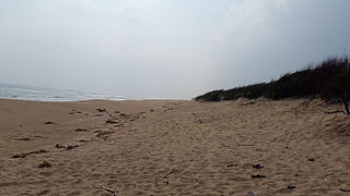
Chandrabhaga Beach is situated three km east of the Sun temple of Konark, in the Puri district in the state of Odisha, India. It is 30 km from the city of Puri. Formerly Chandrabhaga was considered a place of natural cure for lepers. Chandrabhaga beach on the coast of Konark becoming India's first to get the Blue Flag certification — a tag given to environment-friendly clean beaches, equipped with amenities of international standards for tourists.

