
Shirdi is a town and pilgrimage site in the Indian state of Maharashtra. Shirdi is located in the Rahata taluka of Ahmednagar District. It is accessible via the Ahmednagar–Malegaon State Highway No.10, approximately 83 km (52 mi) from Ahmednagar and 15 km (9.3 mi) from Kopargaon. It is located 185 km (115 mi) east of the Ahmednagar–Manmad road. Shri Saibaba Sansthan Trust is located in Shirdi.

Gajuwaka is a major residential area of Visakhapatnam City, India. This neighborhood of Visakhapatnam is considered the biggest shopping district in Andhra Pradesh by revenue. Though conceived as a residential locality, it is now one of the principal shopping districts of the city. The Gajuwaka area of Visakhapatnam has the highest per capita income in Andhra Pradesh.

Tadepalligudem is a city in West Godavari district of the Indian state of Andhra Pradesh. Tadepalligudem is the judicial headquarter of West Godavari. It is a Selection Grade municipality and the mandal headquarters of Tadepalligudem mandal and Tadepalligudem Revenue Division. Tadepalligudem is one of the biggest cities in West Godavari district

Bade Bacheli is a town and a Nagar Palika in Dantewada district in the state of Chhattisgarh, India. It is now very well known as NMDC Township with nature all around to explore and witness. It is situated roughly 400 km from Raipur, capital of Chhattisgarh. The way to travel is by Road with frequent bus service from Raipur, Bhilai, Jagdalpur, and Hyderabad, Visakhapatnam or by train from Jagdalpur and Vishakhapatnam.
Danguwapasi is a census town in Pashchimi Singhbhum district in the state of Jharkhand, India.

Gunupur is a Municipality and one of the sub-divisional headquarters of Rayagada district in the Indian state of Odisha. It is the second biggest town in Rayagada district.
Jhumpura is a census town and a block in Kendujhar district in the Indian state of Odisha.
Karuppur is a panchayat town in Salem District in the Indian state of Tamil Nadu. It is located on the National Highway 7 between Salem and Bangalore. The Periyar University, with which many Salem colleges are affiliated, is located here. Government College of Engineering, referred as GCE-Salem is also located here. It is a railway station on the Chennai-Shoranur railway line.
Manavalakurichi is a panchayat town in Kanniyakumari district in the Indian state of Tamil Nadu. It is hardly 60 km from Thiruvananthapuram, the capital city of Kerala. Tamil and Malayalam are the common languages of people living here.
Sirathu is a town and Nagar Panchayat in Kaushambi district in the Indian state of Uttar Pradesh. It is one of oldest town in Kaushambi district. The town has a population of approximately 2700.

Kaikaluru is a town in Eluru district of the Indian state of Andhra Pradesh. Kaikalur is home to Kolleru Lake, one of the largest freshwater lakes in India, covering about 90,100 hectares and is a tourist attraction.

Srungavarapukota, popularly known by its abbreviated form S.Kota, is a neighbourhood in the district of Vizianagaram, India. S.Kota is located on Visakhapatnam – Araku road. The town was upgraded from gram panchayat to Nagar Panchayat in the year 2011.

Narasannapeta is a census town in Srikakulam district of the Indian state of Andhra Pradesh. It is the mandal headquarters of Narasannapeta mandal in Srikakulam revenue division. 43 villages are there under the administrative division of Narasannapeta.
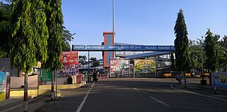
Palasa is one of the twin towns located in the Srikakulam district of Andhra Pradesh, India. The town is situated between Srikakulam and Berhampur. It is categorized as the second grade municipality. Also the town serves as the headquarters of Palasa Mandal.

Pathapatnam is a town in Srikakulam district of the Indian state of Andhra Pradesh. It is located in Pathapatnam mandal of Tekkali revenue division. Telugu is the major spoken language in the town and in entire mandal. Pathapatnam is located on the border of Srikakulam district of Andhra Pradesh and Gajapati district of Odisha. Parlakhemundi, the headquarters of Gajapati District, can be considered as twin town of Pathapatnam because of its close proximity. It is located around 65 km from srikakulam. It was the old capital of Paralakhemundi Gajapati Maharajah of his erstwhile kingdom.

Pendurthi is a neighbourhood in the city of Visakhapatnam, India. The neighbourhood is considered as the major residential and commercial area in the city. It is located within the jurisdiction of the Greater Visakhapatnam Municipal Corporation, which is responsible for the civic amenities in Pendurthi. It is located on the west fringe of Visakhapatnam city. Pendurthi is one of the peaceful neighborhoods of Western Vizag. The pincode of Pendurthi is 531173.
Badagam is a small village in the Rayagada Block and Parlakhemundi municipality in Gajapati district in the Indian state of Odisha. The major languages spoken in this place are Kui and Oriya.

Durgi is a census village & Panchayat Headquarter of Bissam Cuttack Block in Rayagada district of Odisha, India. There are total 439 families residing in this village. The wards/ villages comes under Durgi Panchayat are:- Durgi, Bhaleri, Kundanpadar, Rengabai, Barangpadar, Thambalpadhu, Budhanagar, Kachapai, Kalipadar, Kurankul, Tentili Kalipadar, Mulipada, Dharamguda, Balipadar, Haduguda, Huruguda, Khariguda and IAY Colony.

Chhatrapur railway station is one of two railway stations in Chatrapur, this being the main railway station in Ganjam district, Odisha. Its code is CAP. It serves Chhatrapur city and another one is Chatrapur Court halt, which code is CAPC. It is situated in the heart of the town. The railway station is category NSG-4. Comes under East Coast railway zone & Khurda Road division. 52 trains stops at this station.
Anakapalli mandal is one of the mandals in located in Anakapalli district of the state of Andhra Pradesh, India. It is administered under Anakapalli revenue division and its headquarters are located at Anakapalli. It is bounded by Kasimkota Mandal towards west, Munagapaka Mandal towards South, Paravada Mandal towards East, Achutapuram Mandal towards South.


