The Kwari River, also known as the Kuwari or Kunwari River, flows through the Sheopur, Morena and Bhind districts of Madhya Pradesh in central India. The total length of the river is approx 220 km.

Natavalasa is a village and panchayat in Denkada mandal of Vizianagaram district, Andhra Pradesh, India. It is located on the banks of River Champavathi.

River Champavathi is a small river which originates in the Eastern Ghats at an altitude of 1,200 metres above mean sea level near Andra village and flows eastwards and joins the Bay of Bengal near the village Konada. The river passes through Gajapathinagaram, Nellimarla, Saripalli, Denkada, Palem and Natavalasa of Vizianagaram district. The river has four main tributaries Eduvampula Gedda, Chitta Gedda, Pothula Gedda and Gadi Gedda. The basin has a drainage area of 1,410 square kilometres. This area is divisible into Hilly terrain, Vizianagaram plains and Coastal plains.

The Indrayani River originates in Kurvande village near Lonavla, a hill station in the Sahyadri mountains of Maharashtra, India. It is a rain fed river and flows east through the Hindu pilgrimage centers of Dehu and Alandi to meet the Bhima river. It follows a course mostly north of the city of Pune. It is revered as a holy river and is associated with religious figures such as Sant Tukaram and Dnyaneshwar.
Rudhmuli is a village in Bah Tehsil of Agra District of Uttar Pradesh in India.
Hee Gyathang Monastery is a Buddhist monastery situated in Upper Dzongu, North Sikkim in northeastern India. It was built by hermit Abi Putso Rangdrol in 1914.

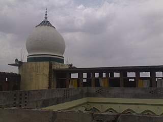
Ziarat Shareef is a mosque with a madrasah (Madrasah khāṣah in Kakrala city, Budaun district of Uttar Pradesh, India. The building was designed and built by Shah Saqlain Miyan. The building also contains the Khatoli Shareef of Shah Dargahi Miyan. People from across the country come to visit the Khatoli Shareef. This visit is called the ziyarat, hence the name of this building.
Lingthem is a village in Mangan subdivision, North Sikkim district, Sikkim, India. The Ministry of Home Affairs has given it a geographical code of 260875.
Lingdem is a village in Mangan subdivision, North Sikkim district, Sikkim, India. The Ministry of Home Affairs has given it a geographical code of 260876.

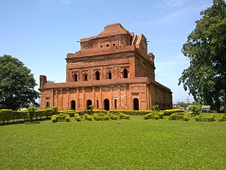
Kareng, also known as The Garhgaon Palace, is located in Garhgaon 15 kilometres (9.3 mi) from Sivasagar, Assam, India. The palace structures were made of wood and stone. In 1751 Sunenphaa, son of Sukhrungphaa, constructed the brick wall of about 5 kilometres (3.1 mi) in length surrounding the Garhgaon Palace and the masonry gate leading to it.
Honnavile is a village in Shimoga district in the central part of the state of Karnataka. This place is located 2 km from state highway BH road. Shimul or Shimoga Milk Union, upcoming IT park near Machenahalli, and Malnad Cancer Hospital are the prominent landmarks.

Chinkara Breeding Centre, Kairu is a protected Chinkara breeding centre in Kairu village, Tosham tehsil, Bhiwani district, Haryana, India. The Ch. Surender Singh Memorial Herbal Park, Kairu is nearby.
Sine is a village in the Boleng Circle of East Siang District, Arunachal Pradesh.
Achhod is a village panchayat located in the Bharuch district of Gujarat state, India. It has a population of around 15,000.
Pindra is one of three tehsils (sub-districts) in Varanasi district in the Indian state of Uttar Pradesh. Pindra is situated 24 kilometers from the city of Varanasi and has 424 villages.

Patliputra Natya Mahotsav (PNM), started in 1985, is an annual theatre festival organized in the Patna, India by the Prangan, a Cultural Organization, with the help of Union and state ministries of culture. held annually at the Kalidas Rangalaya. The first Patliputra Natya Mahotsav was held in 1985 and 2023 was its 37th edition.
Nahub is a village situated in Nalanda district in the Indian state of Bihar. The village is located midway between the cities of Silao and Rajgir. Pin code of nahub is 803116
Tella is a village in Onda CD Block of Bankura district in West Bengal, India. Onda is the nearest town to Tella . Tella is known for its numerous ponds/lakes. While the smaller ones are privately owned, the larger ones are either owned by community or open to public.

Bahadurgarh Fort is a historical fort near Patiala in Punjab, India.
The Chaskaman Dam is one of the important dams of Maharashtra and is built on the Bhima River at Rajgurunagar in Pune district. It is located across river Bhima in Krishna basin near Village Bibi in Khed taluka. The main purpose of this dam was to improve irrigation and supply of electricity to the nearby villages. It is the second Hydel Greenfield power project in the country that is capable of captive power as well. The power will be utilized through the state power board. The project was completed during 2008-09.


