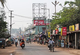
Gopalpur is a coastal town and a Notified Area Council on the Bay of Bengal coast in Ganjam district in the southern part of Odisha, India. Today it is a commercial port, a famous sea beach, a tourist destination. Gopalpur is around 15 km from Berhampur. The reconstruction of an all weather port including new berths is under development.

Subarnapur, also known as Sonepur, is a town and district headquarters of Subarnapur district of Odisha. The district spreads over an area of 2284.89 km2. It is also known as Second Varanasi of India for its cluster of temples having architectural importance and also of tantricism and second Allahabad for the Meeting Point (Sangam) of three rivers Mahanadi, Tel and Sukhtel in place just like in Allahabad. Subarnapur is also famous for silk, handloom, prawns, terracotta etc.

Angul is a town and a municipality and the headquarters of Angul district in the state of Odisha, India. Angul has an average elevation of 195 m (640 ft) above sea level. The total geographical area of the district is 6232 km2. From the point of view of area it stands 11th among the 30 Districts of Odisha.

Boudh is a town and a Notified Area Council in Boudh district in the state of Odisha, India. It is the district headquarters of Boudh district. It is located on the bank of Mahanadi, the largest river of the state of Odisha.

Chhatrapur is a town and a municipality in Ganjam district in the state of Odisha, India. It is the district headquarters town of Ganjam district. Chhatrapur is a Tehsil / Block (CD) in the Ganjam District of Odisha. According to Census 2011 information the sub-district code of Chhatrapur block is 03085. Total area of Chhatrapur is 124 km2 (48 sq mi) including 119.92 km2 (46.30 sq mi) rural area and 4.40 km2 (1.70 sq mi) urban area. Chhatrapur has a population of 94,683 people. There are 20,415 houses in the sub-district. There are about 46 villages in Chhatrapur block

Khordha is a city and a municipality area in Khordha district in the Indian state of Odisha. Bhubaneswar, capital of Odisha, belongs to Khordha district and is only 25 km from Khordha town. Odisha State Highway 1 and National Highway 16 runs via this town.

Asika or Aska is a town and a Notified Area Council in Ganjam district in the state of Odisha, India. Fondly known as the sugar city of India. Asika is the 3rd largest city in district of Ganjam after Berhampur and Bhanjanagar. Asika is a major commercial and transportation hub of Ganjam district. It is situated between river Badanadi and holy river Rushikuliya.

Athagad is a town"(N.A.C)" and a sub-division of Cuttack district in the state of Odisha, India.

Chikiti is a town and a notified area council located in Ganjam district in the state of Odisha, India.

Dhamanagar is a town and a notified area committee in Bhadrak district in the state of Odisha, India.

Digapahandi is a town and a Notified Area Council (N.A.C.) in Ganjam district in the state of Odisha, India. There are 171 small villages which comes under Digapahandi tahasil and largely dependent on this town for their business and livelihood. Digapahandi town is divided into 11 wards, comprising Bazar street, Sunari street, New street, Phulasundari Street, Balaji Nagar Bada Brahmin street, Sana Brahmin street, Sasan street, Chikitia street, Rani street, Annapurna street, Anchala street, Uparabasa, Chikiti road etc.

Hinjilicut is a town and municipality of Ganjam district in the Indian state of Odisha.

Jajpur is a town and a municipality in Jajpur district in the Indian state of Odisha. It was the capital of the Kesari dynasty, later supplanted by Cuttack. Now, it is the headquarter of Jajpur district.

Kamakhyanagar is a town (NAC) and a subdivision in Dhenkanal district in the Indian state of Odisha. It is located 37 km north of Dhenkanal.

Kabisuryanagar is a town and a NAC in Ganjam district in the Indian state of Odisha.

Kodala is a town and a Notified Area Council in Ganjam District in the Indian State of Odisha.

Patnagarh is a town and a Notified Area Council in Bolangir district in the Indian state of Odisha. Its original name is Patnāgarh, and it is pronounced verbally as Patnāgad. The official language is Odia. Patnagarh bears historical significance as it was the epicentre of power in middle age. Patnagarh was the capital of 18 garh that come under south Koshal. In 12th century AD the progenies of the famous King of Delhi, Prithwiraj Chouhan came and settled down in Patnagarh. They came here because Mohammad Ghori defeated Prithwiraj Chowhan in 2nd battle of Tarai in 1193. The first child of the royal scion who ruled Patnagarh as per recorded history was Ramai Deo. However after 16th century onwards when Balangir and Sambalpur came in to being the city lost its charm.

Pipili is a town and a NAC under jurisdiction of Puri district in the Indian state of Odisha. It is famous for designing beautiful Applique handicrafts. It is a town of artisans famous for their colourful fabrics.

Purusottampur is a town and a notified area committee in Ganjam district in the Indian state of Odisha.

Rambha is a town and a notified area council in Ganjam district in the Indian state of Odisha.


