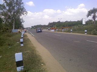
Puthunagaram is a town and gram panchayat in the Palakkad district, state of Kerala, India. It is about 10 km south of Palakkad and 8 Km from Kollengode. Palakkad-Pollachi railway line passes through this town.
Basni Belima is a census town in Nagaur district in the state of Rajasthan, India. Most of the People from Basni Belima is having Milk & Tea shop in Mumbai, Maharashtra. Few of them have Farm in Mumbai.
Bharveli is a census town in Balaghat district in the state of Madhya Pradesh, India.
Choornikkara is a census town and in Aluva in Ernakulam District in Kerala, India. It is also the headquarters of the Choornikkara gram panchayat
Dhampur is a city and a municipal board in Bijnor district in the state of Uttar Pradesh, India. It is located at 29.51°N 78.50°E, and lies in Northern India.
Edaganasalai is a Municipality in Salem district in the state of Tamil Nadu, India.
Ezhudesam is a town panchayat in Kanniyakumari district in the state of Tamil Nadu, India.
Ganapathipuram is a panchayat town in Kanniyakumari district in the state of Tamil Nadu, India.
Kwakta is a town and a Municipal Council in Bishnupur district in the Indian state of Manipur. It is in the Moirang subdivision, between the town of Moirang and the Kuki-dominated villages such as Kangvai and Torbung. It has a population of about 8,000 people, mainly Meitei Pangals (Muslims).
Murgud is a city and a municipal council in Kolhapur district in the Indian state of Maharashtra.This City has a rich culture in various sports such as wrestling and volleyball. In Murgud, there is a big market place and at the same time the Murgud Traders Association is an association organization. Mr. Digambar Bhilavadikar is the president and Mohan Gujar is the vice president and there are other directors in it.
Palamedu is a panchayat town in Madurai district, Indian state of Tamil Nadu
Pappakurichi is a census town in Tiruchirappalli district in the Indian state of Tamil Nadu. It was merged with the Tiruchirappalli Corporation in 2011.
Peerkankaranai is a neighborhood in the city of Tambaram, situated within the Chennai Metropolitan Area, Tamil Nadu, India.
Sadulshahar is a town and a municipality in Sri Ganganagar district in the Indian state of Rajasthan.
Sayalgudi is a town panchayat in Ramanathapuram district of Tamil Nadu State in India. It is located west of the district along the East Coast Highway towards Kanyakumari. The state highway SH200 passes through the town connecting districts of Thoothukudi and Tirunelveli. It surrounded by many small villages and acts as marketplace for people.
Thevaram is a town in Theni district in the Indian state of Tamil Nadu. Thevaram is located in Tamil Nadu near on border of Kerala at the Eastern side foot-hill of the Western Ghats. It is connected with State Highway SH100.

Thiruvalam also known as Thiruvallam, an ancient Temple Town built around Sri Dhanurmadhyambigai Sametha Sri Vilavanadeeswarar Temple, is part of Vellore City.
Jafarabad is a town and nagar panchayat in Jaunpur district in the Indian state of Uttar Pradesh.

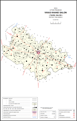
Salon is a town and nagar panchayat in Raebareli district in the Indian state of Uttar Pradesh. It serves as the headquarters of a tehsil as well as a community development block. Originally it was also the headquarters of the entire district, but they were moved after the Indian Rebellion of 1857. It is located a bit to the south of the Sai river, at the junction of the Raebareli-Pratapgarh and Jais-Khaga roads. Other roads lead to Dalmau, Manikpur, and Kunda. To the east is a large jhil.
Kerur is a town in Bagalkot district in Karnataka, which located on NH 218. It has an average elevation of 617 meters (2024 feet). It's the birthplace of Jagadish Shettar, a former Chief Minister of Karnataka. Kerur is a Town Panchayat city in the district of Bagalkot, Karnataka. The Kerur city is divided into 16 wards for which elections are held every five years. The Kerur Town Panchayat has a population of 19,731 of which 9,929 are males while 9,802 are females as per report released by Census India 2011.


