Khaira is a village in Ludhiana district in the Indian state of Punjab.
Chhatrapur is a town and a Municipality in Ganjam district in the state of Odisha, India.
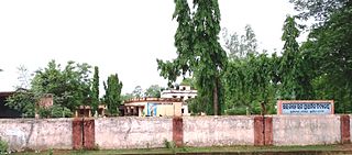
Satwas is a town and a Nagar Panchayat in Dewas district in the Indian state of Madhya Pradesh. Satwas is around 136.8 km (85.0 mi) from Dewas.
Ampani is a town in the Kalahandi district of the state of Odisha, in India. It is a gram panchayat that comes under Kokasara tehsil. It is 15 km from its main town and blocks Kokasara.

Malwas is a village and post in the Churu district of northern Rajasthan state, India.
Gagsina is the notified area committee in Gharaunda tehsil in Karnal district, Haryana, India. It is one of 55 villages in Gharaunda block and is located 20 km south from district headquarters in Karnal, 10 km from Gharaunda and 153 km from state capital Chandigarh. The postal code of the area is 132114. The main occupation of the people residing in the village is agriculture.
Mujagada is a large village located near Bhanjanagar of Ganjam district in Orissa. It is located 89 kilometres (55 mi) north of the district headquarters, Chhatrapur, and 159 kilometres (99 mi) from the state capital Bhubaneswar. Asika, Hinjilicut, Phulabani, and Berhampur are nearby. Oriya is the local language here. The main occupation of this village is agriculture.
Deengli is a village in Rajgarh, Churu, Rajasthan, India. As per 2011 Census of India, the village has population of 2197 of which 1144 are males while 1053 are females. It comes under ‘’’Sulkhnia chhotta’’’ Panchayath. It belongs to Bikaner Division. As per constitution of India and Panchyati Raaj Act, Deengli village is administrated by Sarpanch who is elected representative of village. It is located 65 km towards East from District headquarters Churu. 230 km from State capital Jaipur. The most famous place in Deengli is Net Dada JI temple.
Gopaipali is a small village under Barpali block in Bargarh District with village code 72500 as per 2001 Census.

Durgi is a census village & Panchayat Headquarter of Bissam Cuttack Block in Rayagada district of Odisha, India. There are total 439 families residing in this village. The wards/ villages comes under Durgi Panchayat are:- Durgi, Bhaleri, Kundanpadar, Rengabai, Barangpadar, Thambalpadhu, Budhanagar, Kachapai, Kalipadar, Kurankul, Tentili Kalipadar, Mulipada, Dharamguda, Balipadar, Haduguda, Huruguda, Khariguda and IAY Colony.
Oranda is a village located in the Gurudijhatia Block of the Athagad Tehsil of the Cuttack District of the Indian state of Odisha.
Devli Kalan is a village in Nawa Tehsil in Didwana Kuchaman district of Rajasthan State, India. It belongs to Ajmer Division. It is located 176 km towards East from District headquarters Nagaur, 60 km from State capital Jaipur. Devli Kalan Pin code is 341507 and postal head office is Maroth. Renwal, Jaipur, Sambhar, Phulera, Reengus are the nearby Cities to Devli Kalan. Minda, Loonwa, Shyamgarh & KANCHANPURA 1.5 km are the nearby Villages to Devli Kalan. As per constitution of India and Panchyati Raaj Act, Devli Kalan village is administrated by Sarpanch who is elected representative of village.
Dihapadhal is a Village located near Bhanjanagar of Ganjam district in Orissa. It is located 104 km north off the District Headquarters Chhatrapur and 170 km from State capital Bhubaneswar. Bhanjanagar, Lalsingi, Jilundi, Baunsalundi, Inginathi and Sanakodanda are the nearby Villages to Dihapadhal. Odia is the commonly spoken local language here.
Radhamohanpur is a village in Debra Community Development Block in West Medinipur District of West Bengal, India. It is located in the Burdwan Division, 28 km towards East from District headquarters Midnapore. Bengali is the Local Language. Radhamohanpur village is surrounded by Pingla Block towards South, Panskura-I Block towards East, Kharagpur-II Block towards west, Keshpur Block towards North. Radhamohanpur Railway Station lies along the Kharagpur- Howrah Railway line.
Bheduasole is a medium-sized Gram Panchayat and village in Indpur Block in Bankura District of the Indian state of West Bengal. It is located in Burdwan Division. It is located 23 km towards west from District headquarters Bankura and 187 km from State capital Kolkata.
Huruhuri is a village about 2 km north from the Gomti River in the tehsil of Kerakat, Jaunpur, Uttar Pradesh, India. It belongs to the Varanasi Division. It is located 25 km east of the city of Jaunpur, 4 km west of Kerakat, and 274 km from Lucknow, the capital of Uttar Pradesh. Hurhuri's Postal Index Number is 222142 and the postal head office is situated in Kerakat and Branch Office is JaiGopalGanj. Huruhuri is situated Near State Highway 36.
Sahara is a village in Bichpuri Block in Agra District of Uttar Pradesh State, India. It belongs to Agra Division. It is located 13 km towards west from District headquarters Agra. 3 km from Bichpuri. 356 km from State capital Lucknow
Sanoda is a village in Kotkasim tehsil Alwar District in the state of Rajasthan, India.
Shankerpora, also known as Shankerpur, is a village in Anantnag district in the Indian-administered union territory of Jammu and Kashmir.
Khireitangiri is a village located in Patna Tehsil in the Kendujhar District in the Indian state of Odisha.
