Khordha district

Last updated
Khordha district
Khurda
Northern pintails Odisha India.jpg
Iitbbs.jpg
Maa Barunei Temple.jpg
Pathani Samanta Planetarium.JPG
Chandaka Forest and Elephant Reserve 01.JPG
Rail station, Khurda Road.JPG
Parsurameswara temple complex.jpg
Nickname: 
Paikagada
India Odisha Khordha district.svg
Location in Odisha
Khordha district
Khordha district
Coordinates: 20°09′58″N85°39′58″E / 20.166°N 85.666°E / 20.166; 85.666
CountryFlag of India.svg  India
State Orissa Flag(INDIA).png Odisha
Headquarters Khordha
Government
   Collector & District Magistrate K Sudarshan Chakravarthy
Area
  Total2,813 km2 (1,086 sq mi)
Population
 (2011) [1]
  Total2,251,673
  Density800/km2 (2,100/sq mi)
Languages
  Official Odia, English
Time zone UTC+5:30 (IST)
PIN
751 xxx, 752 xxx
Telephone code674, 6755, 6756
Vehicle registration OD-02/OD-33, OD-33K
Nearest city Bhubaneswar
Sex ratio 1.108 /
Literacy87.51%
Lok Sabha constituency2
Vidhan Sabha constituency6
Climate Aw (Köppen)
Precipitation 1,443 millimetres (56.8 in)
Avg. summer temperature41.4 °C (106.5 °F)
Avg. winter temperature9.5 °C (49.1 °F)
Website www.khordha.nic.in

Khordha district is an administrative division of the state of Odisha, India. It was formed on April 1, 1993, by the division of former Puri District into Puri, Khordha and Nayagarh districts. In the year 2000 the district name was changed to Khordha. The district headquarters is Khordha Town. The capital city of Bhubaneswar is located in this district. [2] Khordha is the most urbanized of all the districts of Odisha.

Contents

Khordha Road, the railway station that serves the town, is also the divisional headquarters of the East Coast Railway of the Indian Railways, and contains its own division. Khordha is known for its brass utensils, cottage industries, railway coach manufacturing and cable manufacturing unit and counsumer food manufacturing unit of various MNCs like Coca-Cola, Pepsi, Unilever, ITC etc.

History

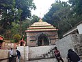
It was the capital of Odisha from 1568 to 1803. It is also known for its fort, often described as the "last independent fort". [3] The commander who kept it free from British East India Company was Bakshi Jagabandhu, popularly called 'Paika Bakshi'.

The Savaras tribal group, who are still to be found in the district in some pockets, once heavily populated the area. Khurda came into prominence when the first Rajas of the Khordha dynasty, Ramachandra Deva, made it the capital of his kingdom during the latter part of the 16th century. Khurda suffered repeated onslaughts from Muslim and Maratha cavalry but its royal house retained independence till 1804, when the British East India Company dispossessed Raja of his territory following the Second Anglo-Maratha War.

British government took Odisha under its rule in 1803 but could only include Khurda in 1827. The Paikas of Khurda are known for protesting against the British rule in Odisha.

Geography

It is also the district headquarters of Khurda district located at 20.11° N 85.40° E. The area of the district is 2,813 km2 (1,086 sq mi). [2] The district is bordered by Cuttack district to the north and east, Puri district to the south, Ganjam district to the west, and Nayagarh district to the northwest. The Daya and Kuakhai Rivers flow through Khurda. The forested area is 618.67 km2 (238.87 sq mi). [4] The district is mainly flat coastal plain, with some hill ranges in the west. It borders the Chilika Lake.

Climate

Bhubaneswar
Climate chart (explanation)
J
F
M
A
M
J
J
A
S
O
N
D
 
 
12
 
 
28
16
 
 
24
 
 
32
19
 
 
24
 
 
35
22
 
 
22
 
 
37
25
 
 
56
 
 
38
27
 
 
196
 
 
35
26
 
 
325
 
 
32
25
 
 
330
 
 
31
25
 
 
288
 
 
32
25
 
 
208
 
 
31
23
 
 
37
 
 
30
19
 
 
28
 
 
28
15
Average max. and min. temperatures in °C
Precipitation totals in mm
Source: IMD
Imperial conversion
JFMAMJJASOND
 
 
0.5
 
 
83
60
 
 
1
 
 
89
65
 
 
1
 
 
95
72
 
 
0.9
 
 
99
77
 
 
2.2
 
 
100
80
 
 
7.7
 
 
96
79
 
 
13
 
 
89
77
 
 
13
 
 
89
77
 
 
11
 
 
89
77
 
 
8.2
 
 
89
73
 
 
1.5
 
 
86
66
 
 
1.1
 
 
82
60
Average max. and min. temperatures in °F
Precipitation totals in inches

Economy

It is renowned for its brass utensils cottage industries, cable factory, spinning mills, watch repairing factory, railway coach repairing factory, oil industries, Coca-Cola bottling plant and small metal industries, or sms group, Iocl gas bottling plant.

Divisions

Blocks

  1. Balianta
  2. Balipatna
  3. Banapur
  4. Begunia
  5. Bhubaneswar
  6. Bolagarh
  7. Chilika
  8. Jatni
  9. Khordha
  10. Tangi

Subdivisions [5]

  1. Bhubaneswar: consists of 4 blocks, viz. Balianta, Balipatana, Jatni, Bhubaneswar.
  2. Khurda: consists of 6 blocks, viz. Tangi, Khorda sadara, Banapur, Begunia, Bolgarh and Chilika.

Demographics

Historical population
YearPop.±%
1901470,409    
1911479,645+2.0%
1921431,482−10.0%
1931478,128+10.8%
1941516,719+8.1%
1951557,718+7.9%
1961658,073+18.0%
1971858,554+30.5%
19811,132,182+31.9%
19911,502,014+32.7%
20011,877,395+25.0%
20112,251,673+19.9%
Source: Census of India [6]
Religions in Khordha district (2011) [7]
ReligionPercent
Hinduism
95.38%
Islam
3.73%
Christianity
0.56%
Other or not stated
0.33%

According to the 2011 census Khordha district has a population of 2,251,673, [1] roughly equal to the nation of Latvia [8] or the US state of New Mexico. [9] This gives it a ranking of 201st in India (out of a total of 640). [1] The district has a population density of 799 inhabitants per square kilometre (2,070/sq mi). [1] Its population growth rate over the decade 2001-2011 was 19.65%. [1] Khordha has a sex ratio of 925 females for every 1000 males, [1] and a literacy rate of 87.51%. 48.16% of the population lives in urban areas. Scheduled Castes and Scheduled Tribes make up 13.21% and 5.11% of the population respectively. [1]

Languages of Khordha district (2011) [10]

   Odia (92.13%)
   Urdu (1.98%)
   Telugu (1.69%)
   Hindi (1.55%)
   Bengali (1.38%)
  Others (1.27%)

At the time of the 2011 Census of India, 92.13% of the population in the district spoke Odia, 1.98% Urdu, 1.69% Telugu, 1.55% Hindi, 1.38% Bengali and 0.43% Santali as their first language. [10]

Politics

Vidhan sabha constituencies

The following are the eight Vidhan sabha constituencies [11] [12] of Khordha district and the elected members [13] of that area

No.ConstituencyReservationExtent of the Assembly Constituency (blocks)Member of 14th Assembly Party
111JayadevSCBalianta, Balipatna Arabinda Dhali BJD
112 Bhubaneswar Central NoneBhubaneswar MC Ward No. 16 to 29 and 35 to 37Bijaya Kumar Mohanty BJD
113 Bhubaneswar North NoneBhubaneswar (MC) (part), Bhubaneswar (part)Priyadarshi Mishra BJD
114Ekamra-BhubaneswarNoneBhubaneswar (MC) (part), Bhubaneswar (part)Ashok Chandra Panda BJD
115JataniNoneJatani (M), Jatani, Khurda (PART), Bhubaneswar (part)Suresh Kumar Routray INC
116BeguniaNoneBegunia, BologarhRaja Sahoo BJD
117KhurdaNoneKhurda (M), Tangi, Khurda (part)Yotirindra Nath Mitra BJD
118ChilikaNoneBalugaon (NAC), Banapur (NAC), Chilika, Banapur,Prasant Jagdev BJP

Lok Sabha constituencies

During 1952 general election, Pandit Lingraj Mishra was elected from the Khurda (Lok Sabha constituency). 1957 onwards members were elected from Bhubaneswar (Lok Sabha constituency). [14]

Related Research Articles

<span class="mw-page-title-main">Odisha</span> State in Eastern India

Odisha, formerly Orissa, is an Indian state located in Eastern India. It is the eighth-largest state by area, and the eleventh-largest by population, with over 41 million inhabitants. The state also has the third-largest population of Scheduled Tribes in India. It neighbours the states of Jharkhand and West Bengal to the north, Chhattisgarh to the west, and Andhra Pradesh and Telangana to the south. Odisha has a coastline of 485 kilometres (301 mi) along the Bay of Bengal in Indian Ocean. The region is also known as Utkaḷa and is mentioned by this name in India's national anthem, Jana Gana Mana. The language of Odisha is Odia, which is one of the Classical Languages of India.

<span class="mw-page-title-main">Rayagada district</span> District of Odisha in India

Rayagada district is a district in southern Odisha, a state in India, which became a separate district in October 1992. Its population consists mainly of tribes, primarily the Khonds and the Soras. In addition to Odia, Kui and Sora are spoken by the district's indigenous population. It was founded by Maharajah Biswanatha Deba Gajapati of the Surjyabansha dynasty of Jeypore.

<span class="mw-page-title-main">Cuttack district</span> District in Odisha, India

Cuttack district is one of the 30 districts of Odisha state in India. It is located in the coastal part of the state and its administrative headquarters are located in the city of Cuttack. As of 2011 Census, after Ganjam, it is the second most populous district of Odisha, with a population of 2,624,470. The name is an anglicized form of Kataka or Katak meaning Fort – referring to the Barabati Fort. The district is bisected by the river Mahanadi and its numerous distributaries and occupies a large portion of the river's delta. It is bounded by the Angul, Dhenkanal, Nayagarh and Khurda districts to the west while its southern and eastern boundaries touch Puri, Jagatsinghpur, Kendrapara and Jajpur districts.

<span class="mw-page-title-main">Nayagarh district</span> District of Odisha in India

Nayagarh district is one of the 30 districts of Odisha state in eastern India. It was created in 1st April 1993 when the erstwhile Puri District was split into three distinct districts, namely Khordha, Nayagarh and Puri.

<span class="mw-page-title-main">Angul district</span> District of Odisha in India

Angul district; also known as Anugul, is one of the thirty districts of Odisha in eastern India. The city of Angul is the district headquarters of Angul district. A major industrial hub of the state, the district hosts numerous industries relating to coal, bauxite and steel apart from extensive forests including the Satkosia Tiger Reserve.

<span class="mw-page-title-main">Puri district</span> District of Odisha in India

Puri district is a coastal district of the Odisha state of India. It has one sub-division, 11 tahasils and 11 blocks and comprises 1722 revenue villages. Puri is the only municipality of the district. Konark, Pipili and Nimapara are the three NACs in this district. Satyabadi, Gop, Kakatpur and Brahmagiri are major semi-urban areas.

Banapur is a town and a Notified Area Council in Khordha district in the state of Odisha, India. The town is named after the King Banasura of Lord Shri Krishna era.

<span class="mw-page-title-main">Jatani</span> Town in Odisha, India

Jatani is a town and a major sub-urban area of Bhubaneswar, the state capital of Odisha. It is also a municipality in Khordha district in the Indian state of Odisha. Jatani, also known as Khurda Road Junction in Indian Railways parlance, acts as an important railway junction between the main railroads running between Kolkata and Chennai, with diversions to the Hindu pilgrimage city of Puri, and to Balangir, passing through the districts of Nayagada, Daspalla, Phulbani, Boudh and Sonepur the vast tribal hinterland of Odisha. It has emerged as a commercial hub with a number of educational and other institutions. It is home to Premier Public Institutes like NISER and IIT-Bhubaneswar and ICAR- International Centre for Foot and Mouth Disease (ICFMD). Jatni is famous for its celebration of the festival of Ganesh Chaturthi.

<span class="mw-page-title-main">Bhubaneswar Lok Sabha constituency</span> Lok Sabha constituency in Odisha

Bhubaneswar Lok Sabha Constituency is one of the 21 Lok Sabha (Parliamentary) Constituencies in Odisha state in eastern India.

Tangi is a town and a Notified Area Council (NAC) in Khordha district in the state of Odisha, India. Tangi is a major town in Khordha district. It is situated 70 km away from the state capital Bhubaneswar and 40 km away from the district headquarter Khordha.

<span class="mw-page-title-main">Malaguni River</span>

The Malaguni River is a Nullah or hill stream in Khurda District, Odisha state of India. It originates on the border of Ganjam District and Khurda District. It flows northeast, east and southeast through Khurda Tahasil, passes historic Golabai Sassan and joins the Daya River at 20°0′1″N85°37′30″E, 1 km (0.62 mi) north of Balabhadrapur village in Puri District. The Daya then flows southwest into Chilika Lake, which then flows to the Bay of Bengal.

<span class="mw-page-title-main">Raj-Ranpur</span>

Raj-Ranpur is a small town in the district of Nayagarh in the eastern Indian state of Odisha. The town is also known as Ranpurgarh or simply Ranpur as per the modern usage. The town is historically significant especially during the British Raj when it was the capital of the princely state of Ranpur. The martyrs Shaheed Raghu-Dibakar who were hanged for their resistance to British rule belong to this place. Rajsunakhala and Tangi are the nearest Town of Raj-Ranpur, which in almost 10 to 20 km from the town. Rajsunakhala is the most important business centre in Ranpur block under Nayagarh district.

<span class="mw-page-title-main">Bakshi Jagabandhu</span> Indian freedom fighter from Odisha

Jagabandhu Bidyadhara Mohapatra Bhramarbara Raya popularly known as Buxi Jagabandhu or Paika Khandayat Buxi was the commander (Buxi) of the forces of the king of Khurda. He is one of the earliest freedom fighters of India. The Paika rebellion in 1817 was under his leadership. The Buxi Jagabandhu Bidyadhar College in Bhubaneswar is named after him.

<span class="mw-page-title-main">Mangalajodi</span>

Mangalajodi is an olden village under Tangi, Odisha block in Khordha district of Odisha at the northern edge of Chilika Lake. The scenery of this village and its wetlands attracts the visitors. In 2017, this village was declared and functioning as a separate Grama Panchayat.

<span class="mw-page-title-main">Paika Rebellion</span> 1817 rebellion in Odisha against East India Company rule

The Paika Rebellion, also called the Paika Bidroha. It was an early armed rebellion against Company rule in India in 1817. The Paikas rose in rebellion under their leader Bakshi Jagabandhu and projecting Lord Jagannath as the symbol of Odia unity, the rebellion quickly spread across most of Odisha before being put down by the Company's forces.

Jankia is a village in Khordha Tehsil in Khordha district of Odisha state, India. It is 18 km from district headquarters Khordha and 50 km from state capital Bhubaneswar on the Howrah–Chennai National Highway-No-16. It is around 55 km from Puri on the new Jagannath road. Jankia's postal code is 752020 and postal head office is Jankia. Odia is the local language.

Jatani is a Vidhan Sabha constituency of Khordha district, Odisha, India.

Chilika is a Vidhan Sabha constituency of Khordha district, Odisha, India.

<span class="mw-page-title-main">Khurda Road–Bolangir line</span> Railway line in India

The Khurda Road-Bolangir line is a rail line between Khurda Road Junction and Balangir which is under construction.

Nayagarh Town Railway Station is the main railway station in Nayagarh District, Odisha. Its code is NYGT. It serves Nayagarh City. The station consists of two platforms.

References

  1. 1 2 3 4 5 6 7 "District Census Handbook 2011 - Khordha" (PDF). Census of India . Registrar General and Census Commissioner of India.
  2. 1 2 Swain, S; et al. (2018). "Development of an ARIMA Model for Monthly Rainfall Forecasting over Khordha District, Odisha, India". Recent Findings in Intelligent Computing Techniques. Advances in Intelligent Systems and Computing. Vol. 708. pp. 325–331). doi:10.1007/978-981-10-8636-6_34. ISBN   978-981-10-8635-9.
  3. "History | Welcome to Khordha District Web Portal | India". 1 December 2023. Retrieved 2023-12-01.
  4. 1 2 3 4 5 6 7 8 9 10 11 "Introduction". Khordha district official website. Archived from the original on 2008-10-02. Retrieved 2008-09-12.
  5. "Subdivision & Blocks | Welcome to Khordha District Web Portal | India" . Retrieved 2023-12-01.
  6. Decadal Variation In Population Since 1901
  7. "Table C-01 Population by Religious Community: Odisha". Census of India, 2011. Registrar General and Census Commissioner of India.
  8. US Directorate of Intelligence. "Country Comparison: Population". Archived from the original on June 13, 2007. Retrieved 2011-10-01. Latvia 2,204,708 July 2011 est.
  9. "2010 Resident Population Data". U. S. Census Bureau. Archived from the original on 2013-10-19. Retrieved 2011-09-30. New Mexico - 2,059,179
  10. 1 2 "Table C-16 Population by Mother Tongue: Odisha". Census of India 2011. Registrar General and Census Commissioner of India.
  11. Assembly Constituencies and their EXtent
  12. Seats of Odisha
  13. "List of Member in Fourteenth Assembly". ws.ori.nic.in. Archived from the original on 2 May 2007. Retrieved 19 February 2013.
  14. "First Lok Sabha - State wise Details - Odisha" . Retrieved 20 December 2017.