
The Godavari is India's second longest river after the Ganga River and drains the third largest basin in India, covering about 10% of India's total geographical area. Its source is in Trimbakeshwar, Nashik, Maharashtra. It flows east for 1,465 kilometres (910 mi), draining the states of Maharashtra (48.6%), Telangana (18.8%), Andhra Pradesh (4.5%), Chhattisgarh (10.9%) and Odisha (5.7%). The river ultimately empties into the Bay of Bengal through an extensive network of distributaries. Its 312,812 km2 (120,777 sq mi) drainage basin is one of the largest in the Indian subcontinent, with only the Ganga and Indus rivers having a larger drainage basin. In terms of length, catchment area and discharge, the Godavari is the largest in peninsular India, and had been dubbed as the Dakshina Ganga.

The Laptev Sea is a marginal sea of the Arctic Ocean. It is located between the northern coast of Siberia, the Taimyr Peninsula, Severnaya Zemlya and the New Siberian Islands. Its northern boundary passes from the Arctic Cape to a point with co-ordinates of 79°N and 139°E, and ends at the Anisiy Cape. The Kara Sea lies to the west, the East Siberian Sea to the east.

The Baitarani is one of six major rivers of Odisha, India. Venerated in popular epics and legends, the Baitarani River is a source of water for agricultural irrigation. The coastal plain of Odisha has the name of "Hexadeltaic region" or the "Gift of Six Rivers". These deltas divide the coastal plain into three regions from north to south. The Baitarani, the Mahanadi and the Brahmani rivers form the Middle Coastal Plain, with evidence of past "back bays" and present lakes.

Hirakud Dam is built across the Mahanadi River, about 10 kilometres (6.2 mi) from Sambalpur in the state of Odisha in India. It is the longest earthen dam in the world. Behind the dam extends a 55 km (34 mi) long lake, Hirakud Reservoir. It is one of the first major multipurpose river valley projects started after India's independence. Hirakud Reservoir was declared a Ramsar site on 12 October 2021.

Asika or Aska is a town and a Municipality in Ganjam district in the state of Odisha, India. Famously known as the Sugar city.
Brajrajnagar is a town and a municipality in Jharsuguda district in the state of Odisha, India. Popular legend says the town was named after Braj Mohan Birla after he set up Orient Paper Mills in 1936. It is a small sleepy town on rocky terrain, built on the banks of IB river, with temples mostly built by the Birlas. Later it became famous for MCL-owned coal mines after Orient Paper Mills of Birlas managed by dulichand Hanuman Prasad shah closed down in 1999.

Phulbani is a municipality and administrative headquarters of Kandhamal district in the state of Odisha in India.

Titlagarh is a Municipality in Balangir district of the Indian state of Odisha. It is a known summer hotspot in India due its extreme heatwaves and was among the top 10 Indian cities with maximum temperature in 2022.
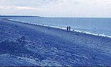
Chandipur, is a resort town in Balasore District, Odisha, India. The town is located on the shore of Bay of Bengal and is approximately 16 kilometers from the Balasore Railway Station. Chandipur beach is unique in a way that the water recedes up to 5 kilometers during the ebb tide. Due to its unique circumstances, the beach supports biodiversity. Horseshoe crab is also found here on the beach towards Mirzapur, the nearby fishing market and community at the confluence of the Budhabalanga River (Balaramgadi). It is a suitable picnic spot. One of Odisha Tourism's Panthanivas is situated here.

The River Nagavali also known as Langulya is one of the main rivers of Southern Odisha and Andhra States in India, between Rushikulya and Godavari basins.

River Vamsadhara or River Banshadhara is an important east-flowing river between Rushikulya and Godavari, in Odisha and Andhra Pradesh states in India.
The Tel river flows in Nabarangpur, Kalahandi, Balangir, Boudh Sonepur District of Odisha, India. Tel is an important tributary of the Mahanadi. It flows just eight kilometers away from the town of Titilagarh. This significant tributary of the Mahanadi river meets the main river at Sonepur or Subarnapur. The convergence of the two rivers offers a remarkable view against a colorful landscape. Baidyanath temple, which is famous for the Kosaleshwar Shiva temple, is located on the left bank of the Tel River.
Birmaharajpur is a subdivision town of Subarnapur district in the state of Odisha, India. Birmaharajpur Subdivisional Headquarter is the Birmaharajpur town. It is located 22 km towards east from district headquarter Sonepur. It is a dispersed town and located on the left bank of the river Mahanadi. It is located about 229 km from state capital Bhubaneswar.
Tebhapadar is a village of Birmaharajpur subdivision of Subarnapur district of Odisha, India. It is located on the bank of Surubalijora and Mahanadi River. Total population of this village is 1,326 out of which 697 are male and 629 are female. This village is spread over 755.673 acres (3.05810 km2) of land.
Pitamahul is a gram panchayat of Birmaharajpur subdivision of Subarnapur district, Odisha, India. It is located on the bank of river Mahanadi and on the side of the road connecting Birmaharajpur and Rairakhol town. Durdura, Tebhapadar, Amsarbhata and Subalaya are the nearby village of Pitamahul.

Lankeswari temple is located inside the river Mahanadi at Sonepur town, Subarnapur district, Odisha, India. Once upon a time Sonepur region was known as Paschima Lanka. Goddess Lankeswari or Nikumbhilaa was the presiding deity of Paschima Lanka. Now Maa Lankeswari is worshiped by the Kaibarta community of Sonepur and people of Subarnapur district. One can see this temple while travelling on the road connecting Ulunda, Dharmasala, Sonepur and Birmaharajpur.
Chandabali is an old town in the Bhadrak district of Odisha on the bank of the River Baitarani.
Soro is a city and a municipality in Balasore district in the Indian state of Odisha. It is about 181 km from the capital of the state Bhubaneswar and 35 km from the district headquarters Balasore. Located on NH-16, the city is located midway between Balasore and Bhadrak cities. Soro along with neighboring cities contributes significantly towards the economy of Balasore district. It has many important areas like Uttareswar, Adang Bazar, College chaka,Badkhuri chaka,Court chaka etc.

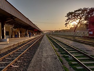
The Kharagpur–Puri Line is a railway line connecting Kharagpur in the Indian state of West Bengal and Puri in Odisha. The total line can be divided into sections. The Kharagpur–Khurda Road portion of this line, which is a part of the Howrah–Chennai main line and Khurda Road - Puri portion.
Birmaharajpur is a Vidhan Sabha constituency of Subarnapur district, Odisha.