
Pulicat Lake is the second largest brackish water lagoon in India,, measuring 759 square kilometres (293 sq mi). A major part of the lagoon lies in the Tirupati district of Andhra Pradesh. The lagoon is one of three important wetlands that attracts northeast monsoon rain clouds during the October to December season. The lagoon comprises the following regions: Pulicat Lake, Marshy/Wetland Land Region (AP), Venadu Reserve Forest (AP), and Pernadu Reserve Forest (AP). The lagoon was cut across in the middle by the Sriharikota Link Road, which divided the water body into lagoon and marshy land. The lagoon encompasses the Pulicat Lake Bird Sanctuary. The barrier island of Sriharikota separates the lagoon from the Bay of Bengal and is home to the Indian Space Research Organisation's Satish Dhawan Space Centre.

Chilika Lake is the largest brackish water lagoon in Asia and second largest coastal lagoon in the world, covering an area of over 1,100 square kilometres (420 sq mi). It is spread over the Puri, Khordha and Ganjam districts of Odisha state on the east coast of India, at the mouth of the Daya River, flowing into the Bay of Bengal.

Khordha district is an administrative division of the state of Odisha, India. It was formed on April 1, 1993, by the division of former Puri District into Puri, Khordha and Nayagarh districts. In the year 2000 the district name was changed to Khordha. The district headquarters is Khordha Town. The capital city of Bhubaneswar is located in this district. Khordha is the most urbanized of all the districts of Odisha.

Puri district is a coastal district of the Odisha state of India. It has one sub-division, 11 tahasils and 11 blocks and comprises 1722 revenue villages. Puri is the only municipality of the district. Nimapada, Konark, Pipili, Satyabadi and Kakatpur are the NACs in this district and Brahmagiri is a semi-urban town.
Balugaon is a town and a Notified Area Council in Khordha district in the state of Odisha, India. It is situated very close to Chilika lake, about 90 kilometres (56 mi) from the state capital Bhubaneswar, and 76 kilometres (47 mi) from the Berhampur, Ganjam. It is a major economic centre of Khordha district because of its prawn and fish business.
Banki is a town and a Subdivision, Legislative Council constituency no. 88 and Notified Area Council in Cuttack district in the state of Odisha, India. Banki is known for the Charchika Temple, dedicated to the deity of Chamunda, the eight armed goddess and incarnation of Durga. In the 2024 Odisha Assembly elections current MLA of Banki is Devi Ranjan Tripathy.

Ganjam is a town and a notified area council in Ganjam district in the state of Odisha, India. Brahmapur, one of the major city of Odisha is situated in this district.

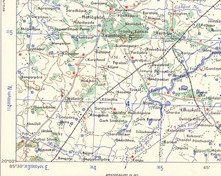
The Daya River starts as a branch of the Kuakhai River at Saradeipur in Odisha state in India. It is joined by the Malaguni River below Golabai and flows through Khordha and Puri districts before emptying into the north-eastern corner of Chilika Lake, 37 kilometres (23 mi) from its origin.

The Par River, also known as the Luxulyan River is a river draining the area north of St Blazey in Cornwall, in the United Kingdom.
Golabai Sasan is a village in Khurda District, Odisha, India at 20°1′21″N85°33′0″E.

Satapada is a town in Puri district, Odisha, India.

Odisha is one of the 28 states in the Republic of India. Odisha is located in the eastern part of the Indian peninsula and the Bay of Bengal lies to its East while Chhattisgarh shares its border in the west and north-west. The state also shares geographic boundaries with West Bengal in the north-east, Jharkhand in the north and Andhra Pradesh in the south. The state is spread over an area of 1,55,707 km2 and extends for 700 km from north to south and 500 kilometres from east to west. Its coastline is 450 km long. The state is divided into 30 districts which are further subdivided into 314 blocks called tahasil.

Odisha, a state in eastern India, is extremely diverse and gives the state abundance of natural beauty and wildlife. The districts in the interior are thickly covered by tropical moist deciduous and tropical dry deciduous forests. The hills, plateaus and isolated areas of the northeastern part of the state are covered by the tropical moist deciduous forests whereas the dry deciduous forests are located in the southwest region of the state. Some of the trees which grow in abundance in Odisha are bamboo, teak, rosewood, sal, piasal, sanghvan and haldi. There are 479 species of birds, 86 species of mammals, 19 species of amphibians and 110 species of reptiles present in Odisha. The state is also an important habitat for the endangered olive ridley turtles and Irrawaddy dolphins. Koraput district of southern Odisha has been identified by Food and Agriculture Organisation (FAO) of UN as Global Agricultural Heritage site which is among only other three sites in the world. Other sites are in Peru, China and Philippines.
The Koina River flows through West Singhbhum in the Indian state of Jharkhand.

Aceituna is a municipality in the province of Cáceres and autonomous community of Extremadura, Spain. The municipality covers an area of 620 square kilometres (240 sq mi) and as of 2011 had a population of 620 people.
Kuakhai River is a distributary of Mahanadi River which flows by Bhubaneswar, Odisha. Mahanadi River branches off at Naraj, Cuttack as Kathajodi River, then immediately it is bifurcated, with its southern branch flowing as Kuakhai River. The Kushabhadra River branches off from the Kuakhai River in Gandarpur, Balianta and flows in a south-western direction towards Nimapara and Gop into the Bay of Bengal. The Daya River starts as a branch of the Kuakhai River at Saradeipur and is then joined by the Malaguni River below Golabai and flows through Khordha and Puri districts before emptying into the north-eastern corner of Chilika Lake. Most of the water supply of Bhubaneswar is met by the Kuakhai river, along with Daya River.

Khurda-Tangi is a Vidhan Sabha constituency of Khordha district, Odisha, India.

Chilika is a Vidhan Sabha constituency of Khordha district, Odisha, India.
The Nirmaljhar is a perennial stream in the Ganjam District in the Indian state of Odisha. It is located beside the temple of Lord Vishnu. The Nirmaljhar flows from the Badaghati Mountains in Eastern Ghats. Khallikote princess Smt. Sugyani Devi has currently formed a committee to promote Nirmaljhar as a tourist site.

Nalbana Bird Sanctuary or Nalbana Island is the core area of the Ramsar designated wetlands of Chilika Lake. It was declared a bird sanctuary under the Wildlife Protection Act in 1972. In the heart of the park, one can see thousands of birds descending during the migratory season. The island disappears during monsoon season due to inundation only to emerge again in post-monsoon.
