Related Research Articles
The Chota Nagpur Plateau is a plateau in eastern India, which covers much of Jharkhand state as well as adjacent parts of Chhattisgarh, Odisha, West Bengal and Bihar. The Indo-Gangetic plain lies to the north and east of the plateau, and the basin of the Mahanadi river lies to the south. The total area of the Chota Nagpur Plateau is approximately 65,000 square kilometres (25,000 sq mi).
East Singhbhum is one of the 24 districts of Jharkhand, India. It was created on 16 January 1990. More than 50% of the district is covered by dense forests and mountains, where wild animals once roamed freely. It is known for being a centre of industry since Jamshedpur, the most populous city in Jharkhand, is located here.

West Singhbhum or Pashchimi Singhbhum is one of the 24 districts of Jharkhand state, India. It came into existence on 16 January 1990, when the old Singhbhum district was bifurcated. Chaibasa is the district headquarters.
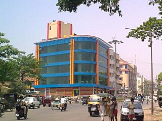
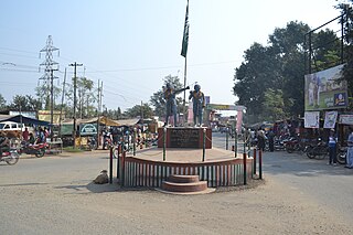
Chaibasa is a town and a municipality in West Singhbhum district in the state of Jharkhand, India. Chaibasa is the district headquarters of West Singhbhum district. It is also the headquarter of Singhbhum Kolhan division headed by the Divisional commissioner.

Periyar, IPA: [peɾijɐːr], is the longest river and the river with the largest discharge potential in the Indian state of Kerala. It is one of the few perennial rivers in the region and provides drinking water for several major towns. The Periyar is of utmost significance to the economy of Kerala. It generates a significant proportion of Kerala's electrical power via the Idukki Dam and flows along a region of industrial and commercial activity. The river also provides water for irrigation and domestic use throughout its course besides supporting a rich fishery. Due to these reasons, the river has been named the "Lifeline of Kerala". Kochi city, in the vicinity of the river mouth draws its water supply from Aluva, an upstream site sufficiently free of seawater intrusion. Twenty five percent of Kerala's industries are along the banks of river Periyar. These are mostly crowded within a stretch of 5 kilometres (3 mi) in the Eloor-Edayar region (Udhyogamandal), about 10 kilometres (6 mi) north of Kochi harbor.
Dhanbad district is one of the twenty-four districts of Jharkhand state, India, and Dhanbad is the administrative headquarters of this district. As of 2011, it is the second most populous district of Jharkhand, after Ranchi. It also has the lowest sex ratio in Jharkhand, at 908.

The Subarnarekha River flows through the Indian states of Jharkhand, West Bengal and Odisha.

Chakradharpur is a city in West Singhbhum district in the state of Jharkhand, India. It is the railway divisional headquarters of Chakradharpur (CKP) division of the South Eastern Railway. The city stands at an elevation of 227 metres and has urban area of 10 square kilometres bounded on the east by Jamshedpur (Tatanagar), on the west by Rourkela (Odisha), on the north by Ranchi and on the south by Chaibasa. Chakradharpur is close to boundaries of two neighbouring states, Odisha and West Bengal.
Noamundi is a census town in West Singhbhum district in the Indian state of Jharkhand. It is also an administrative block. It is a small mining town located close to the Odisha border. It lies near Jamshedpur and 64 km (40 mi) from Chaibasa. Nearby towns include Padapahar, Barajamda, jagannathpur, Kharsawan, Gua and Kiriburu.
Baharagora is a village in the Baharagora CD block in the Ghatshila subdivision of the East Singhbhum district, in the Indian state of Jharkhand.
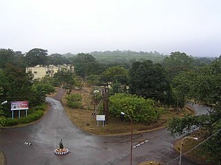
Gua is a census town in Pashchimi Singhbhum district in the Indian state of Jharkhand. It is a mining township situated in the Chotanagpur Plateau. The mines are operated by the Steel Authority of India Limited and are linked to IISCO at Burnpur.
Jadugora is a census town in the Musabani CD block in the Ghatshila subdivision of the Purbi Singhbhum district in the Indian state of Jharkhand.

The Gosthani rises in the Ananthagiri Hills of the Eastern Ghats and flows through the Borra Caves which lie near its source. It is the largest river flowing through Visakhapatnam city. It flows for 120 km before joining the Bay of Bengal through an estuary near Bheemunipatnam. The river basin drains the two coastal districts of Vizianagaram and Visakhapatnam. The basin exhibits a subdendritic and dendritic pattern of drainage. The Gosthani's is a minor river basin with a total drainage area of less than 2000 km2. Much of the basin is covered by khondalite group of gneissic rocks. About 3% of the total area of the Visakhapatnam district is under the Gosthani basin. The river is rainfed, receiving an average rainfall of 110 cm most of which comes from the south-west monsoon. There are several red sand hills near Bheemunipatnam, where the Gosthani joins the Bay of Bengal, which are reminiscent of the Chambal ravines. These are thought to have been formed six millennia ago due to shifts in the river's course following tectonic activity. The river joins the Bay of Bengal at Bhimli where it forms an estuary.
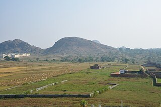
Saranda forest is a dense forest in the hilly region of West Singhbhum, East Singhbhum, Saraikela district in the Indian state of Jharkhand. This area used to be the private hunting reserve of the Singh Deo family. The forest covers an area of 820 km². Saranda (Serengda) literally means "800 hills in local language."
Kokpara is a village in the Dhalbhumgarh CD block in the Ghatshila subdivision of the East Singhbhum district, Jharkhand, India.

South Koel River is a 285 kilometres (177 mi) long river which runs across Jharkhand and Odisha states in India. It originates on the Lawapani Waterfalls, near Lohardaga, Chota Nagpur Plateau a Lawapani Waterfalls, near Lohardaga, Chota Nagpur Plateau 82.5 kilometres (51 mi) from Ranchi, and conjoins the Belsiangar and Singbhum Rivers. The Koel is fed by three streams in Jharkhand, namely the North Karo, South Karo and Koina. The South Koel enters Odisha and joins with Sankh River at Vedavyas near Rourkela from where it is named as Brahmani.
Deo River flows through West Singhbhum in the Indian state of Jharkhand. It rises on the western side of the Gamharia plateau and flows into the South Karo River after a course of about 35 miles (56 km). It receives the Puilgara, a fair-sized mountain stream, from the Santara forest block.
The Koina River flows through West Singhbhum in the Indian state of Jharkhand.

The Tatanagar–Bilaspur section is part of the Howrah–Nagpur–Mumbai line and connects Tatanagar in the Indian state of Jharkhand and Bilaspur in Chhattisgarh. Part of one of the major trunk lines in the country, it passes through an industrial-mining area and handles high volumes of freight, particularly coal and iron ore.
Galudih is a village in the Ghatshila CD block in the Ghatshila subdivision of the East Singhbhum district, Jharkhand, India.
References
- 1 2 "The West Singhbhum District" (PDF). Archived from the original (PDF) on 13 July 2011. Retrieved 20 April 2010.
- 1 2 "Saranda wildlife chokes on river of death". The Telegraph, 3 May 2004. Archived from the original on 3 February 2013. Retrieved 20 April 2010.
| | This article related to a location in Jharkhand is a stub. You can help Wikipedia by expanding it. |