National Highway 6 (India)

Last updated • 1 min readFrom Wikipedia, The Free Encyclopedia

NH6-IN.svg
National Highway 6
National Highway 6 (India)
Map of National Highway 6 in red
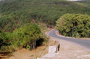
Shillong-Jowai Road.JPG
NH 6 in Meghalaya
Route information
Part of AH1-IN.svg AH1 AH2-IN.svg AH2
Length667 km (414 mi)
Major junctions
North end Jorabat
South end Zokhawthar India/Myanmar border
Location
Country India
States Meghalaya, Assam, Mizoram
Highway system
NH27-IN.svg NH 27 NH2-IN.svg NH 2

National Highway 6, commonly referred to as NH 6, is a primary national highway in India. [1] The highway passes through the Indian states of Meghalaya, Assam, and Mizoram. [2] Before renumbering of national highways NH-6 was variously numbered as old national highways 40, 44, 154 & 54. [3]

Contents

Route

NH6 links Jorabat, Shillong, Jowai, Badarpur, Panchgram, Kolasib, Kawnpui, Aizawl, Seling, Lumtui, Khawthlir, Tuisen, Neihdawn, Champhai and terminates near Zokhawthar at India/Myanmar border. [2] [4] In sept 2008, a 120 meter long tunnel was built at Sonapur in Meghalaya inside the Narpuh Sanctuary northwest of Silchar, it connects Meghalaya with Assam's Barak Valley in Meghalaya's southeast. [5]

Junctions

NH27-IN.svg NH 27 Terminal near Jorabat. [2]
NH106-IN.svg NH 106 near Shillong
NH206-IN.svg NH 206 near Jowai
NH306-IN.svg NH 306 near Kolasib.
NH108-IN.svg NH 108 near Aizawl.
NH2-IN.svg NH 2 near Selling.
NH102B-IN.svg NH 102B near Kawlkulh

Asian Highways

Jorabat to Shillong stretch of National Highway 6 is part of Asian Highway 1 and Asian Highway 2. [6]

See also

References

  1. "Rationalization of Numbering Systems of National Highways" (PDF). Govt of India. 28 April 2010. Retrieved 21 August 2011.
  2. 1 2 3 "State-wise length of National Highways (NH) in India". Ministry of Road Transport and Highways . Retrieved 25 April 2019.
  3. "New Numbering of National Highways notification - Government of India" (PDF). The Gazette of India . Retrieved 25 April 2019.
  4. "Route substituition for national highways 302 and 6" (PDF). The Gazette of India . Retrieved 25 April 2019.
  5. CITYBorder Roads Organisation blazes a trail in most testing conditions, Times of India, 18 nov 2022.
  6. "Asian Highway Database - Country wise". UNESCAP . Retrieved 25 April 2019.