National Highway 206 (India)

Last updated

NH206-IN.svg
National Highway 206
National Highway 206 (India)
Map of the National Highway 206 in red
NH 206.jpg
Route information
Part of AH1-IN.svg AH1 AH2-IN.svg AH2
Length126 km (78 mi)
Major junctions
North end Jowai
South end Mylliem
Location
Country India
StatesMeghalaya
Highway system

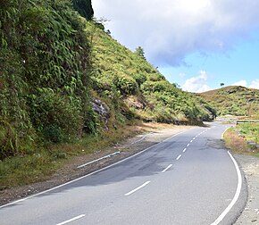
National Highway 206 commonly referred to as NH 206, is a highway in the Indian state Meghalaya. [1] Starting from Jowai near NH 106, it goes via Dawki and ends at Mylliem. It is also a part of Shillong-Sylhet road. It is a spur of National Highway 6. [1]

Contents

NH 206 in Meghalaya NH 206 in Meghalaya.jpg
NH 206 in Meghalaya
View of NH 206 from Dawki River View of NH 206 from Dawki River .jpg
View of NH 206 from Dawki River

See also

Related Research Articles

<span class="mw-page-title-main">National Highway 16 (India)</span> National highway in India

National Highway 16 also known as Kolkata - Chennai Highway is a major National Highway in India that runs along east coast of West Bengal, Odisha, Andhra Pradesh, and Tamil Nadu. It was previously known as National Highway 5.

<span class="mw-page-title-main">National Highway 206 (India, old numbering)</span> Old numbering of road in India

National Highway 206 was a National Highway in India within the state of Karnataka. NH 206 connected the towns of Tumkur and Honnavar, Via: Tiptur, Arsikere, Kadur, Shivamogga and it was 365 km long.

National Highway 8B is an Indian National Highway entirely within the state of Gujarat. NH 8B links Bamanbore to Porbandar and is 206 km (128 mi) long. It is now part of National Highway 47 (India) in new numbering.

National Highway 144 is a national highway in the union territory of Jammu and Kashmir of India. NH-144 is a branch of National Highway 44.

<span class="mw-page-title-main">National Highway 2 (India)</span> National highway in India

National Highway 2 is a national highway in India that runs from Dibrugarh in Assam to Tuipang in Mizoram. This national highway passes through the Indian states of Assam, Nagaland, Manipur and Mizoram. This national highway is 1,325.6 km (823.7 mi) long. Before renumbering of national highways, NH-2 was variously numbered as old national highways 37, 61, 39, 150 and 54.

<span class="mw-page-title-main">National Highway 6 (India)</span> National highway in India

National Highway 6, commonly referred to as NH 6, is a primary national highway in India. The highway passes through the Indian states of Meghalaya, Assam, and Mizoram. Before renumbering of national highways NH-6 was variously numbered as old national highways 40, 44, 154 & 54.

<span class="mw-page-title-main">National Highway 24 (India)</span> National highway in India

National Highway 24 (NH 24) is a primary national highway in India, running in a north–south direction. This highway runs entirely in the state of Uttar Pradesh. This highway was created by renumbering former NH29 and NH97 as per new numbering system of national highways.

National Highway 43 is a primary National Highway in India. It traverses from Gulganj in Madhya Pradesh, through Chhattisgarh and terminates at Chaibasa in Jharkhand. This national highway is 1,062.5 km (660.2 mi) long. Before renumbering of national highways NH-6 was variously numbered as old national highways 78, 23 & 33.

National Highway 47 is a primary National Highway in India. It starts from Bamanbore in Gujarat and terminates at Nagpur in Maharashtra. This national highway is about 1,006 km (625 mi) long. Before renumbering of national highways in 2010, NH-47 was variously numbered as old national highways 8A, 59, 59A & 69.

National Highway 49 is a primary National Highway in India. This highway runs from Bilaspur in the Indian state of Chhattisgarh to Kharagpur in West Bengal. Starting from NH 130 near Bilaspur, it terminates at NH 16 near Kharagpur, West Bengal. The highway is part of AH46 network in India. This national highway is 668 km (415 mi) long.

<span class="mw-page-title-main">National Highway 60 (India)</span> National highway in India

National Highway 60 is a primary national highway in India, connecting Pune and Dhule in the state of Maharashtra. Previously this route was numbered as NH 3 and NH 50. The total length of NH 60 is 360.6 km (224.1 mi). Dhule to Nashik stretch of this route is part of Asian Highway 47.

<span class="mw-page-title-main">National Highway 69 (India)</span> National highway in India

National Highway 69, , is a 732 km (455 mi) long major National Highway in India, that runs through the states of Karnataka and Andhra Pradesh. The western terminal is at the junction of NH 66 near Honnavar, connects NH 48 near Sira, connects NH 44 near Chikkaballapur, connects NH 75 near Mulbagal and terminates at the east end Renigunta. Its old name was NH 234.

<span class="mw-page-title-main">National Highway 73 (India)</span> National Highway in India

National Highway 73 is a National Highway in India. This highway runs in the Indian state of Karnataka. It starts from sea port city of Mangaluru ( Mangalore) and ends at Tumakuru. Even though named as national highway the road is narrow and prone to landslips and falling of trees in Charmady ghat section of Western ghats. This highway was previously part of national highways 48, 234 and 206 but subsequent to rationalisation of national highway numbers of India by Gazette notification on 5 March 2010 it was changed to National Highway 73.

<span class="mw-page-title-main">National Highway 77 (India)</span> National Highway in India

National Highway 77 is a National Highway in India. This is the main National Highway to connect Pondicherry with Krishnagiri. It starts from Tindivanam in Villupuram district then runs westward till Uthangarai via Thiruvannamalai and then joins NH 48 at Krishnagiri. NH-77 runs entirely in the state of Tamil Nadu.

<span class="mw-page-title-main">National Highway 275 (India)</span> National highway in India

National Highway 275 (NH-275), also commonly referred to as Bengaluru–Mysuru access-controlled Expressway, part of the Bengaluru–Mangaluru Economic Corridor (EC-34), is a national highway that starts from Bengaluru and goes through Mysuru as a 6-lane expressway of 119 km (74 mi), and again as 4-lane till Bilikere, and ends at Bantwal. This highway connects the coastal city of Mangaluru to Bengaluru. It is also a bypass route for the National Highway 75 (NH-75). The Bengaluru to Mysuru section of this highway was upgraded from 4 to 10 lanes, out of which the 6-lane section is the main elevated access-controlled carriageway and the other 2-lane section on both ends of the carriageway are service roads. It claims to reduce the travel time between Bengaluru and Mysuru from 3 hours to 75 minutes.

National Highway 150A is a National Highway in Indian State of Karnataka. It is a spur road of National Highway 50. NH-150A traverses the states of Karnataka and Andhra Pradesh in India.

<span class="mw-page-title-main">National Highway 19 (India)</span> National highway in India

National Highway 19 is a national highway in India. It was previously referred to as Delhi–Kolkata Road and is one of the busiest national highways in India. After renumbering of national highways, Delhi to Agra route is now national highway 44 and Agra to Kolkata route is numbered national highway 19. It constitutes a major portion of the historical Grand Trunk Road. It is also part of AH1 of Asian Highway Network, that traverses from Japan to Turkey.

<span class="mw-page-title-main">National Highway 57 (India)</span> National highway in India

National Highway 57, previously numbered as NH 224, is a primary National Highway in India connecting Balangir and Khordha in the state of Odisha.

National Highway 81, commonly referred to as NH 81, is a highway connecting the city of Coimbatore to Chidambaram in South India. This highway was previously part of old national highways 67 and 227 but subsequent to rationalisation of national highway numbers of India by Gazette notification on 5 March 2010 it was changed to National Highway 81. This national highway is 321.4 km (199.7 mi) long and runs entirely in the Indian state of Tamil Nadu.

References

  1. 1 2 "Rationalization of Numbering Systems of National Highways" (PDF). Govt of India. 28 April 2010. Retrieved 21 August 2011.