 | ||||
|---|---|---|---|---|
 Map of National Highway 154 in red | ||||
| Route information | ||||
| Length | 279 km (173 mi) | |||
| Major junctions | ||||
| From | Pathankot | |||
| To | Bilaspur, Himachal Pradesh | |||
| Location | ||||
| Country | India | |||
| Highway system | ||||
| ||||
National Highway 154 (NH 154) is a National Highway in India. [1]
| | ||||
|---|---|---|---|---|
| Map of National Highway 154 in red | ||||
| Route information | ||||
| Length | 279 km (173 mi) | |||
| Major junctions | ||||
| From | Pathankot | |||
| To | Bilaspur, Himachal Pradesh | |||
| Location | ||||
| Country | India | |||
| Highway system | ||||
| ||||
National Highway 154 (NH 154) is a National Highway in India. [1]

State Route 154 is a state highway in the U.S. state of California that runs from Los Olivos to Santa Barbara, crossing the San Marcos Pass in the Santa Ynez Mountains. Before U.S. Route 101 was built through the Gaviota Pass, SR 154 was the main throughway to Santa Barbara and the tri city area including use as a stagecoach route in early years. After being replaced by US 101 as the primary route between the Santa Ynez Valley and Santa Barbara, SR 154 now serves as a scenic bypass.
The South Carolina State Highway System is the fourth largest state-maintained system of state highways in the country. It consists of Interstates, U.S. highways, state highways, and secondary roads, totaling approximately 41,500 miles (66,800 km).

State Highway 64 is a Texas state highway that runs from Wills Point via Tyler to Henderson.

State Route 154 (SR 154) is a 56.2-mile-long (90.4 km) state highway in the area around Atlanta in the U.S. state of Georgia. It begins in Sharpsburg and ends just to the east of Avondale Estates. The road also runs through portions of Atlanta.
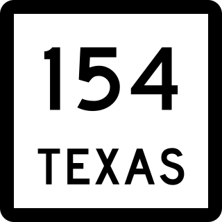
State Highway 154 is a state highway that runs from Cooper to Marshall in northeast Texas.

State Route 534 (SR 534) is a north–south state highway in the northeastern portion of the U.S. state of Ohio. The southern terminus of SR 534 is at its junction with the duplex of U.S. Route 62 (US 62) and SR 173 nearly 4.50 miles (7.24 km) west of Salem. Its northern terminus is a curve in Geneva-on-the-Lake where the highway directly transitions into SR 531 at that route's western terminus.

M-154 is a state trunkline highway in the U.S. state of Michigan. It is entirely on Harsens Island at the mouth of the St. Clair River. It is one of only three trunklines in Michigan on islands. The other two are M-134 on Drummond Island and M-185 on Mackinac Island. Access to Harsens Island and M-154 is provided by ferry which runs year round. The highway was first designated in 1931, and realigned on the island within the next two years.

State Route 136 (SR 136) is a 136.380-mile-long (219.482 km) state highway that travels west-to-east through portions of Dade, Walker, Gordon, Murray, Gilmer, Pickens, Dawson, and Hall counties in the northwestern and north-central parts of the U.S. state of Georgia. The highway extends from its western terminus at SR 71 at the Alabama state line, west of Trenton, to its eastern terminus at SR 60 north-northwest of Gainesville.

U.S. Highway 29 (US 29) in the state of Georgia is a north–south United States Numbered Highway that runs southwest to northeast from West Point at the Alabama state line to the South Carolina state line, near Lake Hartwell. From West Point to Downtown Atlanta, the Georgia Department of Transportation (GDOT) has cosigned US 29 with State Route 14 (SR 14). North of Downtown Atlanta, the route runs along SR 8 to Dacula and again from west of Statham to the South Carolina state line.

State Route 154 (SR 154) is a 16.27-mile-long (26.18 km) Ohio State Route that runs between Lisbon and the Pennsylvania state line in the US state of Ohio. Some of the highway is listed on the National Highway System. Most of the route is a rural two-lane highway and passes through both farmland and woodland. The highway was first signed in 1923 on a route that is now SR 517 and SR 558. SR 154 was rerouted in 1926 to its current alignment. Two section of the highway was paved in 1929, with the rest of the route was paved in 1933.

National Route 154 is a national highway of Japan connecting Minato-ku, Nagoya and Atsuta-ku, Nagoya in Japan, with a total length of 4 km (2.49 mi).

National Route 176 is a national highway of Japan connecting Miyazu, Kyoto and Kita-ku, Osaka in Japan, with a total length of 154.2 km (95.82 mi).

National Route 249 is a national highway of Japan connecting Nanao, Ishikawa and Kanazawa, Ishikawa in Japan, with a total length of 248.8 km (154.6 mi). Much of the route is concurrent with Route 159.

National Route 456 is a national highway of Japan connecting Morioka, Iwate and Motoyoshi, Miyagi in Japan, with a total length of 154.5 km (96 mi).
Fairview is a hamlet in southern Alberta, Canada within Lethbridge County. It is adjacent to the eastern boundary of Lethbridge, approximately 0.3 kilometres (0.19 mi) south of Highway 3. More specifically, it is located on southeast corner of Highway 4 and Highway 512.

National Highway 6, commonly referred to as NH 6, is a primary national highway in India. The highway passes through the Indian states of Meghalaya, Assam, and Mizoram. Before renumbering of national highways NH-6 was variously numbered as old national highways 40, 44, 154 & 54.

National Highway 503, commonly referred to as NH 503, is a highway connecting the city of Dharamshala to Mubarakpur in Himachal Pradesh. NH503 has been extended from Mubarakpur to Kiratpur in Punjab. The route of NH503 is extended from Mataur Kangra to Mcleodganj Dharamshala.
National Highway 563 is a National Highway in India. Total length 248.83(154.62mi). It passes through the districts of Jagtial, Karimnagar, Warangal and Khammam in Telangana state. The Karimnagar Cable Bridge is on the route and shortened the distance to Warangal by 7km.
National Highway 154A, commonly called NH 154A is a national highway in India. It is a spur road of National Highway 54. NH-154A traverses the states of Punjab and Himachal Pradesh in India.


