National Highway 53 (India)

Last updated

NH53-IN.svg
National Highway 53
National Highway 53 (India)
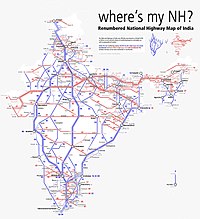
Map of National Highway 53 in red
4 lane roads network highways NH 53 and NH 6 in Chhattisgarh India.jpg
NH 53 in Chhattisgarh
Route information
Part of AH46-IN.svg AH46
Length1,849 km (1,149 mi)
Bharatmala: 1,300 km (810 mi) (Dhule - Barkote)
Major junctions
West end Hajira
East end Paradeep Port
Location
Country India
States Gujarat, Maharashtra, Chhattisgarh, Odisha
Highway system
NH64-IN.svg NH 64 NH16-IN.svg NH 16
Schematic map of National Highways in India Renumbered National Highways map of India (Schematic).jpg
Schematic map of National Highways in India

National Highway 53, combination of old (NH6 Surat-Kolkata), (NH200 Bilaspur-Chandikhole) & (NH5A Chandikhole-Paradeep) is a national highway in India. [1] It connects Hajira in Gujarat and Paradeep port in Odisha. NH-53 traverses the states of Gujarat, Maharashtra, Chhattisgarh and Odisha in India. [2] The road is the part of AH46 network in India and it is officially listed as running over 1975 km (1227 mi) from Kolkata to Surat. it is also known as Surat - Kolkata Highway. It passes through Maharashtra, Chhattisgarh and Odisha states. [3]

Contents

The National Highway Authority of India (NHAI) has created a Guinness World Record of constructing the longest highway stretch of 75 kilometres (km) between Amravati and Akola in the least time--105 hours and 33 minutes. The newly constructed road is part of National Highway 53.

Route

Route of primary national highway 53 passes through four states of India. [1] [2]

Gujarat

Hajira, Surat, Vyara, Songadh, Uchchhal - Maharashtra border.

Maharashtra

Gujarat border Navapur Nandubar Dhule, Jalgaon, Malkapur, Khamgaon,Akola, Amravati,Karanja(Wardha)Nagpur, Bhandara, Tirora,Gondia, Deori

Chhattisgarh

Maharashtra border - Rajnandgaon, Durg, Bhilai, Raipur, Arang, Ghorari, Pithora, Saraipali - Odisha border.

Odisha

Chhattisgarh border - Bargarh, Sambalpur, Tileibani, Deogarh, Barkote, Pallahara, Samal Barrage, Godibhanga, Talcher, Kamakhyanagar, Bhuban,Sukinda, Dubri, Chandhikhol, Haridaspur, Silipur, Bhutamundai, Paradip Port.

Asian Highways

The stretch of National Highway 53 from Dhule in Maharashtra to Pallahara in Odisha is part of Asian Highway 46. [4]

Junctions list

Gujarat
Aerial view of ONGC bridge across Tapi river, Gujarat Surat Aerial View.jpg
Aerial view of ONGC bridge across Tapi river, Gujarat
Terminal point at Hazira port.
NH64-IN.svg NH 64 near surat
NH48-IN.svg NH 48 near Palsana
NH56-IN.svg NH 56 near Vyara
NH953-IN.svg NH 953 near Songadh
Maharashtra
NH 53 at Dhule, Maharashtra Gurudwara of Dhule.jpg
NH 53 at Dhule, Maharashtra
NH752G-IN.svg NH 752G near Visarwadi
NH753B-IN.svg NH 753B near Shewali
NH160H-IN.svg NH 160H near Kusumbe
NH52-IN.svg NH 52 near Dhule
NH60-IN.svg NH 60 near Dhule
NH753J-IN.svg NH 753J near Jalgaon
NH753F-IN.svg NH 753F near Jalgaon
NH753L-IN.svg NH 753L near Muktainagar
NH753A-IN.svg NH 753A near Malkapur
NH161H-IN.svg NH 161H near Nandura
NH753E-IN.svg NH 753E near Khamgaon
NH548C-IN.svg NH 548C near Khamgaon
NH548CC-IN.svg NH 548CC near Khamgaon
NH161G-IN.svg NH 161G near Balapur
NH161-IN.svg NH 161 near Akola
NH161A-IN.svg NH 161A near Akola
NH361C-IN.svg NH 361C near Murtizapur
NH161E-IN.svg NH 161E near Hiwra Budruk
NH353K-IN.svg NH 353K near Nandgaon Peth
NH347A-IN.svg NH 347A near Talegaon
NH547E-IN.svg NH 547E near Gondkheri
NH353I-IN.svg NH 353I near Nagpur
NH353J-IN.svg NH 353J near Nagpur
NH353D-IN.svg NH 353D near Nagpur
NH44-IN.svg NH 44 near Nagpur
NH247-IN.svg NH 247 near Gumthala
NH247-IN.svg NH 247 near Bhandara
NH353C-IN.svg NH 353C near Sakoli
NH753-IN.svg NH 753 near Kohmara
NH543-IN.svg NH 543 near Deori
Chhattisgarh
NH 53 in Chhattisgarh 4 lane roads network highways NH 53 and NH 6 in Chhattisgarh India 2.jpg
NH 53 in Chhattisgarh
NH30-IN.svg NH 30 near Raipur
NH353-IN.svg NH 353 near Ghorai Mahasamund
NH153-IN.svg NH 153 near Saraipali
Odisha
NH126-IN.svg NH 126 near Sohela
NH26-IN.svg NH 26 near Bargarh
NH55-IN.svg NH 55 near Sambalpur
NH53-IN.svg NH 53 near Pallahara
NH49-IN.svg NH 49 near Pravasuni
NH153B-IN.svg NH 153B near Sarapal
NH149-IN.svg NH 149 near Deogarh
NH720-IN.svg NH 720 near Duburi
NH16-IN.svg NH 16 near Chandikhole
Terminal point at Paradip Port

Map with spur routes

National Highway 53 (India)
Map of NH53 in red, spur routes in blue

See also

Related Research Articles

<span class="mw-page-title-main">Buldhana district</span> District of Maharashtra in India

Buldhana district is located in the Amravati division of Maharashtra, India. It is situated at the western border of Vidarbha region and is 500 km away from the state capital, Mumbai. The district has towns and cities like deulghat, dhad, mehakar, Shegaon, Malkapur, Khamgaon, Lonar and Chikhli. It is surrounded by Madhya Pradesh in the north, Akola, Washim, and Amravati districts on the east, Jalna district on the south, and Jalgaon and Aurangabad districts on the west. Khamgaon is the largest city in the district.

<span class="mw-page-title-main">Shegaon</span> City in Maharashtra, India

Shegaon is a city and municipal council in the Buldhana district in the Indian state of Maharashtra. Shegaon has become a pilgrimage centre due to the influence of Shri Sant Gajanan Maharaj, who is a Hindu saint.

Chikhli is a city and a municipal council in Buldana district in Vidarbha Region of Maharashtra state, India. It is located on the Pune-Nagpur highway. It is situated at the westernmost border of Vidarbha region of Maharashtra and is 500 km from the state capital, Mumbai. Chikhli is situated on the border of the Marathwada Region and Vidarbha Regions of Maharashtra.

Erandol is a town and a taluka in Jalgaon district in the Indian state of Maharashtra state. It is situated on the banks of the Anjani River. The vehicle registration is changed now it's MH-54.

<span class="mw-page-title-main">Malkapur, Buldhana district</span> City in Maharashtra

Malkapur is a city and municipality in the Buldhana district of Maharashtra, India.

Nandura (नांदुरा) is a city in Buldhana district in Maharashtra state. Nandura is the headquarters of Nandura taluka. Nandura is situated on the National Highway No. 6 and the Mumbai-Howrah railway line. The municipality of Nandura was established during the British Raj in 1931. The place is major supplier of milk products to all nearby area.

Songadh is a taluka in Tapi district in the Indian state of Gujarat.

Parola is a city and a municipal council in Jalgaon district in the Indian state of Maharashtra. It is located on the Hajira (Surat)–Dhule–Kolkata national highway 6. The municipal council was established by the British government before the independence of India. This City is centuries old known for the two main features such as the Shree Balaji Temple and The Parola fort Also known as the native of Rani Laxmibai of Jhansi. City and Fort Build by Jahagirdar Sadashiv Rao Damodar Newalkar the great grandfather in law of Rani Lakshmibai Jhansi.

<span class="mw-page-title-main">Mahasamund district</span> District of Chhattisgarh in India

Mahasamund district is a district in Chhattisgarh state in central India. The city of Mahasamund is the district headquarters. The district is particularly famous for the historical temple town of Sirpur besides the Mahanadi river.

National Highway 6 & Economic Corridor 1 (EC1), was a National Highway in India that has been separately designated under the new national highway numbering system. It was officially listed as running over 1,949 km (1,211 mi) from Surat to Kolkata. The route was also known as Asian Highway 46 (AH46) & Mumbai - Kolkata Highway and Great Eastern Highway.

Asian Highway 46 (AH46) is a route of the Asian Highway Network within India, from Kharagpur in West Bengal to Dhule in Maharashtra. The route is part of old National Highway 6.

<span class="mw-page-title-main">Bhusawal railway division</span> Railway division of India

Bhusawal railway division is one of the five railway divisions of the Central Railway (India) zone of Indian Railways, located at Bhusawal in the Jalgaon district of Maharashtra state in western India. The other railway divisions are: Mumbai CSMT, Nagpur, Solapur and Pune. There are 115 railway stations in the Bhusawal railway division.

Kusumba is a small village in the state of Maharashtra, India. It is located in the Dhule taluka of Dhule District in Maharashtra at dhule- sakri road on Gujarat-Nagpur highway.

The 22827 / 22828 Puri–Surat Express is a Superfast train running between Puri of Odisha and Surat of Gujarat.

'Sagbara is a Town in Sagbara Taluka in Narmada District of Gujarat State, India. It is located 55 KM towards South from District head quarters Rajpipla. It is a Taluka head quarter.. Its location is at NH-753B Ankleshwar-Valia-Netrang-Dediapada-Sagbara up to State Border to Akkalkuva in Maharashtra

The 13425 / 13426 Surat–Malda Town Express is an Express train running between Surat of Gujarat and Malda Town of West Bengal.

<span class="mw-page-title-main">Nagpur–Bhusawal section</span> Railway line in India

The Nagpur–Bhusawal section is part of the Howrah–Nagpur–Mumbai line and connects Nagpur and Bhusawal both in the Indian state of Maharashtra. This section also has a number of branch lines. Part of one of the major trunk lines in the country, Nagpur–Bhusawal section passes through a section of the Deccan Plateau. The main line crosses Nagpur, Wardha, Amravati, Akola, and Buldhana districts of Vidarbha region and Jalgaon district of Khandesh region.

<span class="mw-page-title-main">Howrah–Mumbai Mail via Nagpur</span> Train in India

The 12809 / 12810 Howrah–Mumbai CSMT Mail is a Superfast Express train belonging to Indian Railways - South Eastern Railways that runs between Howrah Junction and Mumbai CSMT in India.

<span class="mw-page-title-main">National Highway 161 (India)</span> National highway in India

National Highway 161,, is a National Highway in India running through the states of Maharashtra and Telangana of India. The National Highway 161 joins the cities of Akola, Washim, Hingoli, Nanded, Degloor, Bichkunda, Pitlam, Nizampet, Shankarampet(A), Jogipet, Sanga Reddy.

National Highway 161A, commonly as NH 161A, is a National Highway running through states of Karnataka and Maharashtra, with a total length 507 Kilometres that connects Akot, Maharashtra to Bidar, Karnataka. National Highway 161A joins the cities of Akot, Akola, Barshitakli, Mangrulpir, Manora, Digras, Arni, Mahur, Kinwat, Himayatnagar, Mudkhed, Waghala, Mukhed, Maharashtra–Karnataka border in central southern India with each other. It is an auxiliary route of National Highway 61.

References

  1. 1 2 "New Numbering of National Highways notification - Government of India" (PDF). The Gazette of India . Retrieved 27 October 2018.
  2. 1 2 "State-wise length of National Highways in India". Ministry of Road Transport and Highways . Retrieved 27 October 2018.
  3. "Rationalisation of Numbering Systems of National Highways" (PDF). New Delhi: Department of Road Transport and Highways. Archived from the original (PDF) on 31 March 2012. Retrieved 3 April 2012.
  4. "Asian Highway Database - Country wise". UNESCAP . Retrieved 21 June 2019.