
New Hampshire Route 16 is a 154.771-mile (249.080 km), north–south state highway in New Hampshire, United States, the main road connecting the Seacoast region to the Lakes Region and the White Mountains. Much of its length is close to the border with Maine. The section from Portsmouth to Milton is a controlled-access toll highway known as the Spaulding Turnpike. Between Milton and Chocorua, and between Conway and Glen, it is known as the White Mountain Highway. It is known as Chocorua Mountain Highway between Chocorua and Conway and various other local names before crossing into Maine about 20 miles (32 km) south of the Canadian border. Portions of NH 16 run concurrent with U.S. Route 4 (US 4), US 202, NH 25, and US 302, and US 2.

National Highway 16 is a major National Highway in India that runs along east coast of West Bengal, Odisha, Andhra Pradesh, and Tamil Nadu. It was previously known as National Highway 5.
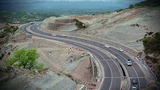
National Highway 44 is a major north–south National Highway in India, the longest in the country.
National Highway 11 or NH 11 is a National Highway in India that links Jaisalmer (Rajasthan) and Rewari (Haryana). This 848 km-long highway passes through Myajlar, Pithala, Jaisalmer, Pokaran, Ramdevara, Phalodi, Bap, Diyatra Gajner, Bikaner, Sri Dungargarh, Rajaldesar, Ratangarh, Rolsabsar, Fatehpur, Tajsar, Mandawa, Jhunjhunu, Bagar, Chirawa, Singhana, Pacheri, Narnaul, Ateli and Rewari.

National Highway 966 is a highway which connects Palakkad, Malappuram and Kozhikode district headquarters in Kerala. It was previously known as NH 213. It covers a distance of 125 km. At Ramanattukara, near Kozhikode, it joins NH 66. At Palakkad it joins NH 544, which connects Coimbatore and Cochin through Palakkad.

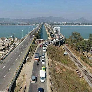
National Highway 2 is a national highway in India that runs from Dibrugarh in Assam to Tuipang in Mizoram. This national highway passes through the Indian states of Assam, Nagaland, Manipur and Mizoram. This national highway is 1,325.6 km (823.7 mi) long. Before renumbering of national highways, NH-2 was variously numbered as old national highways 37, 61, 39, 150 and 54.

National Highway 7 is a highway connecting Fazilka (Punjab) to Mana (Uttarakhand) in India. It passes through the Indian states of Punjab, Haryana, Himachal Pradesh, and Uttarakhand.
National Highway 9 is a National Highway in India in east-west direction. It starts at Malout in Punjab and ends at Pithoragarh in Pithoragarh district in Uttarakhand. It passes through the states of Punjab, Haryana, Delhi, Uttar Pradesh and Uttarakhand. After renumbering of all national highways by National Highway Authority of India in 2010, the current NH 9 was formed by merging segments of five separate national highways in 2010; these were Old NH 10, Old NH 24, Old NH 87, Old NH 74 and Old NH 125.

National Highway 24 (NH 24) is a primary national highway in India, running in a north-south direction. This highway runs entirely in the state of Uttar Pradesh. This highway was created by renumbering former NH29 and NH97 as per new numbering system of national highways.
National Highway 27, an East - West National highway in India that starts in Porbandar and ends in Silchar, the highway passes through the states of Gujarat, Rajasthan, Madhya Pradesh, Uttar Pradesh, Bihar, West Bengal, Assam. NH-27 was laid and is maintained by Ministry of Road Transport and Highways (MoRTH). It is the second longest National Highway in India and is a part of NS-EW Corridor of NHAI.
National Highway 29(NH 29) is a primary national highway in India. This highway was previously part of old national highways 36, 39 and 150. Due to rationalisation of national highway numbers of India by Gazette notification on 5 March 2010, it was renumbered as National Highway 29. NH-29 runs across the Indian states of Assam, Nagaland and Manipur. This national highway is 338.5 km (210.3 mi) long.

National Highway 31 is a primary national highway in India. It starts from Unnao in Uttar Pradesh and passes through Bihar and terminates at its crossing with State Highway 10 at Samsi in Malda district of West Bengal. SH 10 (WB) connects Samsi to NH 12.
National Highway 33 is a National Highway in India. It runs from Arwal to Farakka. It is a very important highway linking Bihar and West Bengal .This highway connects Major cities of Bihar like Munger and Bhagalpur to capital city patna.
National Highway 45 is a primary national highway in India. This highway runs in the states,sagartola of Madhya Pradesh and Chhattisgarh. The route of NH-45 was extended from Jabalpur to Bilaspur in June 2016.
National Highway 43 is a primary National Highway in India. It traverses from Gulganj in Madhya Pradesh, through Chhattisgarh and terminates at Chaibasa in Jharkhand. This national highway is 1,062.5 km (660.2 mi) long. Before renumbering of national highways NH-6 was variously numbered as old national highways 78, 23 & 33.
National Highway 47 is a primary National Highway in India. It starts from Bamanbore in Gujarat and terminates at Nagpur in Maharashtra. This national highway is about 1,006 km (625 mi) long. Before renumbering of national highways in 2010, NH-47 was variously numbered as old national highways 8A, 59, 59A & 69.
National Highway 344 is a national highway in India running from Ambala in Haryana to Roorkee in Uttarakhand. It is a secondary route of National Highway 44. NH-344 runs in the states of Haryana, Punjab, Uttar Pradesh and Uttarakhand in India.
National Highway 150A is a National Highway in Indian State of Karnataka. It is a spur road of National Highway 50. NH-150A traverses the states of Karnataka and Andhra Pradesh in India.

National Highway 19 is a national highway in India. It was previously referred to as Delhi–Kolkata Road and is one of the busiest national highways in India. After renumbering of national highways, Delhi to Agra route is now national highway 44 and Agra to Kolkata route is numbered national highway 19. It constitutes a major portion of the historical Grand Trunk Road. It is also part of AH1 of Asian Highway Network, that traverses from Japan to Turkey.


