National Highway 9 (India)

Last updated

NH9-IN.svg
National Highway 9
National Highway 9 (India)
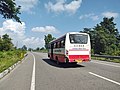
Map of National Highway 9 in red
Renumbered National Highways map of India (Schematic).jpg
Schematic map of National Highways in India
Route information
Part of AH2-IN.svg AH2
Length954 km (593 mi)
Major junctions
east endGori Ganga Bridge atAskot in Pithoragarh(Kumaun) District, Uttarakhand
Major intersections
west end Fazilka, Punjab
Location
Country India
States Punjab, Haryana, Delhi, Uttar Pradesh, Uttarakhand,
Primary
destinations
Fazilka, Malout (Punjab)
Sirsa-Hisar-Rohtak (Haryana)
Delhi
Ghaziabad-Moradabad-Rampur (Uttar Pradesh)
Rudrapur-Sitarganj-Tanakpur-Pithoragarh (Uttarakhand), Gori Ganga Bridge Askot(Kailash Mansarovar Road).
Highway system
NH8-IN.svg NH 8 NH10-IN.svg NH 10

National Highway 9 (NH 9) is a National Highway in India in east-west direction. It starts at Fazilka in Punjab and ends at Gori Ganga Bridge at Askot in Pithoragarh (Kumaun) District of Uttarakhand [1] in Pithoragarh district in Uttarakhand. It passes through the states of Punjab, Haryana, Delhi, Uttar Pradesh and Uttarakhand. [2] After renumbering of all national highways by National Highway Authority of India in 2010, the current NH 9 was formed by merging segments of five separate national highways in 2010; these were Old NH 10 (Fazilka-Delhi section), Old NH 24 (Delhi-Rampur section), Old NH 87 (Rampur-Rudrapur section), Old NH 74 (Rudrapur-Sitarganj-Khatima section) and Old NH 125 (Tanakpur-Pithoragarh section).

Contents

Route

Starting at Fazilka in Punjab and ending at Gori Ganga Bridge Askot in the State of Uttarakhand, it passes connects several important cities in five states in North India (from west towards east): [3] [4] The highway runs 954 kilometres (593 mi) end to end and is also known as Kailash Mansarovar Road in Uttarakhand.

Map with spur routes

National Highway 9 (India)
Map of NH9 in red, spur routes in blue

See also

Related Research Articles

<span class="mw-page-title-main">Kumaon division</span> Administrative division in India

Kumaon is a revenue and administrative division in the Indian state of Uttarakhand. It spans over the eastern half of the state and is bounded on the north by Tibet, on the east by Nepal, on the south by the state of Uttar Pradesh, and on the west by Garhwal. Kumaon comprises six districts of the state: Almora, Bageshwar, Champawat, Nainital, Pithoragarh and Udham Singh Nagar.

<span class="mw-page-title-main">Champawat</span> Town in Uttarakhand, India

Champawat is a town and a Nagar Palika Parishad in Champawat district in the state of Uttarakhand, India. It is the administrative headquarters of Champawat district. The town was the former capital of the Kumaon Kingdom.

<span class="mw-page-title-main">Udham Singh Nagar district</span> District in Uttarakhand, India

Udham Singh Nagar is a district of Uttarakhand state in northern India. Rudrapur is the district headquarter. The district consists of nine Tehsils named Bajpur, Gadarpur, Jaspur, Kashipur, Khatima, Kichha, Nanakmatta, Rudrapur, Sitarganj. The district is located in the Terai region, and is part of Kumaon Division. It is bounded on the north by Nainital District, on the northeast by Champawat District, on the east by Nepal, and on the south and west by Bareilly, Rampur, Moradabad, Pilibhit and Bijnor District of Uttar Pradesh state. The district was created on 29 September 1995, by Mayawati government out of Nainital District. It is named for freedom fighter and Indian revolutionary Udham Singh.

<span class="mw-page-title-main">Cantonment</span> Military residential quarters, temporary or permanent

A cantonment is a military quarters. In India and other parts of South Asia, a cantonment refers to a permanent military station. In United States military parlance, a cantonment is, essentially, "a permanent residential section of a fort or other military installation," such as Fort Cavazos.

<span class="mw-page-title-main">Askot</span> Village in Uttarakhand, India

Askot or Askote is a small Himalayan town in Pithoragarh district of Uttarakhand in India. It is the part of Kanalichhina development Block and Didihat Tehsil.

Rithora is a town and a nagar panchayat in Bareilly Tehsil of Bareilly district in the Indian state of Uttar Pradesh.

<span class="mw-page-title-main">Rudrapur, Uttarakhand</span> City in Uttarakhand, India

Rudrapur is a city that serves as the headquarters of the Udham Singh Nagar district in the Indian state of Uttarakhand. Located at a distance of about 250 km (160 mi) northeast of New Delhi and 250 km (160 mi) south of Dehradun, Rudrapur is located in the fertile Terai plains in the southern part of Kumaon division over an area of 27.65 km2. With a population of 140,857 according to the 2011 census of India, it is the 5th most populous city of Uttarakhand.

<span class="mw-page-title-main">Sitarganj</span> City in Uttarakhand, India

Sitarganj is a city and a municipal board in Udham Singh Nagar district in the Indian state of Uttarakhand. Now it is home to the Integrated Industrial Estate Sitarganj (IIE) being developed by State Industrial Development Corporation of Uttarakhand Limited (SIDCUL).

<span class="mw-page-title-main">Tanakpur</span> City in Uttarakhand, India

Tanakpur is a city and a municipal board in Champawat district of Uttarakhand state of India. Located in the plains area in the northern part of India. The town is the gateway for Purnagiri Temple as well as the 'Gateway to the Kumaon Himalayas'.

Sultanpur is a town in Udham Singh Nagar district in the Indian state of Uttarakhand. It is located approximately 15 kilometres from Kashipur and 42 kilometers from Rudrapur.

<span class="mw-page-title-main">Joya, India</span> City in Uttar Pradesh, India

Joya is a nagar panchayat located along highway NH-24 in Amroha district in the Western Uttar Pradesh. It is predominantly a milk producing city. Joya was a gram panchayat before 1988. The late Abrar Hussain was the first chairman of Joya in 1988.

Delhi, a major metropolitan region of India, is connected to various parts of country through several national highways and expressways. All the highways and expressways from Delhi lead to Haryana or Uttar Pradesh and continue from there.

<span class="mw-page-title-main">National Highway 10 (India, old numbering)</span> Old numbering of road in India

National Highway 10 was a National Highway, length 403 km (250 mi), in North India that originated at Delhi and ended at the town of Fazilka in Punjab near the Indo-Pak Border.

<span class="mw-page-title-main">National Highway 30 (India)</span> National highway in India

National Highway 30 is a primary national highway in India. NH 30 connects Sitarganj in Uttarakhand with Ibrahimpatnam, Vijayawada in Andhra Pradesh. The total length of this highway is 1,984.3 km (1,233.0 mi). It starts at the junction of NH 9 at Sitarganj and ends at the junction of NH 65 at Ibrahimpatnam, Vijayawada. Development of Ibrahimpatnam-Jagadalpur Route is under process. Rajdeep Rohan joint venture is the contract agency for this project. Second bridge was completed on 17 April 2024 at pilgrimage city of Bhadrachalam which is famous for temple of Lord Shri Rama. NH-30 runs through the states of Uttarakhand, Uttar Pradesh, Madhya Pradesh, Chhattisgarh, Telangana and Andhra Pradesh in India.

<span class="mw-page-title-main">Western Uttar Pradesh</span> Region in northern India

Western Uttar Pradesh is a region in India that comprises the western districts of Uttar Pradesh state, including the areas of Rohilkhand and those where Hindi, Urdu and Braj are spoken; it is in the region of Western Uttar Pradesh that Hindi-Urdu originated. The region has some demographic, economic and cultural patterns that are distinct from other parts of Uttar Pradesh, and more closely resemble those of Haryana and Rajasthan states. The largest city of the region is Ghaziabad, while the second-largest city, Agra, is a major tourist destination.

<span class="mw-page-title-main">National Highway 7 (India)</span> National highway in India

National Highway 7 is a highway connecting Fazilka (Punjab) to Mana (Uttarakhand) in India. It passes through the Indian states of Punjab, Haryana, Himachal Pradesh, and Uttarakhand.

The Uttarakhand movement refers to the events of statehood activism within the undivided state of Uttar Pradesh which ultimately resulted in the formation of Uttarakhand, India as a separate state.

National Highway 530 is a National Highway in India. It runs from Pantnagar in Uttarakhand with Rampur covering 140 kilometres (87 mi) distance.

National Highway 709AD, commonly called Panipat-Khatima Highway is a national highway in India. It is a spur road of National Highway 9. NH-709AD traverses the states of Uttar Pradesh and Haryana passes through various Cities and Town in Haryana and Western Uttar Pradesh like Shamli, Muzaffarnagar, Bijnor in India before its terminal at Nagina in Bijnor. Shamli acts as one of the major junction as two other major highways of the area (709A) and (709B) intersects with (709AD) at Shamli. The other major junction is Muzaffarnagar where this highway intersects with (334) Delhi-Rishikesh National Highway and UP State Highway 59

National Highway 731K, commonly referred to as NH 731K is a national highway in India. It is a secondary route of National Highway 31. NH-731K runs in the states of Uttar Pradesh and Uttarakhand in India.

References

  1. "Press Information Bureau GOI - 145083" . Retrieved 10 March 2018.
  2. "Rationalisation of Numbering Systems of National Highways" (PDF). New Delhi: Department of Road Transport and Highways. Archived from the original (PDF) on 4 December 2018. Retrieved 3 April 2012.
  3. "National highway 9 route substitution notification" (PDF). The Gazette of India . 31 March 2015. Retrieved 1 August 2018.
  4. "Press Information Bureau GOI - 145083" . Retrieved 10 March 2018.