Transport in Bhutan uses about 8,000 kilometres (5,000 mi) of roads and four airports, three of which are operational and interconnected. Paro Airport is the only airport which accommodates international flights. As part of Bhutan's infrastructure modernization programs, its road system has been under development since the 1960s. There are no railways, and as Bhutan is a landlocked country with no major waterways, there are no ports.

Alipurduar is a city and a municipality in the Indian state of West Bengal. It is the headquarters of the Alipurduar district. Situated on the east bank of Kaljani River in the foothills of the Himalayas, the city is a gateway to Bhutan and the northeastern states of India. Alipurduar was a sub-divisional town of Jalpaiguri district until 2014 when it was created a separate district.

Jalpaiguri district is a district of the Indian state of West Bengal. The district was established in 1869 during British Raj.
Birpara is a census town in Alipurduar I CD block in Alipurduar subdivision of Alipurduar district, West Bengal, India. At the 2011 Census of India, Birpara had a population of 10,821, of which 5,607 (52%) were males and 5,214 (48%) females. There were 9,771 persons in the age range of 0 to 6 years. The total number of literate people in Birpara was 7,937.

Jaigaon is a census town in Alipurduar subdivision under Kalchini Block of Alipurduar district in the state of West Bengal, India. It is located on the country's border with Bhutan, and Bhutan Gate separates the two countries. Phuentsholing is the Bhutan's nearest city to Jaigaon. Bhutan does not have domestic roads linking all its towns, so it uses roads passing through Jaigaon to reach destinations such as Samtse, Gomtu, Nganglam and Samdrup Jongkhar.

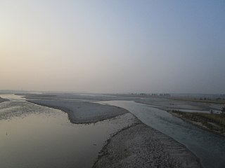
Malbazar, also known as Mal, is a town and a municipality in Jalpaiguri district in the state of West Bengal, India. It is the headquarters of the Malbazar subdivision. It lies about 65 km from Jalpaiguri and 55 km from Siliguri. It lies on the bank of river Neora.
Hasimara is a town in Alipurduar district of West Bengal state, India near the border with Bhutan. It is located at 26° 45' N latitude and 89° 21' E longitude at an altitude of 109 metres above sea level and has a population of about 40,000.
Binnaguri is a cantonment town located in the Jalpaiguri district of West Bengal state, India. It is located at 26° 46' N latitude and 89° 3' E longitude at an altitude of 216 metres above sea level.
Banarhat is a census town of the Banarhat CD block in Dhupguri subdivision of the Jalpaiguri District in the state of West Bengal, India. Sharing nearest international border with BHUTAN.

Dhupguri is a town and a municipality of Jalpaiguri district near Jaldhaka River in the state of West Bengal, India.It is the headquarters of the Dhupguri subdivision.
Gairkata is a census town in the Dhupguri subdivision of the Jalpaiguri district in the state of West Bengal, India. It is the native town of prominent Bengali writer Samaresh Majumdar, poet and journalist Bikash Sarkar and CPI leader Samar Ganguly. Gairkata, home to Gosaihat Eco-Park, features Telipara as its main industrial hub. An NGO named Aaranyak was also located in Gairkata.

Mainaguri is a Town and a Municipality in the Jalpaiguri Sadar subdivision of the Jalpaiguri district in the state of West Bengal, India. It is known as the "Gateway of the Dooars" and is a regionally significant tourist destination for Jalpesh Temple of Lord Shiva and nearby Gorumara National Park.
Phulbari also known as Fulbari is a road border crossing for vehicles and people on the India-Bangladesh border and a proposed municipality in Rajganj community development block in Jalpaiguri district in the Indian state of West Bengal. The Bangladesh side of the border crossing is Banglabandha.
National Highway 27, an East - West National highway in India that starts in Porbandar and ends in Silchar, the highway passes through the states of Gujarat, Rajasthan, Madhya Pradesh, Uttar Pradesh, Bihar, West Bengal, Assam. NH-27 was laid and is maintained by Ministry of Road Transport and Highways (MoRTH). It is the second longest National Highway in India and is a part of NS-EW Corridor of NHAI.
National Highway 317 is a National Highway in India. This highway runs entirely in the state of West Bengal. It is a secondary route of National Highway 17. This route was earlier part of old national highway 31C. Birpara to Hasimara stretch of this national highway is part of Asian Highway 48.
National Highway 517 is a national highway in India, running from Gairkata to Dhupguri in the state of West Bengal. It is a secondary route of National Highway 17. This route was earlier part of old national highway 31. This national highway is also part of Asian Highway 48.

National Highway 717 is a national highway in India. This highway runs entirely in the state of West Bengal. It is a secondary route of National Highway 17. Prior to renumbering of national highways in 2010, the stretch between Chalsa and Mainaguri was part of old national highway 31. By a gazette notification on 27 December 2013, NH-717 route was extended from Mainaguri to land border crossing of India/Bangladesh border near Changrabandha. Mainaguri to Changrabandha stretch of this route is part of Asian Highway 48.
National Highway 317A, commonly called NH 317A is a national highway in the state of West Bengal in India. It is a branch of National Highway 317. NH 317A is a very important road providing connectivity to Bhutan. This national highway is also part of Asian Highway 48.

The P.C. Mittal Memorial Bus Terminus is a bus terminal located on Sevoke Road, Siliguri, District Darjeeling. It is from 5.4 km (3.4 mi) from Siliguri Junction railway station and about 8.2 km (5.1 mi) from New Jalpaiguri Railway Station. Both State owned North Bengal State Transport Corporation (NBSTC) buses and private buses ply from here. Some bus routes may be shifted to this terminal to reduce traffic congestion. The Terminus is named after P.C. Mittal, a social worker and a businessman, who was a resident of the Darjeeling District.

Banarhat is a community development block that forms an administrative division in the Dhupguri subdivision of the Jalpaiguri district in the India state of West Bengal.

