National Highway 39 (India)

Last updated

NH39-IN.svg
National Highway 39
National Highway 39 (India)
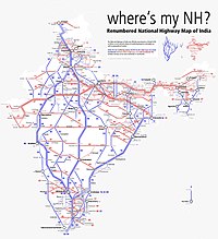
Map of the National Highway in red
NH75.jpg
NH 39 (former NH75)
Route information
Length869 km (540 mi)
Major junctions
West end Jhansi
East end Ranchi
Location
Country India
States Uttar Pradesh, Madhya Pradesh, Jharkhand
Highway system
NH27-IN.svg NH 27 NH20-IN.svg NH 20
Schematic map of National Highways in India Renumbered National Highways map of India (Schematic).jpg
Schematic map of National Highways in India

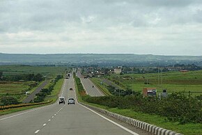
National Highway 39 (NH 39) is a National Highway in India. This highway passes through the Indian states of Madhya Pradesh, Uttar Pradesh and Jharkhand. [1]

Contents

Route

This 869-kilometre-long (540 mi) highway passes through Jhansi, Chhatarpur, Panna, Satna, Rewa, Rampur Naikin, Sidhi, Singrauli, Renukut, Shaktinagar, and some major town in Jharkhand with 604-kilometre-long (375 mi) length in Madhya Pradesh & Uttar Pradesh & rest 265-kilometre-long (165 mi) stretch in Jharkhand, starting from Kanhar near Garhwa , connecting NH-139 in Daltonganj, then passes through Latehar, connecting NH-22 at Chandwa, connecting NH-143A in Kuru, Lohardaga then passes through Chanho, Mandar, Ratu, and finally ends at Ring Road, Tupudana, Ranchi

Route conditions

NH39 is sadly one of the worst highways in India as per route conditions. The highway is 4 laned between Jhansi-Khajuraho, Satna-Rewa, Sidhi-Tenduha, Garhwa-Kundi & Kuru, Lohardaga-Ranchi stretches covering just 370-kilometre-long (230 mi) of distance. Rest 499-kilometre-long (310 mi) is 2 laned & has serious bad road conditions. NHAI is working to make 192-kilometre-long (119 mi) more stretch into 4 lane by 2026.

See also

References

  1. "Rationalisation of Numbering Systems of National Highways" (PDF). New Delhi: Department of Road Transport and Highways. Archived from the original (PDF) on 31 March 2012. Retrieved 3 April 2012.