
The Dwight D. Eisenhower National System of Interstate and Defense Highways, commonly known as the Interstate Highway System, or the Eisenhower Interstate System, is a network of controlled-access highways that forms part of the National Highway System in the United States. The system extends throughout the contiguous United States and has routes in Hawaii, Alaska, and Puerto Rico.

Highways in Australia are generally high capacity roads managed by state and territory government agencies, though Australia's federal government contributes funding for important links between capital cities and major regional centres. Prior to European settlement, the earliest needs for trade and travel were met by narrow bush tracks, used by tribes of Indigenous Australians. The formal construction of roads began in 1788, after the founding of the colony of New South Wales, and a network of three major roads across the colony emerged by the 1820s. Similar road networks were established in the other colonies of Australia. Road construction programs in the early 19th century were generally underfunded, as they were dependent on government budgets, loans, and tolls; while there was a huge increase in road usage, due to the Australian gold rushes. Local government authorities, often known as Road Boards, were therefore established to be primarily responsible for funding and undertaking road construction and maintenance. The early 1900s saw both the increasingly widespread use of motorised transportation, and the creation of state road authorities in each state, between 1913 and 1926. These authorities managed each state's road network, with the main arterial roads controlled and maintained by the state, and other roads remaining the responsibility of local governments. The federal government became involved in road funding in the 1920s, distributing funding to the states. The depression of the 1930s slowed the funding and development of the major road network until the onset on World War II. Supply roads leading to the north of the country were considered vital, resulting in the construction of Barkly, Stuart, and Eyre Highways.

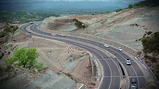
The national highways in India are a network of limited access roads owned by the Ministry of Road Transport and Highways. National highways have flyover access or some controlled-access, where entrance and exit is through the side of the flyover. At each highway intersection, flyovers are provided to bypass the traffic on the city, town, or village. These highways are designed for speeds of 100 km/h. Some national highways have interchanges in between, but do not have total controlled-access throughout the highways. The highways are constructed and managed by the Central Public Works Department (CPWD), the National Highways and Infrastructure Development Corporation Limited (NHIDCL), and the public works departments (PWD) of state governments. Currently, the longest national highway in India is National Highway 44 at 4,112 km. India started four laning of major national highways with the National Highway Development Project (NHDP). As of March 2022 India has approximately 35,000 km of four laned National highways.

National Highway 16 also known as Kolkata - Chennai Highway is a major National Highway in India that runs along east coast of West Bengal, Odisha, Andhra Pradesh, and Tamil Nadu. It was previously known as National Highway 5.
National Highway 44 is a major north–south National Highway in India and is the longest in the country.
National Highway 133, commonly called NH 133 is a national highway in India. It is a spur road of National Highway 33. NH-133 traverses the states of Jharkhand and Bihar in India. The highway is 134 km (83 mi) long. The highway connects Godda in Jharkhand with Pirpainti in Bihar.
National Highway 136, commonly referred to as NH 136, is a national highway of India. It comes under Ministry of Road Transport and Highways, Government of India. It is a secondary route of National Highway 36. NH-136 traverses the state of Tamil Nadu in India.
National Highway 146 is a National Highway in India. This highway is in the state of Madhya Pradesh, running from Bhopal to Sagar. This national highway is 167.6 km (104.1 mi) long. Before renumbering of national highways, NH-146 was numbered as old National Highways 86A (India).
National Highway 10 is a national highway in North East India that connects Indo/Bangladesh border via Siliguri to Gangtok. It passes through the Indian states of West Bengal and Sikkim.The highway is being maintained by the National Highways and Infrastructure Development Corporation Limited (NHIDCL) from Rangpo to Ranipool in the state of Sikkim.
National Highway 33 is a National Highway in India. It runs from Arwal to Farakka. The highway links Bihar to West Bengal. The highway connects some major cities of Bihar such as Munger and Bhagalpur to the capital city Patna.
National Highway 32 is a National Highway in India. It starts from Chennai and terminates at Thoothukudi. It is also known as East Coast Road.
National Highway 45 is a primary national highway in India. This highway runs in the states,sagartola of Madhya Pradesh and Chhattisgarh. The route of NH-45 was extended from Jabalpur to Bilaspur in June 2016.
National Highway 46 is a primary National Highway in India. This highway is in the state of Madhya Pradesh, running from Gwalior to Betul. This national highway is 634 km (394 mi) long. Before renumbering of national highways, NH-46 was variously numbered as old national highways 3, 12 & 69. Gwalior-Biaora section of this highway is a part of the Legendary Agra-Bombay Road, also known as AB Road
National Highway 47 is a primary National Highway in India. It starts from Bamanbore in Gujarat and terminates at Nagpur in Maharashtra. This national highway is about 1,006 km (625 mi) long. Before renumbering of national highways in 2010, NH-47 was variously numbered as old national highways 8A, 59, 59A & 69.
National Highway 163 is a National Highway in India that links Kodangal(Ravulapally) in Telangana and Bhopalpatnam road in Chhattisgarh Via major cities like Hyderabad, Uppal, Ghatkesar, Bhuvanagiri, Jangaon, Kazipet, Hanamkonda, Warangal. It was renumbered as NH 163. Currently there was a proposal for extension of NH 163 Pre-starting point to Hyderabad.

National Highway 19 is a national highway in India. It was previously referred to as Delhi–Kolkata Road and is one of the busiest national highways in India. After renumbering of national highways, Delhi to Agra route is now national highway 44 and Agra to Kolkata route is numbered national highway 19. It constitutes a major portion of the historical Grand Trunk Road. It is also part of AH1 of Asian Highway Network, that traverses from Japan to Turkey.
National Highway 129A, commonly referred to as NH 129A is a national highway in India. It is a spur road of National Highway 29. NH-129A traverses the states of Manipur and Nagaland in India.


