National Highway 3 (India)

Last updated

NH3-IN.svg
National Highway 3
National Highway 3 (India)
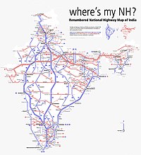
Map of the National Highway in red
Best place to drive,Rohtang pass.jpg
Rohtang Pass on NH 3
Route information
Part of AH1-IN.svg AH1 AH2-IN.svg AH2
Maintained by NHAI
Length556 km (345 mi)
Major junctions
West end Attari, Punjab
Major intersections
List
East end Leh, Ladakh
Location
Country India
States Punjab, Himachal Pradesh, Ladakh
Primary
destinations
Attari, Amritsar, Kartarpur, Jalandhar, Hoshiarpur, Gagret, Nadaun, Hamirpur, Sarkaghat, Kotli, Mandi, Kullu, Manali, Gramphoo, Kyelong, Leh
Highway system
NH2-IN.svg NH 2 NH4-IN.svg NH 4

National Highway 3, or NH 3, is a national highway in India. [1] It starts from Atari adjacent to India-Pakistan border and near Amritsar and terminates at Leh in Ladakh, via Manali in Himachal Pradesh. [2]

Contents

History

After renumbering of all national highways by National Highway Authority of India in 2010, parts of the former NH 1 and NH 70 have been combined with parts of former NH 21 to create the new NH 3.

Mountain passes

Part of national Highway 3 runs through the upper reaches of Himachal Pradesh and Ladakh, crossing some high elevation mountain passes. First major pass comes after Manali, which is Rohtang pass at an elevation of 3,978 m. Rohtang pass provides connectivity between the Kullu valley and the Lahaul and Spiti valleys of Himachal Pradesh. Next major pass on NH3 is Baralacha La at an elevation of 4,890 m in Zanskar range. In Leh district, NH 3 crosses over Nakee La (4739 m, 15547 ft), Lachulung La (5064 m, 16616 ft) and Taglang La. [3]

Route

National Highway 3 route runs through three states.

Punjab

Attari, Amritsar, Jalandhar, Hoshiarpur - H.P. border (178.44 km). [4]

Himachal Pradesh

Punjab border - Gagret, Amb, Nadaun, Hamirpur, Toni Devi, Awa Devi, Mandi, Kullu, Manali, Gramphoo, Kyelong - J & K border (208 km). [5] [6]

Ladakh

H.P border - Leh (170 km). [6]

Construction and upgradation

Process for upgrading of road from two to four lanes on Jalandhar to Hoshiarpur section was started by NHAI to improve connectivity. Traffic congestion is encountered at Adampur and Rama Mandi on this 58 km stretch. [7] 39.4 km of this project is assigned to the public works department, Punjab. [8]

Junctions list

NH 3 near Kothi, Kullu district Leh-Manali Highway - Kothi - Kullu 2014-05-10 2497.JPG
NH 3 near Kothi, Kullu district
Terminal at Wagah India/Pakistan border.
NH54-IN.svg NH 54 near Amritsar.
NH354-IN.svg NH 354 near Amritsar.
NH503A-IN.svg NH 503A near Amritsar.
NH44-IN.svg NH 44 near Jalandhar.
NH703-IN.svg NH 703 near Jalandhar.
NH703A-IN.svg NH 703A near Jalandhar.
NH344B-IN.svg NH 344B near Hoshiarpur.
NH503A-IN.svg NH 503A near Hoshiarpur.
NH503-IN.svg NH 503 near Mubarakpur.
NH303-IN.svg NH 303 near Nadaun.
NH103-IN.svg NH 103 near Hamirpur.
NH305-IN.svg NH 305 near Aut.
NH505-IN.svg NH 505 near Gramphoo.
NH1-IN.svg NH 1 Terminal point near Leh.

Interactive map

Schematic map of National Highways in India Renumbered National Highways map of India (Schematic).jpg
Schematic map of National Highways in India
National Highway 3 (India)
Interactive map of NH3 in red, spur routes in blue

See also

Related Research Articles

Rohtang Pass Mountain pass

Rohtang Pass is a high mountain pass on the eastern end of the Pir Panjal Range of the Himalayas around 51 km (32 mi) from Manali in the Indian state of Himachal Pradesh. It connects the Kullu Valley with the Lahaul and Spiti Valleys of Himachal Pradesh, India.

Una is a district in the Indian state of Himachal Pradesh. Una shares its border with the Hoshiarpur and Rupnagar districts of Punjab and Kangra, Hamirpur and Bilaspur district of Himachal Pradesh. The terrain is generally semi-hilly with low hills.

Mandi district District of Himachal Pradesh in India

Mandi district is one of the central districts of Himachal Pradesh state in northern India. The town of Mandi is the headquarters of the district. The town has mythological and historical significance and boasts of a unique temple architecture. It is referred to as Chhoti Kashi as there are many ancient temples in the city and on the banks of river Beas.

Manali, Himachal Pradesh Town in India

Manali is a town in the Indian state of Himachal Pradesh. It is situated in the northern end of the Kullu Valley, formed by the Beas River. The town is located in the Kullu district, approximately 270 kilometres (170 mi) north of the state capital of Shimla and 544 kilometres (338 mi) northeast of the national capital of Delhi. With a population of 8,096 people recorded in the 2011 Indian census Manali is the beginning of an ancient trade route through Lahaul and Ladakh, over the Karakoram Pass and onto Yarkand and Hotan in the Tarim Basin of China. Manali is a popular tourist destination in India and serves as the gateway to the Lahaul and Spiti district as well as the city of Leh in Ladakh.

Kyelang Town in Himachal Pradesh, India

Kyelang is a town and the administrative centre of the Lahaul and Spiti district in the Indian state of Himachal Pradesh, 71 km (44 mi) north of Manali via Atal Tunnel and 120 km (75 mi) from the Indo-Tibetan border. It is located along the Manali-Leh Highway, about 7 km (4.3 mi) north-east of intersection of the Chandra, Bhaga, and Chenab valleys, on the banks of Bhaga River.

Kullu Town in Himachal Pradesh, India

Kullu is a municipal council town that serves as the administrative headquarters of the Kullu district of the Indian state of Himachal Pradesh. It is located on the banks of the Beas River in the Kullu Valley about 10 kilometres (6.2 mi) north of the airport at Bhuntar.

Pir Panjal Range Mountain range of the Lower Himalayas

The Pir Panjal Range is a group of mountains in the Lesser Himalayan region, running from east-southeast (ESE) to west-northwest (WNW) across the Indian territories of Himachal Pradesh and Jammu and Kashmir and then Pakistan's Azad Kashmir and Punjab. The average elevation varies from 1,400 m (4,600 ft) to 4,100 m (13,500 ft). The Himalayas show a gradual elevation towards the Dhauladhar and Pir Panjal ranges. Pir Panjal is the largest range of the Lesser Himalayas. Near the bank of the Sutlej River, it dissociates itself from the Himalayas and forms a divide between the Beas and Ravi rivers on one side and the Chenab on the other. The renowned Galyat mountains are also located in this range.

Geography of Himachal Pradesh

The state of Himachal Pradesh is spread over an area 55,673 km2 (21,495 sq mi) and is bordered by Jammu and Kashmir and Ladakh on the north, Punjab on the southwest, Haryana on the south, Uttarakhand on the southeast, a small border with Uttar Pradesh in the south, and Tibet on the east. Entire Himachal Pradesh lies in the mountainous Himalaya region, rich in natural resources

Gagret is a nagar panchayat in Tehsil Ghanari of Una district in the state of Himachal Pradesh, India. It is situated in plains of Una.

Sundar Nagar is a town and a municipal council in Mandi district in the Indian state of Himachal Pradesh. Formerly it was a princely state, known as Suket.

Leh–Manali Highway High elevation mountain highway in India

The Leh–Manali Highway is a 428 km (266 mi) long highway in northernmost India connecting Leh, one of the two capitals of the union territory of Ladakh, to Manali in the state of Himachal Pradesh. It connects the Manali Solang valley to the Lahaul and Spiti valleys in Himachal Pradesh and the Zanskar valley in Ladakh. It is open for only about five months in a year, from mid-May or June to October, when snowfall again blocks the high passes on the highway. However, the Lahaul valley will now remain connected to Manali for most part of the year through already completed Atal tunnel. With the completion of proposed Shingo La Tunnel on new route through Zanskar valley, targeted to be completed by 2025, the whole Leh-Manali route will become all-weather road.

The development of tribal areas in Himachal Pradesh is one of the major steps taken by the state government for its economic development. The border districts of Kinnaur, Lahaul, Spiti and the Pangi and Bharmour tehsils of Chamba districts are the major tribal areas of the state. They are located near the borders of Tibet and Indian States of Jammu and Kashmir. Other backward areas include Shillai in Sirmaur district, and deep cut-off valleys in the Kullu and upper stretches of Kangra districts. Due to poor accessibility, life in these areas had grown in isolation.

National Highway 1 (India, old numbering) Old numbering of road in India

National Highway 1 or NH 1 was a National Highway in Northern India that linked the national capital New Delhi to the town of Attari in Punjab near the India–Pakistan border. Old National Highway 1 in its entirety, was part of historic Grand Trunk Road or simply known as GT Road.

Sissu Village in Himachal Pradesh, India

Sissu is a small town in the Lahaul valley of Himachal Pradesh in India. It is around 40 km from Manali and located on the right bank of Chandra river. It is located at 32°29′0″N77°7′0″E. It is 3,120 m above sea level. It is 14 km from Koksar to the south-east and 11 km. west to Gondhla.

National Highway 70 (India, old numbering) National Highway in India

National Highway 70 was a National Highway in Northern India linking Jalandhar in Punjab to Mandi in Himachal Pradesh. After renumbering of all national highways by National Highway Authority of India in 2010, the old NH 70 has now been subsumed in new National Highway 3 (India) or NH 3 and there is no NH 70 now.

Atal Tunnel Highway tunnel of the Himalayas

Atal Tunnel, named after former Prime Minister of India, Atal Bihari Vajpayee is a highway tunnel built under the Rohtang Pass in the eastern Pir Panjal range of the Himalayas on the Leh-Manali Highway in Himachal Pradesh, India. At a length of 9.02 km, it is the longest highway single-tube tunnel above 10,000 feet (3,048 m) in the world. With the existing Atal Tunnel and after the completion of under-construction Shingo La Tunnel, which is targeted to be completed by 2024, both the Leh-Manali Highway and the Nimmu–Padum–Darcha road routes will become all-weather roads.

Dehlan Lower, is a village located in Una district of the Indian state of Himachal Pradesh. Recently, Dehlan was adopted by Shri Anurag Singh Thakur, the sitting Member of Parliament from the Hamirpur seat under Sansad Adarsh Gram Yojna.

Himachal Road Transport Corporation

Himachal Road Transport Corporation, also referred to as HRTC, is the state-owned road transport corporation of the state of Himachal Pradesh, India. HRTC provides bus services to towns and cities within Himachal Pradesh and the adjoining and nearby states of Uttarakhand, Punjab, Haryana, Delhi, Uttar Pradesh, Jammu and Kashmir and Rajasthan. HRTC is one of the first RTC's in India to offer a facility for online booking of tickets for all types of buses.

National Highway 503A, commonly called NH 503A is a national highway in India. It is a branch of National Highway 3. NH-503A traverses the state of Punjab and Himachal Pradesh in India.

Amritsar–Jamnagar Expressway is an under-construction 1,257 km long, 4/6-lane wide expressway in the north-western part of India. This expressway will reduce the distance between Amritsar and Jamnagar from earlier 1,430 km to 1,316 km. It is a part of the Amritsar–Jamnagar Economic Corridor (EC-3) and will pass through 4 Indian states of Punjab, Haryana, Rajasthan and Gujarat.

References

  1. "New Numbering of National Highways notification - Government of India" (PDF). The Gazette of India . Retrieved 5 July 2018.
  2. "Route substitution notification for national highways 3 and 503" (PDF). The Gazette of India . Retrieved 5 July 2018.
  3. "Manali - Leh - Srinagar - 12 Mountain Passes" . Retrieved 22 November 2018.
  4. "National highways in Punjab". Public Works Department - Government of Punjab . Retrieved 10 September 2018.
  5. "National highways in H.P. as on 31.8.2015" (PDF). Public Works Department - Government of Himachal Pradesh . Retrieved 10 September 2018.
  6. 1 2 "State-wise length of National Highways (NH) in India as on 30.06.2017". Ministry of Road Transport and Highways . Retrieved 5 July 2018.
  7. "NHAI starts process for widening of 58 km stretch of Jalandhar-Hoshiarpur road". The Tribune India . 9 January 2015. Retrieved 11 September 2018.
  8. "Work on Doaba four-laning projects set to gather pace". Hindustan Times . 16 January 2018. Retrieved 11 September 2018.

Route map Route map