National Highway 505, commonly called NH 505, is a national highway in India.[1] It is a spur road of National Highway 5.[2] NH 505 traverses the state of Himachal Pradesh in India. NH 505 is a high elevation road, covering the Kinnaur and Lahaul and Spiti districts of Himachal Pradesh, mainly running along the Spiti River in the Spiti Valley. The highway from Kaza to Gramphu remains closed for 6–9 months in a year due to heavy snowfall and the closure of Kunzum La pass at an elevation of 4,550m (14,930ft).[3][4]
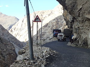
National Highway 505 was designated Himachal State Highway 30 prior to its being named on 4 March 2014 as a national highway.[5] The highway runs through the high-elevation cold desert area of Lahaul and Spiti valleys of Himachal, which area receives negligible rainfall.[1] The terrain is barren and treacherous, prone to landslides and disruptions. The road is narrow and rough at places and crosses the high-elevation Kunzum pass, requiring good driving skills in mountains.[6]
NH 505 has been of key importance to the growth of a cash crop economy, mass tourism, and the expansion of telecommunications in Spiti.[7] This highway provides connectivity to some major Buddhist monasteries and various other interesting places.[8]
The route of NH 505 starts at the Khab Sangam in Kinnaur district from National Highway 5. It runs along the Spiti Valley through Kinnaur and enters Lahaul and Spiti district at Sumdo. It continues up the Spiti Valley to Kunzum Pass. It descends and follows the Chandra River to the terminus at Gramphoo.[1]
The terminus at Khab, Kinnaur district is the preferred point of entry to the Spiti Valley which is located at an average elevation of 3,350m (10,990ft).[4] This mostly all-weather access point to Spiti Valley from Khab is at an elevation of about 2,600m (8,500ft). Travelling from Chandigarh or Shimla to Khab gives a chance for travellers to gradually acclimatize themselves to avoid altitude sickness. NH 505 climbs steeply from Khab Sangam up to Nako (3,662m (12,014ft)). It descends to Chango on the Spiti River, then enters Lahaul and Spiti district at Sumdo.
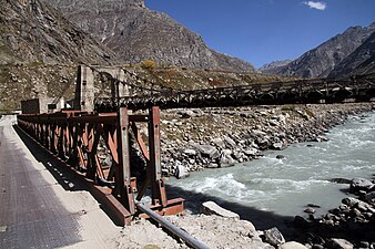
NH 505 enters Spiti Valley from bridge over Sutlej River
Broad riverbed of Spiti river above Kaza, Kaza-Kibber road on right
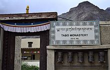
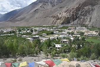
From Sumdo, NH 505 runs mostly alongside the Spiti river for about 130km (81mi) until Losar. After passing through Hurling, the next town is Tabo with the well-known Tabo Monastery and caves. The highway passes through some unusual clay pillars[10] en route to Kaza, the largest town in the Spiti Valley. Near Lingti, 15km (9.3mi) before Kaza, the 33km (21mi) road to Pin Valley National Park branches off over the Attargo Bridge to the right bank of the Spiti.[11] On the Tabo side of Lingti is the road to the Dhanker Monastery. In this section, the riverbed is very wide, up to 500m (1,600ft) in places. The river itself is much narrower and meanders in braids along the broad riverbed.[10]
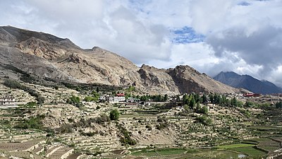
Tabo with Spiti River beneath distant cliff, June '18
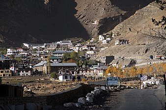
After Kaza, NH 505 crosses to the right bank of the Spiti river over the Rangrik Bridge. At the bridge, the Kaza-Kibber road continues on the left bank to Key Monastery (8km (5.0mi)) and the Kibber Wildlife Sanctuary (15km (9.3mi)).[12] NH 505 continues on the right bank running through a flat, narrow valley in which the Spiti Rver has carved a gorge about 300m (980ft) deep. The road crosses back to the left bank 3km (1.9mi) before Kialto village. Here, the Kaza-Kibber road rejoins NH 505, a distance of 22km (14mi) from Kibber. After Morang and Hanse villages, the valley broadens before Losar village.
After Losar, NH 505 turns up the right bank of the Lichu, a right bank tributary of the Spiti. The road climbs gradually up to Kunzum La, elev. 4,551m (14,931ft). There is a temple at the pass.
Spiti gorge above Kaza with NH 505 on the right bank (view from Kibber-Kialto road)
Spiti gorge with NH 505 on the right and Kibber-Kialto road on the left.
En route from Kaza to Losar
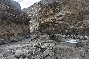
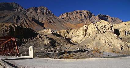
Bridge across Spiti river
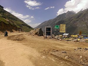
NH 505 entering Losar from the east
West of Losar towards Kunzum La, Elev. 4,090 metres (13,420ft).
From Kunzum pass, the highway descends through steep hairpin bends to Batal village on the left bank of the Chandra River. Chandra Taal is a pristine lake on the Chandra River popular with tourists and high-altitude trekkers. The road to Chandra Taal branches off from NH 505 about 2.9 kilometres (1.8mi) from Batal and 8km (5.0mi) from Kunzum Pass.[13]
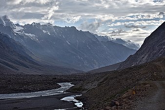
From Batal, NH 505 follows the left bank of the Chandra River, practically running on the riverbed in some places, as both sides of the narrow valley are very steep. This section is largely unpaved and impassable during the winter months. Passing through Chotta Dara, the highway reaches Chhatru, where it crosses to the right bank. It climbs steeply and runs along the top of a cliff overlooking the Chandra River until the terminus at Gramphu (Gramphoo).[5]
This page is based on this Wikipedia article Text is available under the CC BY-SA 4.0 license; additional terms may apply. Images, videos and audio are available under their respective licenses.