Bageshwar is a town and a municipal board in Bageshwar district in the state of Uttarakhand, India. It is located at a distance of 470 km from the National Capital New Delhi and 332 km from the State Capital Dehradun. Bageshwar is known for its scenic environment, glaciers, rivers and temples. It is also the administrative headquarters of Bageshwar district.

Berinag is a hill station, located 124 km from Pithoragarh city in the Pithoragarh district, which is the easternmost Himalayan district in the state of Uttarakhand, India. It is one of the six Administrative Subdivisions (tehsil) of Pithoragarh district. National Highway 309A passes through Berinag. Closest prominent villages include Garawon, Dhanoli, Bana, Bhattigaon, Banoli, Quarali, Tripuradevi and Sangarh.

Chaukori is a hill station in the Pithoragarh district set among the lofty peaks of the western Himalayan Range in the Kumaon Division of Uttarakhand, India. To its north is Tibet and to its south is Terai. The Mahakali River, running along its eastern boundary, forms the Indo-Nepal international border. This place has become a prominent tourist place and from here a wide and picturesque view of Himalayan range can be viewed. The golden yellow colour of sun rays falling on the Himalayan range in the morning time is really worth seeing. There are cottages available here where one can stay and enjoy the serene surroundings. Tourists coming to this place generally also visit the nearby tourist places like Patal Bhuvaneshwar, Kausani, Bageshwar and Almora.

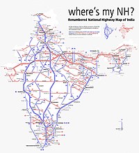
National Highway 30 is a primary national highway in India. NH 30 connects Sitarganj in Uttarakhand with Ibrahimpatnam, Vijayawada in Andhra Pradesh. The total length of this highway is 1,984.3 km (1,233.0 mi). It starts at the junction of NH 9 at Sitarganj and ends at the junction of NH 65 at Ibrahimpatnam, Vijayawada. Development of Ibrahimpatnam-Jagadalpur Route is under process. Rajdeep Rohan joint venture is the contract agency for this project. Second bridge was completed on 17 April 2024 at pilgrimage city of Bhadrachalam which is famous for temple of Lord Shri Rama. NH-30 runs through the states of Uttarakhand, Uttar Pradesh, Madhya Pradesh, Chhattisgarh, Telangana and Andhra Pradesh in India.

Kanda is a small historic town and tehsil in Bageshwar district, in the state of Uttarakhand, India.
Uttar Pradesh State Highway 37 or SH 37 is a State Highway in the state of Uttar Pradesh, India that connects Bareilly to Kichha, running through Baheri.
National Highway NH 34 is a National Highway in India. It runs from Gangotri Dham in Uttarakhand to Lakhnadon in Madhya Pradesh, passing through the state of Uttar Pradesh.
National Highway 344 is a national highway in India running from Ambala in Haryana to Roorkee in Uttarakhand. It is a secondary route of National Highway 44. NH-344 runs in the states of Haryana, Punjab, Uttar Pradesh and Uttarakhand in India.

National Highway 19 is a national highway in India. It was previously referred to as Delhi–Kolkata Road and is one of the busiest national highways in India. After renumbering of national highways, Delhi to Agra route is now national highway 44 and Agra to Kolkata route is numbered national highway 19. It constitutes a major portion of the historical Grand Trunk Road. It is also part of AH1 of Asian Highway Network, that traverses from Japan to Turkey.
National Highway 219, commonly referred as NH 219 is a National Highway in India. It is a spur road of National Highway 19. NH-219 traverses the states of Bihar and Uttar Pradesh in India.
Mankot is a Village situated in Bageshwar district in the State of Uttarakhand, India. It is located at a distance of 13.5 kilometres (8.4 mi) from Bageshwar on the National Highway 309A. Mankot is a medium-sized village with total 118 families residing.
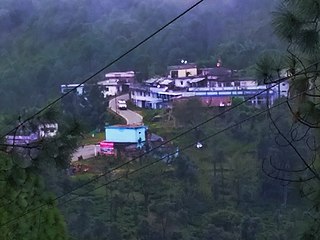
Vijaypur, officially known as Bijaypur is a hill station and village situated in Bageshwar district in the state of Uttarakhand, India. It is located at a distance of 30 km from Bageshwar and 5 km from Kanda; amidst dense Pine Forests on the Bageshwar-Chaukori Highway.
National Highway 334A, commonly referred to as NH 334A is a national highway in India. It is a spur road of National Highway 334. NH-334A traverses the states of Uttarakhand and Uttar Pradesh in India.
National Highway 309B, commonly referred to as NH 309B is a national highway in India. It is a spur road of National Highway 9. NH-309B traverses the state of Uttarakhand in India.
National Highway 124C, commonly referred to as NH 124C is a national highway in India. It is a secondary route of National Highway 24. NH-124C runs in the states of Uttar Pradesh and Bihar in India.
National Highway 128C, commonly referred to as NH 128C is a national highway in India. It is a secondary route of National Highway 28. NH-128C runs in the state of Uttar Pradesh in India.
National Highway 328A, commonly referred to as NH 328A is a national highway in India. It is a secondary route of National Highway 28. NH-328A runs in the state of Uttar Pradesh in India.
National Highway 731K, commonly referred to as NH 731K is a national highway in India. It is a secondary route of National Highway 31. NH-731K runs in the states of Uttar Pradesh and Uttarakhand in India.
National Highway 727AA, commonly referred to as NH 727AA is a national highway in India. It is a secondary route of National Highway 27. NH-727AA runs in the states of Bihar and Uttar Pradesh in India.

National Highway 109K, commonly referred to as NH 109K, is a National highway connecting the city of Simli to Jauljibi in the Indian State of Uttarakhand. The Highway was Notified on 12 Feb 2021 under the Bharatmala project of Government of India.