Bahadurgarh | |
---|---|
Coordinates: 28°41′N76°55′E / 28.68°N 76.92°E | |
Country | India |
State | Haryana |
District | Jhajjar |
Founded by | First founder Rathi Jats [1] |
Government | |
• Body | Municipal Council of Bahadurgarh |
• Chairperson | Mrs.saroj rathi |
Area | |
• Total | 50 km2 (20 sq mi) |
Population (2011) | |
• Total | 170,767 [2] |
Languages | |
• Official | Hindi, Haryanvi |
Time zone | UTC+5:30 (IST) |
PIN | 124507 |
Tel Code | 01276 |
Vehicle registration | HR-13 (Private), HR-63 (Commercial) |
gender ratio | 1.13 ♂/♀ |
Vidhan Sabha | Bahadurgarh |
Planning agency | Haryana Shahari Vikas Pradhikaran |
Civic agency | Municipal council of Bahadurgarh |
Bahadurgarh is a city and municipal council within Jhajjar district in the Indian state of Haryana and Part of National Capital Region or NCR of Delhi.The city comprises 31 wards and is approximately 21 km from National Capital Territory (NCT) of Delhi and 31 km from Jhajjar, the district headquarter.
Bahadurgarh is also known as the "Gateway of Haryana".
Bahadurgarh was founded by Rathee Jat Kshatriyas. [3] The city was founded by Mughal Emperor Alamgir II, [4] [5] who was the Sultan of Delhi from 1754 to 1759. He gave the town in jagir to Bahadur Khan and Tej Khan, Baloch rulers of Farrukhnagar in 1754, who changed its name from Sharafabad to Bahadurgarh. [6] One of their ruler, Bahadur Khan, constructed a fort in 1793 CE and named it Bahadurgarh Fort. Baloch Nawabs were defeated by Maratha forces and Bahadurgarh came into the hands of Sindhia in 1793. After Sindhia's defeat in 1803 at the hands of the British raj, Lord Lake transferred control of the town's government to the brother of the Nawab of Jhajjar in the aftermath of Treaty of Surji-Anjangaon. Bahadurgarh Fort is also called Singh Dwar or Gateway of Haryana. [7]
During 1995–1998, a series of rapes and murders of young girls by the Bahadurgarh baby killer led to several dharnas and bandhs by the local population. The police prosecuted three men as the "baby killer", before the real culprit was caught in November 1998. [8] [9]
Bahadurgarh is located in the Jhajjar district in the Indian state of Haryana and is situated in the eastern part of the state, and northern part of the country. The city is located on the border with New Delhi (commonly known as Tikri Border). The city has a total area of 50 km2. It is located between 76º-55'-25" East longitude and 28º-43'-50" North latitude. The city of Bahadurgarh is very well linked with New Delhi and other important towns such as Rohtak, Sonipat, Najafgarh and Nangloi by Roads and Railways. [10]
The climate of Bahadurgarh is considered to be a local steppe climate. Here, there is little rainfall throughout the year. This climate is considered to be BSh according to the Köppen-Geiger climate classification. The average temperature in the city is 25.1 °C (77.2 °F). [11] The average annual rainfall is approximately 510 mm (20 in). [12] The city experiences all four seasons along with the monsoon season setting in towards the later half of the summer. Summers are usually long and hot extending from early April to October which includes the monsoon season. Whereas winters start in November and extend till late February. The winters are usually cold and foggy with a few sunny days.
Climate data for Bahadurgarh | |||||||||||||
---|---|---|---|---|---|---|---|---|---|---|---|---|---|
Month | Jan | Feb | Mar | Apr | May | Jun | Jul | Aug | Sep | Oct | Nov | Dec | Year |
Record high °C (°F) | 27 (81) | 33 (91) | 41 (106) | 45 (113) | 49 (120) | 47 (117) | 45 (113) | 41 (106) | 39 (102) | 38 (100) | 33 (91) | 29 (84) | 47 (117) |
Mean daily maximum °C (°F) | 19 (66) | 24 (75) | 29 (84) | 37 (99) | 41 (106) | 39 (102) | 35 (95) | 33 (91) | 34 (93) | 33 (91) | 28 (82) | 22 (72) | 33.5 (92.3) |
Mean daily minimum °C (°F) | 6 (43) | 8 (46) | 13 (55) | 20 (68) | 26 (79) | 29 (84) | 28 (82) | 26 (79) | 24 (75) | 19 (66) | 13 (55) | 8 (46) | 18.3 (64.9) |
Record low °C (°F) | 0 (32) | 2 (36) | 7 (45) | 14 (57) | 21 (70) | 25 (77) | 25 (77) | 24 (75) | 21 (70) | 15 (59) | 8 (46) | 2 (36) | 0 (32) |
Average rainfall mm (inches) | 8 (0.3) | 18 (0.7) | 10 (0.4) | 11 (0.4) | 21 (0.8) | 49 (1.9) | 135 (5.3) | 128 (5.0) | 66 (2.6) | 18 (0.7) | 2 (0.1) | 7 (0.3) | 476 (18.7) |
Average rainy days | 2.2 | 4.4 | 4.2 | 4 | 6.9 | 12 | 22.2 | 22.6 | 10.9 | 2.1 | 0.7 | 1.5 | 93.7 |
Source: MeteoBlue (Based on 30-year Data) [13] |
According to the 2011 census, the population of Bahadurgarh is 170,426: 91,736 men and 78,690 women. There are 20,374 total children (0-6) --11,420 boys and 8,954 girls. The child gender ratio is 784 girls per 1000 boys. The average literacy rate in Bahadurgarh is 88.04%; the male and female literacy rates were 94.27 and 80.87 percent.[ citation needed ]
Religion | Population (1911) [14] : 20 | Percentage (1911) |
---|---|---|
Hinduism | 2,551 | 51.12% |
Islam | 2,344 | 46.97% |
Christianity | 55 | 1.1% |
Others [lower-alpha 1] | 40 | 0.8% |
Total Population | 4,990 | 100% |
Bahadurgarh is often called as an "Industrial Hub". It has a large Industrial area in Haryana's Delhi NCR region situated along Delhi Western Peripheral Expressway, i.e.- MIE-I, MIE-II, HSIIDC(Sector16 & 17).It is an important Industrial town wherein Haryana Government has developed about 200 hectares (490 acres) of land for Industrial purpose. Besides other big Industrial units such as Hindustan National Glass Company, Hindustan Sanitary Wares, Surya Roshni, Somany Ceramics, Parle Biscuits and Swastik Pipe, Relaxo, Aerobok Shoes, Yokohoma, Seaga India etc. are its main Industrial Units existing here on the land privately purchased by them. The town has specialization in manufacturing of Sanitary Ware, China Ware, Galvanized steel pipe, footwear etc. In bahadurgarh there is especially developed footwear park established to enhance the production of footwear industries. Recently an area of about 250 Hectares has also been developed by Haryana State Industrial and Infrastructure Development Corporation for Industrial purpose. It is connected to Delhi Metro green line since June 2018.
Bahadurgarh is considered a Knowledge Hub due to presence of a number of Govt. & Private College & Institutions including PDM University, Bls Institute of Technology and Management, Haryana Institute of Technology (HIT), DTC (Delhi Tech. Campus), AKIDO College of Engineering, MERI Engineering college, Ganga Technical Campus, Sat Kabir Institute of Technology, Vaish Kanya Mahavidyalaya, Govt. PG College for Boys and Govt. PG College for Girls, Sainik Public School. There are approx. 100 schools in the city, affiliated to CBSE & State Board. [15] Major schools of the area include Bal Bharti, scholar, triveni, SR century school, St Thomas and Delhi Public School.
Majaraja Agrasen Medical College is under construction in sector 37, on Bahadurgarh-Jhajjar Road near Delhi bypass. After completion, it will be the largest medical institute in Bahadurgarh city.
Bahadurgarh is well connected with other parts of the country through Roadways, Railways (Including National Railways), in June 2018 Bahadurgarh City metro station connected to Green Line was opened, which connects the city to different parts of New Delhi.
The major highway that passes through the city is National Highway 9. The highway links Bahadurgarh to Delhi, Hisar, Rohtak and various other cities of Haryana. Multiple modes of public transport are available such as taxis, buses, e-rickshaws, and auto rickshaws. [16]
Bahadurgarh is connected to the Green Line of the Delhi Metro since 24 June 2018. From Inderlok / Kirti Nagar to Brigadier Hoshiyar Singh metro station in Bahadurgarh, the total travel time on Delhi Metro is approximately 50 minutes. In September 2018, CM Manohar Lal Khattar renamed Bus Stand metro station and City Park metro station to Bahadurgarh City metro station and Brigadier Hoshiyar Singh metro station respectively.
As per provisional reports of Census India, the population of Bahadurgarh in 2011 is 170,426; of which males and females are 91,736 and 78,690 respectively. In the education section, total literates in Bahadurgarh city are 132,108 of which 75,714 are males while 56,394 are females. The average literacy rate of Bahadurgarh city is 88.04 percent of which male and female literacy was 94.27 and 80.87 percent. The sex ratio of Bahadurgarh city is 858 per 1000 males. The child sex ratio of girls is 784 per 1000 boys. Total children (0-6) in Bahadurgarh city are 20,374 as per figure from Census India report on 2011. There were 11,420 boys while 8,954 are girls. The child forms 11.95% of the total population of Bahadurgarh City.
Beri is a town and a Municipal committee in the Jhajjar district in Indian state of Haryana. It was founded by Kadyan Jat Chaudharies. The city is located 17 kilometres (11 mi) northwest of Jhajjar city and is a trading center. Beri is one of the largest tehsils of Haryana State including 77 villages. Beri City is situated on Road Connecting Gurgaon to Hisar and Kosli (Rewari) to Rohtak. This is the middle of these four cities. The First Chief Minister of Haryana, Bhagwat Dayal Sharma, was from Beri village. The Town has a world famous temple dedicated to the goddess Mata Bhimeshwari Devi and Lord Krishna. The "Beri Pashu Mela" or "Beri Cattle Fair" is celebrated in the days of Navratra every 6 months and is famous for its donkeys and horses.
Jhajjar district is one of the 22 districts of Haryana state in northern India. Carved out of Rohtak district on 15 July 1997 and with its headquarters in Jhajjar, it lies 29 kilometres (18 mi) from Delhi and had developed into an important industrial center. Other towns in the district are Bahadurgarh and Badli and Beri. Bahadurgarh is the major city of the district and state. Bahadurgarh is known as 'The City of Destiny'. Beri used to be a village fifty years ago.
Charkhi Dadri is a city and the headquarters of Charkhi Dadri district in the Indian state of Haryana, about 90 km from the national capital Delhi. The town was made by joining the villages of Charkhi and Dadri after urban development. Charkhi Dadri is on NH 148B between Narnaul to Bathinda and NH 348B between Meerut to Pilani segment passing through the city.
Jind is one of the largest and oldest cities in Jind district in the Indian state of Haryana. It is the administrative headquarter of Jind district. Rani Talab is the main destination for tourists while Pandu Pindara and Ramrai are the main religious spots, attracting devotees for the holy bath during Amavasya.
Mahendragarh is a city and a municipal committee in Mahendragarh district in the Indian state of Haryana. It is 100 kilometres (62 mi) from Gurgaon and comes under National Capital Region (India).
Jhajjar is a town in Jhajjar district in the Indian state of Haryana.It is a part of Delhi National Capital Region and situated on the road connecting Rewari to Rohtak (NH-352), Loharu to Meerut (NH334B), Charkhi Dadri to Delhi and Gurgaon to Bhiwani. Jhajjar is located 55 km (34 mi) west of Delhi.
Rohtak is a city and the administrative headquarters of the Rohtak district in the Indian state of Haryana. It lies 70 kilometres (43 mi) north-west of New Delhi and 250 kilometres (160 mi) south of the state capital Chandigarh on NH 9. Rohtak forms a part of the National Capital Region (NCR) which helps the city in obtaining cheap loans for infrastructure development from the NCR Planning Board.
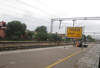
Palwal is a city and a municipal council. It is the headquarters of Palwal district, the 21st district of Haryana state in northern India. It is a centre of the cotton trade in the area. It is part of Braj region. It is also a part of National Capital Region.
Farrukhnagar is a small town and municipality in Farrukhnagar tehsil of Gurugram district in the Indian state of Haryana. It is situated 21 kilometres (13 mi) from Gurgaon and shares its border with Jhajjar district. It is part of the Ahirwal region.
Narnaul is a city, a Municipal Council, and location of headquarters of the Mahendragarh district in the Indian state of Haryana. It is located in the National Capital Region of India.
Taoru or Tauru is a town, near Nuh city in Nuh district in the Indian state of Haryana.
Fatehabad is a town and a municipal council in Fatehabad district in the state of Haryana, India. It is the administrative headquarters of Fatehabad district.
Chhara is a large village in the Bahadurgarh tehsil of Jhajjar district in the Indian state of Haryana. The population was 12,989 in the 2011 census.
Jasaur Kheri is a large village located, near Jhajjar city in Jhajjar District of Indian state of Haryana. It is located on Jhajjar-Bahadurgarh-Sonipat road; it is about 15 kilometres (9 mi) from nearest city Bahadurgarh and about 36 km from Jhajjar city, the district headquarter.↵The village is famous for its ancient Mata Chandraghanta Devi temple. Every year villagers organise a big 'Jagrata' on the eve of Ashtami in Navaratras, followed by Bhandara in morning. On side of temple there is Harshringi lake, Whose water is considered very holy and used for bathing gods and goddesses in temple. Harshringi devi mandir is named after Harshringi('Har' means Shri Krishan and 'Shringi' is the name of a famous saint). There is a hospital and water treatment plant established by Government of Haryana to cater health needs of people. Village also has its own stadium and akhara, where boys work on their physique and improve wrestling skills. In past, village used to be known as village of wrestlers. Most of the people living here, work in government departments located in Delhi. It is 40 km (25 mi) from National Capital New Delhi and can be reached by both train or road. Village is developing on good pace. It might possible it become the well known place of Haryana in future.
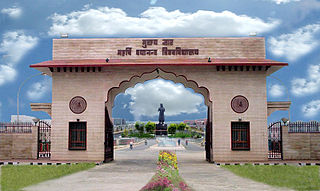
Kablana is a village on Jhajjar-Bahadurgarh road in Haryana state in India. Gaje Singh Kablana in Gurgaon won the election as an independent candidate. The post-graduate College, Kendriya Vidyalaya, Sarvodaya School and Govt. Polytechnic in Jhajjar are about 5 km from this village. The "Ganga Institute of Technology and Management (GITAM)" has set up its branch in Kablana, on Jhajjar-Bahadurgarh Road. The village has a temple where an annual fair and a Wrestling Competition is held around festival of Holi. It belongs to Rohtak Division. It is located 10 km to the east of district headquarters Jhajjar and 274 km from state capital Chandigarh.
Bisahan is a village in the Beri tehsil of Jhajjar district of Haryana, India. The village lies roughly 5 kilometres (3.1 mi) from the town of Beri.
Brig. Hoshiar Singh Metro Station or BHS metro station is a terminus station on the Green Line of the Delhi Metro and is located at Bahadurgarh which comes under Jhajjar district of Haryana. It is an elevated station. Nearby stops to the station are Devilal Park, Sector-6 and Sector-7.
M.P. Majra also known as MahmudPur Majra or Jahazgarh Majra is a village in the Jhajjar district of the Indian state of Haryana. It is part of the town of Beri tehsil. As per 2011 Census of India, the village had 822 households, with a total population of 4,090, of which 2,143 were males and 1,947 were females.
Haryana Orbital Rail Corridor (HORC), with target completion by 31 March 2025, is an under construction twin-track 121.7-kilometre (75.6 mi)-km long, 160 km per hour high-speed, railway project in Haryana state of India, which will run around along the Western Peripheral Expressway (WPE) on the western side of Delhi.
Raja Balram Singh Tewatia, popularly known as Ballu Jat, was a Hindu Jat ruler of Ballabhgarh state of Tewatia Jats. He founded the town of Ballabgarh in Faridabad, which was named after him.
Bahadurgarh and Beri are the two most populous cities in the Jhajjar district. Rathi Jats were the ones who established Bahadurgarh. Bahadurgarh was formerly known as Saraffabad before its current name. The town of Bahadurgarh in the Jhajjar district has seen a significant increase in the number of industrial units.