Arang | |
---|---|
Country | India |
Arang, also known as "The town of temples" of Chhattisgarh, is a block and a Nagar Palika in Raipur District in the state of Chhattisgarh, India. It is situated near the eastern limits of Raipur City and close to Mahasamund City. Arang is an ancient town, which was ruled by the Haihayas Rajput dynasty. It is famous for its many Jain and Hindu temples which belong to the 11th and 12th centuries; these are the Mand Deval Jain temple, the Mahamaya temple, the Panchmukhi temple and the Hanuman temple. Due to the Archaeological finds of a copper plate inscription dated to the Gupta Empire, known as the Arang Plate of Bhimasena II of the clan of Rajarsitulya, has established the town's ancient history as a Hindu and Jain religious centre, which was then under the rule of Hindu kings. The Mand Deval Jain temple is the most ancient of these temples dated to the 11th century where three huge images of Digambara tirthankaras are deified in the sanctum sanctorum; these are carved in black stone and polished.
Economic activity in the town is mostly related to small scale industries of rice and pulse mills, and many types of forest products. Religious tourism is receiving attention.
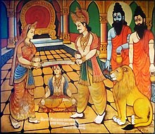
The name Arang is formed of two words "ara" meaning "saw" and "anga" meaning "body". According to a legend, god Krishna appeared disguised as a Brahmin before King Murddhawaja (Mordhwaj) of the Haihaya dynasty. The pious king offered him whatever dakshina he wanted. [1] The disguised Brahmin asked for one half of the king's body. The king immediately ordered that he be sawed off, and one half given as dakshina. As he was about to be cut in half, a tear drop fell from one of the eyes. [1] The Brahmin asked the king if the tear drop reflected his regret in accepting his request. The king replied no, adding that the half of the body which he did not ask for weeps as it too would like to be a part of the dakshina. Krishna then revealed himself and blessed the king for his devotion. [1]
Arang was ruled in ancient times by the Haihayas Rajput dynasty. [2] Archaeological finds establishes that the town had an ancient history as the centre of Hindu and Jain religious faiths. [3] Arang also finds mention in the Hindu epic Mahabharata . [4]
An archaeological antiquary in the form a copper plate inscription dated to the Gupta period, known as the Arang Plate of Bhimasena II of the clan of Rajarsitulya was unearthed at Arang. It attests to the reign of this dynasty over Chhattisgarh, particularly of Bhimasena II and five rulers who preceded him. It is inferred that they were vassals of the Gupta Empire. [5]
Archaeological finds in Arang also included few Jain images made of gem stones, which are now preserved in the Digambar Jain temple at Raipur. [6]
Another historical legend attributed to Arang in particular, and Chhattisgarh in general, relates to the princess Chandini and her lover Lorik. This legend is in the form of folk-poetry which is widely sung in the state. A memorial statue in their honour exists near Arang. [7]
Arang, a prosperous ancient town, known for its many Jain and Hindu temples, is located on the west bank of the Mahanadi River, a Nagar Palika in Raipur District in Chhattisgarh, [8] [2] [3] at 21°12′N81°58′E / 21.2°N 81.97°E . It has an average elevation of 267 metres (876 ft). It is 36 kilometres (22 mi) from Raipur on National Highway 53 (N.H.53), a four lane expressway to Durg passing through Arang. It is 15 kilometres (9.3 mi) from Mahasamund city. [9] [10] There is also a four lane road from Arang to Tumgaon. The nearest airport is the Raipur Airport situated near Mana Camp, which is 23.8 kilometres (14.8 mi) away from Arang. [11] Arang Is located beside National Highway 53 that connects Kolkata to Mumbai.
According to the Köppen-Geiger classification, Arang has a Temperate or subtropical hot-summer climate with nomenclature as Cwa [ broken anchor ]. The average annual rainfall is 589 millimetres (23.2 in) with July and August recording the maximum. The average temperature is 22.2 °C (72.0 °F) with a maximum of 40.9 °C (105.6 °F) and a minimum of 3 °C (37 °F). June is the hottest month of the year with average temperature of 33.1 °C (91.6 °F) and January recording the lowest. [12]
Climate data for Arang | |||||||||||||
---|---|---|---|---|---|---|---|---|---|---|---|---|---|
Month | Jan | Feb | Mar | Apr | May | Jun | Jul | Aug | Sep | Oct | Nov | Dec | Year |
Record high °C (°F) | 18.0 (64.4) | 19.4 (66.9) | 24.5 (76.1) | 30.2 (86.4) | 36.2 (97.2) | 40.9 (105.6) | 37.5 (99.5) | 35.3 (95.5) | 34.7 (94.5) | 31.6 (88.9) | 25.6 (78.1) | 19.9 (67.8) | 40.9 (105.6) |
Daily mean °C (°F) | 10.5 (50.9) | 12.6 (54.7) | 17.6 (63.7) | 22.8 (73.0) | 28.2 (82.8) | 33.1 (91.6) | 31.6 (88.9) | 30.0 (86.0) | 28.4 (83.1) | 23.4 (74.1) | 17.0 (62.6) | 11.8 (53.2) | 22.3 (72.1) |
Record low °C (°F) | 3.0 (37.4) | 5.9 (42.6) | 10.7 (51.3) | 15.5 (59.9) | 20.3 (68.5) | 25.3 (77.5) | 25.7 (78.3) | 24.7 (76.5) | 22.5 (72.5) | 15.3 (59.5) | 8.5 (47.3) | 3.8 (38.8) | 3.0 (37.4) |
Average precipitation mm (inches) | 48 (1.9) | 49 (1.9) | 57 (2.2) | 40 (1.6) | 22 (0.9) | 25 (1.0) | 107 (4.2) | 136 (5.4) | 58 (2.3) | 12 (0.5) | 9 (0.4) | 26 (1.0) | 589 (23.3) |
Source: Climate: Arang [12] |
As of 2001 [update] India census, [13] Arang had a population of 16,593. Males constituted 51% of the population and females 49%. Arang had an average literacy rate of 64%, higher than the national average of 59.5%; with 60% of the males and 40% of females literate. 16% of the population is under 6 years of age. [13] As of 2011, the population reported was 19,091, an increase of 1.3% over the 2001 figure, which gives a density figure of 812.7/km2 over the Nagar Panchayat area of 23.49 square kilometres (9.07 sq mi). [14]
Economic activity is in the form of small scale industries of rice and pulses mills. [15] It is a commercial town where various types of forest products are marketed in Earlier Days. [16]
Arang is one of the three locations chosen for community development in its Chandkhuri development block. [17]
Arang has many Jain and Hindu temples that are dated to the 11th and 12th centuries. Archaeological excavations carried out in the town has confirmed the town's ancient history as a Hindu and Jain religious centre, which prospered under the rule of Hindu kings. [3]
The ancient temples in Arang, which are tourist attractions are: the Mand deval temple, the Mahamaya temple, the Danteshwari temple, the Chandi Maheshwari temple, the Panchmukhi Mahadev temple, and the Panchmukhi Hanuman temple. Of these, the Mand Dewal temple and Bagh Deval temple are particularly ancient and well-known. [3]
Bhand Dewal temple, a Jain temple dated to the late eleventh century, is in the Mahakosala area of Arang. It is built in the Bhumija style of architecture. [18] The plinth of this temple has detailed ornamentation. It has a socle plinth that supports a pedestal, and two rows of sculptures on the wall. The temple layout plan is in a star shape known as stellate (meaning: shaped like a star, having points, or rays radiating from a center) with six "offsets". The temple rises to five floors, which is considered an unusual feature. [8] [18] [19]
The temple faces west and is in rundown condition. In the past, a mandapa (an outdoor pavilion) and a porch probably existed as part of the temple. The temple has three free standing large images of Jain tirthankaras deified in the garbha griha or sanctum sanctorum. [19] These are carved ornately in black stone and highly polished. The three tirthankaras are Ajitanatha, Neminath and Shreyanasanatha. [20] The central figure is adorned with the symbol of a wheel holding two deer in the left hand, and a globe on the right hand. The base of this image has a "winged figure" carving. Carved images also embellish the exterior faces of the temple. [19]
Bhand Deval temple, which was inferred initially as a Jain temple, is dated to the 11th century. It has similar architectural features as the Khajuraho temple. [21]
Chhattisgarh is a landlocked state in Central India. It is the ninth largest state by area, and with a population of roughly 30 million, the seventeenth most populous. It borders seven states – Uttar Pradesh to the north, Madhya Pradesh to the northwest, Maharashtra to the southwest, Jharkhand to the northeast, Odisha to the east, Andhra Pradesh and Telangana to the south. Formerly a part of Madhya Pradesh, it was granted statehood on 1 November 2000 with Raipur as the designated state capital.
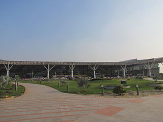
Raipur district is a district in the Chhattisgarh state of India. Its administrative headquarters is the city of Raipur. The district is rich in mineral resources and there are many wildlife sanctuaries. With a population of 2 million, it is the most populous district of Chhattisgarh.
Amarkantak is a pilgrim town and a Nagar Panchayat in Anuppur, Madhya Pradesh, India. The Amarkantak region is a unique natural heritage area and is the meeting point of the Vindhya and the Satpura Ranges, with the Maikal Hills being the fulcrum. This is where the Narmada River, the Son River and Johilla River originate.
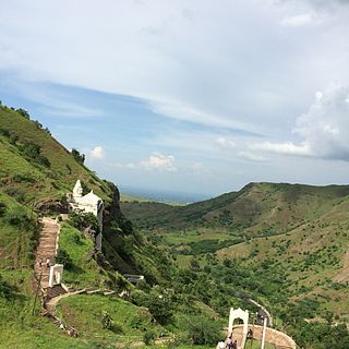
Bawangaja is a famous Jain pilgrim center in the Barwani district of southwestern Madhya Pradesh in India. Located about 6 kilometers south of River Narmada, its main attraction is the world's second largest megalithic statue of Lord Rishabhadeva, the first Jain Tirthankara. The statue is 84 feet (26 m) high. The center is located in the Satpura Range and is about 8 km from a Barwani town.
Rajnandgaon is a district of the state of Chhattisgarh in central India. The administrative headquarters the district is Rajnandgaon town.
Dakshina Kosala is a historical region of central India. It was located in what is now Madhya Pradesh and Chhattisgarh along with parts of Western Odisha. At its greatest extent, it may have also included a part of the Vidarbha region in present-day Maharashtra.
Jainism is India's sixth-largest religion and is practiced throughout India. Per the 2011 census, there are 4,451,753 Jains in the 1.35 billion population of India, the majority living in Maharashtra, Rajasthan, Gujarat, Madhya Pradesh and Karnataka. However, the influence of Jainism has been far greater on the Indian population than these numbers suggest. Jains can be found in every state and all union territories, varying from large societies to smaller. The state of Jharkhand, with a population of 16,301 Jains also contains the holy pilgrimage centre of Sammed Shikharji. Jains can be found throughout India and in many other countries throughout the world.
Bijoliya is a census town in Bhilwara district in the state of Rajasthan, India and is surrounded by nature and waterfalls and is famous for Tapodaya Teerth Kshetra and Mandakini Temple.
Gandai-Pandaria is a village town and a nagar panchayat in Chhuikhadan Block In the Khairagarh-Chhuikhadan-Gandai district in the state of Chhattisgarh, India. It is located about 80 kilometers northwest of Raipur, the state capital. Gandai is one of the centers of Gond people in contemporary times, particularly the kandra tribe.
Ratanpur is a town and a nagar palika in Bilaspur district in the Indian state of Chhattisgarh. It is located about 25 kilometres (16 mi) from Bilaspur on National Highway 130 towards Ambikapur.
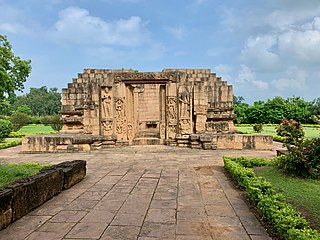
Malhar is a small town situated in Bilaspur district of Chhattisgarh, India. A historically important site that once was a major city and served as a capital in the 1st millennium, it has been referred to as Mallar, Mallari and Sarabhapur in inscriptions and Indian literature. In contemporary times, it is more village like with mounds and ruins of an ancient fort, two restored Shiva temples and a museum with the ruins of major group of Hindu, Jain and Buddhist temples. It has archaeological significance. It is about 30 kilometers southeast from Bilaspur in a rural terrain, connected with a feeder road from India's National Highway 49.
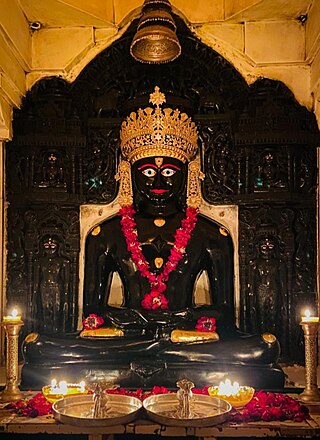
Nemināth, also known as Nemi and Ariṣṭanemi, is the twenty-second Tīrthaṅkar of Jainism in the present age. Neminath lived 81,000 years before the 23rd Tirthankar Parshvanath. According to traditional accounts, he was born to King Samudravijaya and Queen Shivadevi of the Yadu dynasty in the north Indian city of Sauripura. His birth date was the fifth day of Shravan Shukla of the Jain calendar. Krishna, who was the 9th and last Jain Vasudev, was his first cousin.
Bhumija is a variety of north Indian temple architecture marked by how the rotating square-circle principle is applied to construct the shikhara on top of the sanctum. Invented about the 10th-century in the Malwa region of central India during the Paramara dynasty rule, it is found in Hindu and Jain temples. Most early and elegant examples are found in and around the Malwa region, but this design is also found in Gujarat, Rajasthan, Deccan and some major Hindu temple complexes of southern and eastern India.
Bhoramdeo Temple is a Hindu temples dedicated to the god Shiva in Bhoramdeo, in the Indian state of Chhattisgarh. It comprises a group of four temples of which the earliest is a brick-temple. The main temple is the Bhoramdeo temple built in stone. The architectural features with erotic sculptures has given a distinct style akin to the Khajuraho temple and the Konark Sun Temple in Odisha, and hence the Bhoramdeo complex is known by the sobriquet the "Khajuraho of Chhattisgarh".
Uttar Pradesh, a state in north India has a long association with Jainism. Today the state is home to a number of Jain monuments, such as Jain Temples and Jain Tirths. There are around 213,267 Jains in Uttar Pradesh according to 2011 Census of India.
The Jain Temple complex is group of 31 Jain temples located at Deogarh in Lalitpur district, Uttar Pradesh built around 8th to 17th century CE. The Jain complex in Deogarh are protected by the Department of Archaeology of the Archaeological Survey of India (ASI), and managed through its Northern Circle Office located in Lucknow. ASI maintain an archaeological museum at the Deogarh site, which is noted for its treasured archaeological sculptures.
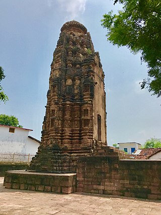
Arang Jain temples is group of three Jain temples in Arang, Raipur, Chhattisgarh, India. These temples dates back to the 9th and 11th centuries.
Sirpur Group of Monuments are an archaeological and tourism site containing Hindu, Jain and Buddhist monuments from the 5th to 12th centuries in Mahasamund district of the state of Chhattisgarh, India. Located near an eponymous village, it is 78 kilometres (48 mi) east of Raipur, the capital of the state. The site is spread near the banks of the river Mahanadi.
The Panduvamshis or Pandavas were an Indian dynasty that ruled the historical Dakshina Kosala region in present-day Chhattisgarh state of India, during the 7th and the 8th centuries. They may have been related to the earlier Panduvamshis of Mekala: both dynasties claimed lunar lineage and descent from the legendary Pandavas.
Rajarsitulyakula was a royal house that controlled Dakshina Kosala in India. They were also known as the Sura dynasty and were succeeded by the Parvatadvarkas.
{{cite book}}
: CS1 maint: multiple names: authors list (link)