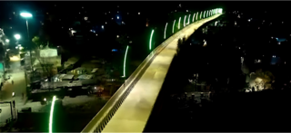
Rajnandgaon is a city in Rajnandgaon District, in the state of Chhattisgarh, India. As of the 2011 census the population of the city was 163,122. Rajnandgaon district came into existence on 26 January 1973, as a result of the division of Durg district.
Bagbahara is a town and a Municipality in Mahasamund district in the state of Chhattisgarh, India. It is situated on National Highway No. 353 and Raipur-Vishakhapattanam Rail Route.
Banarsi is a census town in Raipur District in the state of Chhattisgarh, India.
Bhanpuri is a census town in Raipur District in the state of Chhattisgarh, India.
Bhilai Charoda is a municipal corporation and a part of Bhilai city in the state of Chhattisgarh, India. Charoda is an industrial area of Bhilai city. Asia's longest railway marshaling yard is present in Charoda, Bhilai.

Gandai-Pandaria is a village town and a nagar panchayat in Chhuikhadan Block In the Khairagarh-Chhuikhadan-Gandai district in the state of Chhattisgarh, India. It is located about 80 kilometers northwest of Raipur, the state capital. Gandai is one of the centers of Gond people in contemporary times, particularly the kandra tribe.
Gobranawapara is a city and a municipality in Raipur district in the Indian state of Chhattisgarh.
Gogaon is a census town in Raipur district in the Indian state of Chhattisgarh.
Jaitaran is a city and a municipality in Beawar district in the Indian state of Rajasthan. Formerly in Pali district. Jaitaran is known by the place of Jaita-Koopa and Jaitee Gurjari.
Kanker is a municipality and the headquarters of Kanker District, in the Indian state of Chhattisgarh. It is the second largest city of Bastar division after Jagdalpur.
Kharsia in Chhattisgarh State, India
Kurud is a town and a nagar panchayat in Dhamtari District in the Indian state of Chhattisgarh.
Pithora is a town and a Nagar Panchayat and a Tehsil in Mahasamund district in the Indian state of Chhattisgarh.

Raipur Rani is a census town in Panchkula district in the Indian state of Haryana. It is located on the Panchkula city-Chandigarh-Nahan-Paonta Sahib-Dehradun highway 30 kilometres east from the Chandigarh-Mohali-Panchkula urban cities combine. It is about 20 kilometres from the Dera Bassi Industrial belt and 10 kilometres from the Barwala industrial estate. Narayangarh in the Ambala District is the next large town in its proximity.

Ratanpur is a town and a nagar palika in Bilaspur district in the Indian state of Chhattisgarh. It is located about 25 kilometres (16 mi) from Bilaspur on National Highway 130 towards Ambikapur.
Tilda Newra also called Tilda-Neora is a small town and a municipality and a Tehsil Block in the outskirts of Raipur City in the Indian state of Chhattisgarh.

Titlagarh is a Municipality located in the Indian state of Odisha. It is a known summer hotspot in India due its extreme heatwaves.

Raipur is a census town in Dehradun district in the Indian state of Uttarakhand. Situated in the municipal area of Uttarakhand, it's one among the 7 blocks of Dehradun district.
Bhatgaon is a town and a Nagar Panchayat in Raipur district in the state of Chhattisgarh, India.
Urla is a census town in Raipur District in the Indian state of Chhattisgarh.


