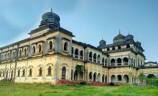
Koriya district, officially known as Korea district, is a district in the north-western part of the Chhattisgarh state in Central India. The administrative headquarters of the district is Baikunthpur.

Baloda Bazar is a nagar palika parishad in Baloda Bazar district in the Indian state of Chhattisgarh. Its PIN code is 493332. On 15 August 2011, it was declared as a district. Baloda Bazar is also called Cement hub of Chhattisgarh because there are many reputed cement plants like Ambuja Cement Rawan, Nuvoco Cement Sonadih, Nu Vista Cement Risda, Shree Cement Khapradih, UltraTech Cement Hirmi, UltraTech Cement Rawan, Ultratech Cement Kukurdih, etc.
Bhatapara is a city and a nagar palika (municipality) in the Baloda Bazar-Bhatapara district of the state of Chhattisgarh, India.
Bodri is a town and a nagar panchayat in Bilaspur district in the state of Chhattisgarh, India.

Gandai-Pandaria is a village town and a nagar panchayat in Chhuikhadan Block In the Khairagarh-Chhuikhadan-Gandai district in the state of Chhattisgarh, India. It is located about 80 kilometers northwest of Raipur, the state capital. Gandai is one of the centers of Gond people in contemporary times, particularly the kandra tribe.
Gharghoda is a town and a nagar panchayat in Raigarh district in the state of Chhattisgarh, India. Here you can explore various tourist places in Gharghoda.
Khamhria is a town and a nagar panchayat in Bemetara district in the Indian state of Chhattisgarh.
Kharod is a town and a nagar panchayat in Janjgir-Champa district in the Indian state of Chhattisgarh. Kharod is historically very important place as this place is also known as Chhattisgarh ki Kashi.
Kumhari is located in Bhilai-3 Tehsil of Durg district in the Indian state of Chhattisgarh. Kumhari is a Nagar Palika Parishad and situated at Durg district and Raipur district border beside Kharun River. It is situated at 21°27'N 81°52' and has an average elevation of 284 meters above the sea level.
Kurud is a town and a nagar panchayat in Dhamtari District in the Indian state of Chhattisgarh.
Pendra is a nagar panchayat in the Gaurella-Pendra-Marwahi district in the Indian state of Chhattisgarh.
Takhatpur is a Nagar Palika in Bilaspur district in the Indian state of Chhattisgarh.
Bhatgaon is a Census town and Nagar Panchayat in Surajpur district in the Indian state of Chhattisgarh. Bhatgaon is known for its South Eastern Coalfields Limited,.
Bhatgaon is a town and a Nagar Panchayat in Raipur district in the state of Chhattisgarh, India.
Patan is a town and a nagar panchayat in Durg district in the Indian state of Chhattisgarh.
Shahpur is a town and a Nagar panchayat in Burhanpur district in the Indian state of Madhya Pradesh.
Raya is a town and a nagar panchayat in the Mathura district of the Indian state of Uttar Pradesh. It was founded by Rai Sen, a Godar Jat. Raya formed a quarter of Tappa Raya, a chiefship in the pargana of Mahawan during the Mughal time. The descendants of Rai Sen remained in control of Tappa Raya till the revolt of 1857 during which their chief Raja Devi Singh Godar was hanged by the Britishers.

Dewa Sharif or Dewa is a town and a nagar panchayat in Barabanki district in the state of Uttar Pradesh, India. It is famous for the shrine of Haji Waris Ali Shah. This town is also known by the name of Dewa Sharif in respect for the shrine. It is about 26 km north-east of the state capital Lucknow.
Patti is a town and a Nagar Panchayat in Pratapgarh district in the Indian state of Uttar Pradesh.
"Parpodi," also known as "Raja Parpodi," is a town and a Nagar Panchayat in the Bemetara district of Chhattisgarh, India. The town is situated in the district of Bemetara in the state of Chhattisgarh, India. It has a small population and has been declared a "Nagar Panchayat" of the Bemetara district.


