Durg

Last updated

Durg
City
Rajendra park, durg.jpg
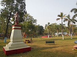
Rajendra Park in Durg
India Chhattisgarh location map.svg
Red pog.svg
Durg
Coordinates: 21°11′N81°17′E / 21.19°N 81.28°E / 21.19; 81.28
CountryFlag of India.svg  India
State Chhattisgarh
District Durg
Government
  BodyNagar Nigam Durg
  MayorDheeraj Bakliwal [1]
   District Collector Richa Prakash Chaudhary (IAS)
Area
  City182 km2 (70 sq mi)
  Rank12 in state
Elevation
289 m (948 ft)
Population
  City268,679
  Density1,500/km2 (3,800/sq mi)
   Metro
1,064,077
Languages
  Official Hindi [2]
  Additional official Chhattisgarhi
Time zone UTC+5:30 (IST)
PIN
491001 (Durg) [3]
07880788
Vehicle registration CG-07
Sex ratio 982 /
Website durg.gov.in

Durg is a city in the Indian state of Chhattisgarh, east of the Shivnath River and is part of the Durg-Bhilai urban agglomeration. With an urban population of 1,064,077, Durg-Bhilai is the second largest urban area in Chhattisgarh after Raipur. It is the headquarters of Durg District. [4]

Contents

History

The town was founded about the tenth century by a person named Jagpal, who originally came from Badhal Desh in Mirzapur, and became treasury officer of the Kalachuri king of Chhattisgarh. He was rewarded the land grant of Durg with 700 villages for his excellent services and later helped the Kalachuri king greatly in his conquests. [5] [6]

The original name of the town was "Shiva Durg", literally meaning fort on the Shivnath River. [5] Durg used to have a fort that was the headquarters of one of the 18 Garhs or districts under the administration of the medieval Kalachuri kings. [5]

Alexander Cunningham, a prominent British archeologist, thought Durg must have been a place of some importance in medieval times as it name literally means "fort". [7] When the Marathas of Nagpur invaded Chhattisgarh in 1741, they occupied the old Kalachuri fort and made it their base of operations. [7]

Industry

Durg is high rich industrial areas which contribute highly in state & country GDP . Its main Industrial areas have in Bhilai , Rasmada & Kumhari . Majorly Industries belong to steel production example Bhilai Steel Plant

Demographics

As of 2001 India census, [8] Durg had a population of 231,182. Males constitute 51% of the population and females 49%. 12.8% of the population is in the 0 to 6 years age range. Durg had an effective literacy rate of 82.7% of the population 7 years and older in 2001.

In the 2011 census, Durg-Bhilainagar Urban Agglomeration had a population of 1,064,077. [9] Durg-Bhilainagar Urban Agglomeration includes: Durg (M Corp.), Bhilai Nagar (M Corp.), Dumardih (part) (OG), Bhilai Charoda (M Corp), Jamul (M), Kumhari (M) and Utai (NP). [10]

Durg Municipal Corporation had a total population of 268,679 in 2011, out of which 136,537 were males and 132,142 were females. Durg had a below six years population of 29,165. Durg had an effective literacy rate (7+ population) of 87.94 per cent, with male literacy of 93.72% and female literacy of 82.00. In 2011, the city had a sex ratio of 968. [11]

Notable people

Related Research Articles

<span class="mw-page-title-main">Chhattisgarh</span> State in central India

Chhattisgarh is a landlocked state in South East India. It is the ninth largest state by area, and with a population of roughly 30 million, the seventeenth most populous. It borders seven states – Uttar Pradesh to the north, Madhya Pradesh to the northwest, Maharashtra to the southwest, Jharkhand to the northeast, Odisha to the east, Andhra Pradesh and Telangana to the south. Formerly a part of Madhya Pradesh, it was granted statehood on 1 November 2000 with Raipur as the designated state capital.

<span class="mw-page-title-main">Raipur</span> Metropolis in Chhattisgarh, India

Raipur ( ) is the capital city of the Indian state of Chhattisgarh. Raipur is also the administrative headquarters of Raipur district and Raipur division, and the largest city of the state. It was a part of Madhya Pradesh before the state of Chhattisgarh was formed on 1 November 2000. It is a major commercial hub for trade and commerce in the region. It has exponential industrial growth and has become a major business hub in Central India. It has been ranked as India's 6th cleanest city as per the Swachh Survekshan for the year 2021. Raipur is ranked 7th in the Ease of Living Index 2019 and 7th in the Municipal Performance Index 2020, both by the Ministry of Housing and Urban Affairs (MoHUA).

<span class="mw-page-title-main">Raipur district</span> District of Chhattisgarh in India

Raipur district is a district in the Chhattisgarh state of India. Its administrative headquarters is the city of Raipur. The district is rich in mineral resources and there are many wildlife sanctuaries. With a population of 2 million, it is the most populous district of Chhattisgarh.

<span class="mw-page-title-main">Ambikapur, Chhattisgarh</span> City in Chhattisgarh, India

Ambikapur is a city and headquarters of Surguja district in the Indian state of Chhattisgarh. It is one of the oldest cities in the state, in east-central India. Ambikapur is also the divisional headquarters of Surguja Division which consists of the six districts of Surguja, Korea, Manendragarh, Balrampur, Surajpur and Jashpur.

Rajnandgaon is a city in Rajnandgaon District, in the state of Chhattisgarh, India. As of the 2011 census the population of the city was 163,122. Rajnandgaon district came into existence on 26 January 1973, as a result of the division of Durg district.

<span class="mw-page-title-main">Dhamtari</span> City in Chhattisgarh, India

Dhamtari is a municipal corporation and headquarters of the Dhamtari district in the state of Chhattisgarh, India, which is part of the Mahasamund Lok Sabha constituency formed on 6 July 1998.. The district is home to 3.13 percent of Chhattisgarh's total population.

Mahasamund is a city in Mahasamund District in the Indian state of Chhattisgarh.It is situated on the Mumbai-Kolkata and Raipur-Vishakhaptnam National Highways. It is one of the largest and most important cities in the State. The city is divided into 30 wards and 5 zones and is also the biggest city in the Trans-Mahanadi area. It is also the administrative headquarters of the Mahasamund District and part of the proposed new Mahasamund Municipal Corporation. The current mayor is Prakash Chandrakar. Reliance Trends, Vishal Megamart, Reliance Jio Smart Point, B mart and Zee Sale are prominent Shopping Centers of the City.

<span class="mw-page-title-main">Durg district</span> District of Chhattisgarh in India

Durg district is a district situated in Chhattisgarh, India. The district headquarters is Durg. The district covers an area of 2,238 km². As of 2011 it is the second most populous district of Chhattisgarh, after Raipur.

<span class="mw-page-title-main">Rajnandgaon district</span> District of Chhattisgarh in India

Rajnandgaon is a district of the state of Chhattisgarh in central India. The administrative headquarters the district is Rajnandgaon town.

Bhilai Charoda is a municipal corporation and a part of Bhilai city in the state of Chhattisgarh, India. Charoda is an industrial area of Bhilai city. Asia's longest railway marshaling yard is present in Charoda, Bhilai.

Chhuikhadan is a City municipality and district in Khairagarh-Chhuikhadan-Gandai district in the Indian state of Chhattisgarh, India. Chhuikhadan is also known as "city of martyr".

Kumhari is located in Dhamdha tehsil of Durg district in the Indian state of Chhattisgarh. Kumhari is a Nagar Palika Parishad and situated at Durg district and Raipur district border beside Karun River. It is situated at 21°27'N 81°52' and has an average elevation of 284 meters above the sea level.

<span class="mw-page-title-main">Dhamtari district</span> District of Chhattisgarh in India

Dhamtari is a district of the Indian state of Chhattisgarh. This district is situated at 20°42' N latitude and 81°33' E longitude. Dhamtari district was officially formed on 6 July 1998 by trifurcating Raipur district into Raipur, Dhamtari and Mahasamund districts.

Bemetara is a municipality in Bemetara district of Indian state of Chhattisgarh.

<span class="mw-page-title-main">Bhilai</span> Metropolis in Chhattisgarh

Bhilai is a city in Durg district of the Indian state of Chhattisgarh, in eastern central India. Along with its twin-city Durg, the urban agglomeration of Durg-Bhilai Nagar has a population of more than a million, making it the second-largest urban area in Chhattisgarh after Raipur. The Bhilai metropolis contains three municipal corporations: Bhilai Municipal Corporation, Bhilai Charoda Municipal Corporation and Risali Municipal Corporation.

Anda is a village located in Durg Tehsil of Durg district in the Indian state of Chhattisgarh. The village population is estimated to be at 4,169.

Bhilai Power House Railway Station is the second main railway station in Durg district in the Indian state of Chhattisgarh. Its code is BPHB. It serves the Bhilai urban areas. The station consists of three platforms. The Bhilai Power House is one of five in Bhilai city. It is well connected with other major cities. It has been rated grade A by Indian Railways. This railway station is most important among other 2 railway station which provide railway connection for Bhilai. Its too nearest from Bhilai Steel Plant about 1 Kilometer south. ACC Jamul cement plant have in 2 Kilometer north of this railway station.

<span class="mw-page-title-main">Khairagarh-Chhuikhadan-Gandai district</span> District of Chhattisgarh in India

Khairagarh-Chhuikhadan-GandaiKCG is a district in the central Indian state of Chhattisgarh which consists of three cities, Khairagarh, Chhuikhadan and Gandai. It was carved out of Rajnandgaon in 2022. It is the 31st district of the state inaugurated by chief minister Bhupesh Baghel.

<span class="mw-page-title-main">Raipur Metropolitan Region</span> Metropolitan Area in Chhattisgarh, India

Raipur Metropolitan Region, also known as the Raipur Metropolitan Area and Greater Raipur, is the Urban Agglomeration of Raipur-Naya Raipur and some part of Durg Bhilai in the Indian state of Chhattisgarh. The area is administered by the Raipur Development Authority, Raipur Municipal Corporation and Nava Raipur Vikas Pradikaran.

References

  1. "Chhattisgarh: Congress wins five mayoral posts, Aijaz Dhebar elected Raipur mayor | Raipur News - Times of India". The Times of India. 7 January 2020. Retrieved 7 January 2020.
  2. "52nd Report of the Commissioner for Linguistic Minorities in India" (PDF). nclm.nic.in. Ministry of Minority Affairs. p. 18. Archived from the original (PDF) on 25 May 2017. Retrieved 21 December 2018.
  3. "Durg Pin Code List". indiapincodes.net. Retrieved 31 May 2023.
  4. "Durg District Official website".
  5. 1 2 3 Nelson, A. E., ed. (1910). Central Provinces District Gazetteers: Drug District, Vol. A. Calcutta: The Baptist Mission Press. pp. 164–166.
  6. Shukla, Shyama Charan; Nayak, Rama Prasanna; Sinh, Raghubir; Trivedi, H.V.; Krishnan, V.S.; Tripathi, Sundarlal; haterjee, H.C.; Pandey, Rajbali; Sinha, R.M. (1972). Madhya Pradesh District Gazetteers: Durg. Bhopal, Department of District Gazetteers.
  7. 1 2 Cunningham, Alexander (1884). Archaeological Survey of India: Report of a Tour in the Central Provinces and Lower Gangetic Doab in 1881-82, Vol. XVII. Archaeological Survey of India. p. 4.
  8. "Census of India 2001: Data from the 2001 Census, including cities, villages and towns (Provisional)". Census Commission of India. Archived from the original on 16 June 2004. Retrieved 1 November 2008.
  9. "Urban Agglomerations/Cities having population 1 lakh and above" (PDF). Provisional Population Totals, Census of India 2011. Retrieved 16 April 2012.
  10. "Constituents of urban Agglomerations Having Population 1 Lakh & above" (PDF). Provisional Population Totals, Census of India 2011. Retrieved 16 April 2012.
  11. "Cities having population 1 lakh and above" (PDF). Provisional Population Totals, Census of India 2011. Archived from the original (PDF) on 7 May 2012. Retrieved 16 April 2012.