| Chandil Dam | |
|---|---|
 Chandil Dam | |
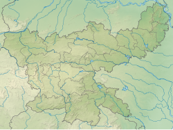 Chandil Dam Location in Jharkhand  Chandil Dam Chandil Dam (India) | |
| Country | India |
| Location | Seraikela Kharsawan district, Jharkhand |
| Coordinates | 22°58′29″N86°01′13″E / 22.9747°N 86.0203°E |
| Status | Functional |
| Construction began | 1982–1993 |
| Dam and spillways | |
| Impounds | Subarnarekha River |
| Height | 56.5 m (185 ft). |
| Length | 720.10 m (2,362.5 ft) |
| Reservoir | |
| Total capacity | 1,963 square kilometres (196,300 ha) |
Chandil Dam was built across the Subarnarekha, in Bihar (later Jharkhand), as a part of the Subarnarekha Multipurpose Project.
