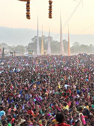
Kharsawan garh is a town and a notified area in the Seraikela Sadar subdivision of the Seraikela Kharsawan district in the Indian state of Jharkhand. On January 1, 1948, the town of Kharsawan in present-day Jharkhand witnessed a massacre reminiscent of what happened in Jallianwala Bagh in 1919. Police opened fire at a crowd gathered for a protest and the weekly haat (market), killing hundreds, or by some accounts, thousands of Adivasis. Odisa police say that the total number of deaths was around 35, but actual numbers are likely to have been far higher. In Memoir of a Bygone Era (2000), PK Deo, a former Lok Sabha MP and the last ruler of Kalahandi stated that at least 2,000 Adivasis were killed, and many more were likely injured.
Saraikela is the district headquarters and a nagar panchayat in the Seraikela Sadar subdivision of the Seraikela Kharsawan district in the Indian state of Jharkhand. It was formerly the capital of Saraikela State, a princely state. The town is a road junction, an agricultural trade centre and upcoming industrial centre. It is situated between Jamshedpur and Chaibasa.
Chandil is a census town in the Chandil CD block in the Chandil subdivision of Seraikela Kharsawan district in the state of Jharkhand, India.
Kandra is a census town in the Adityapur CD block in the Seraikela Sadar subdivision of the Saraikela Kharsawan district in the Indian state of Jharkhand.
Sini is a census town in the Seraikela CD block in the Seraikela Sadar subdivision of the Seraikella- Kharshwan district in the Indian state of Jharkhand.
Kuchai block is a CD block that forms an administrative division in the Seraikela Sadar subdivision of Seraikela Kharsawan district, in the Indian state of Jharkhand.
Kharsawan block is a CD block that forms an administrative division in the Seraikela Sadar subdivision of Seraikela Kharsawan district, in the Indian state of Jharkhand.

Chandil block is a CD block that forms an administrative division in the Chandil subdivision of Seraikela Kharsawan district, in the Indian state of Jharkhand.
Ichagarh block is a CD block that forms an administrative division in the Chandil subdivision of Seraikela Kharsawan district, in the Indian state of Jharkhand.
Kukru block is a CD block that forms an administrative division in the Chandil subdivision of Seraikela Kharsawan district, in the Indian state of Jharkhand.
Nimdih block is a CD block that forms an administrative division in the Chandil subdivision of Seraikela Kharsawan district, in the Indian state of Jharkhand.

Seraikela block is a CD block that forms an administrative division in the Seraikela Sadar subdivision of Seraikela Kharsawan district, in the Indian state of Jharkhand.
Kuchai is a village in the Kuchai CD block in the Seraikela Sadar subdivision of the Seraikela Kharsawan district in the Indian state of Jharkhand.
Gobindpur is a village in the Gobindpur CD block in the Seraikela Sadar subdivision of the Seraikela Kharsawan district in the Indian state of Jharkhand.
Rajnagar is a village in the Gobindpur CD block in the Seraikela Sadar subdivision of the Seraikela Kharsawan district in the Indian state of Jharkhand.
Kukru is a village in the Kukru CD block in the Chandil subdivision of the Seraikela Kharsawan district in the Indian state of Jharkhand.
Nimdih is a village in the Nimdih CD block in the Chandil subdivision of the Seraikela Kharsawan district in the Indian state of Jharkhand.
Chowka is a village in the Chandil CD block in the Chandil subdivision of the Seraikela Kharsawan district in the Indian state of Jharkhand.
Seraikela Sadar subdivision is an administrative subdivision of the Seraikela Kharsawan district in the Kolhan division in the state of Jharkhand, India.
Chandil subdivision is an administrative subdivision of the Seraikela Kharsawan district in the Kolhan division in the state of Jharkhand, India.


