
West Singhbhum or Pashchimi Singhbhum is one of the 24 districts of Jharkhand state, India. It came into existence on 16 January 1990, when the old Singhbhum district was bifurcated. Chaibasa is the district headquarters.
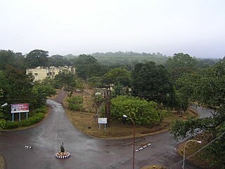
Chaibasa is a small town and a municipality in West Singhbhum district in the state of Jharkhand, India. Chaibasa is the district headquarters of West Singhbhum district. It is also the headquarter of Singhbhum Kolhan division headed by the Divisional commissioner. It consists of the main city including Sadar Bazar, Garikhana, Bari Bazar, Amla Tola, Sentola, Railway Station Area, JMP Chowk, Post Office Chowk and Gandhi Tola; and the surrounding suburbs and entry gates to the city including Tambo Chowk, Tungri, Khapparsai, Moholsai, Gutusai and Purana Chaibasa.

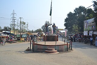
Chakradharpur is a municipal town situated in the West Singhbhum district of Jharkhand, India, positioned strategically on the Chota Nagpur Plateau. Located 62 kilometers west of Jamshedpur, 115 kilometers south of Ranchi, and 101 kilometers east of Rourkela, it serves as a crucial hub for the mineral-rich regions of Jharkhand and Odisha, as well as for the cement, steel, and limestone industries in the vicinity. The town spans an urban area of 10 square kilometers and stands at an elevation of 227 meters. It shares its borders with Jamshedpur to the east, Rourkela to the west, Ranchi to the north, and Chaibasa to the south, which also serves as the district headquarters of West Singhbhum.
Noamundi is a census town in West Singhbhum district in the Indian state of Jharkhand. It is also an administrative block. It is a small mining town located close to the Odisha border. It lies near Jamshedpur and 64 km (40 mi) from Chaibasa. Nearby towns include Padapahar, Barajamda, jagannathpur, Kharsawan, Gua and Kiriburu.
Bagbera Colony is a census town in the Golmuri-cum-Jugsalai CD block in the Dhalbhum subdivision of the Purbi Singhbhum district in the state of Jharkhand, India.
Barajamda is a census town in Keonjhar district in the state of Orissa, India.
Barbil is a town and a Municipal Council in the Kendujhar district of the state of Odisha, India. The region around Barbil has one of the largest deposits of iron ore and manganese ore in the world. It is a major source of revenue generation for both the central and the state governments.

Chakulia or Chakuliya is a Notified Area Council (NAC) and 4th Municipal Corporation in the Ghatshila subdivision of the East Singhbhum district in the state of Jharkhand, India.It is 71 km from Jamshedpur City, the district headquarter.
Chiria is a census town in Pashchimi Singhbhum district in the state of Jharkhand, India. India's largest iron ore mine with reserves of 2 billion tonnes of iron ore is located here. The mine is operated by Steel Authority of India Limited.
Gadhra is a census town in the Golmuri-cum-Jugsalai CD block in the Dhalbhum subdivision of the Purbi Singhbhum district in the state of Jharkhand, India.
Haludbani is a census town in the Golmuri-cum-Jugsalai CD block in the Dhalbhum subdivision of the Purbi Singhbhum district in the Indian state of Jharkhand.
Jadugora is a census town in the Musabani CD block in the Ghatshila subdivision of the East Singhbhum district in the Indian state of Jharkhand.

Kiriburu is a census town in Odisha. The town is mainly known for having big Iron-ore Mines KIOM & MIOM both governed by Steel Authority of India Limited (SAIL). The road connecting the township to the mines is divided by the border of Odisha and Jharkhand. It is also a famous hill station situated in the core of Saranda forest. Saranda forest is land of seven hundred hills. The name of the forest Saranda is due to the large number of elephants found in this forest. The forest has some waterfalls.
Musabani, also spelt as Mosabani or Mushabani, is a census town in the Musabani CD block in the Ghatshila subdivision of the East Singhbhum district in the Indian state of Jharkhand.
Sarjamda is a census town in the Golmuri-cum-Jugsalai CD block in the Dhalbhum subdivision of the Purbi Singhbhum district in the Indian state of Jharkhand.
Tensa is a Town Wonder Natural Hill Station in Sundargarh District in the Indian state of Odisha. It has been declared the best mine by the Director General of Mines Safety, Govt. of India. Its origins are unknown, but it is believed it was tribal settlement prior to industrialization. In 1960 is came under the auspices of Steel Authority of India Limited (SAIL) Iron Mines. The township and ore processing plant were inaugurated by then governor of Odisha, Honourable Shri Yeshwant Narayan Sukthankar, on 25 April 1961.

Dindori is a district of Madhya Pradesh state of central India. The town of Dindori is the district headquarters. It was created on 25th May 1998 with total 927 villages. The district is a part of Jabalpur Division.
Saranda forest is a dense forest in the hilly region of West Singhbhum, East Singhbhum, Saraikela district in the Indian state of Jharkhand. This area used to be the private hunting reserve of the Singh Deo family. The forest covers an area of 820 km². Saranda (Serengda) literally means "700 hills in local language."
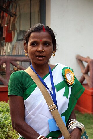
The Ho people are an Austroasiatic Munda ethnic group of India. They are mostly concentrated in the Kolhan region of Jharkhand and northern Odisha where they constitute around 10.7% and 7.3% of the total Scheduled Tribe population respectively, as of 2011. With a population of approximately 700,000 in the state in 2001, the Ho are the fourth most numerous Scheduled tribe in Jharkhand after the Santals, Kurukhs, and Mundas. Ho also inhabit adjacent areas in the neighbouring states of Odisha, West Bengal and Bihar bringing the total to 806,921 as of 2001. They also live in Bangladesh and Nepal.

The Tatanagar–Bilaspur section is part of the Howrah–Nagpur–Mumbai line and connects Tatanagar in the Indian state of Jharkhand and Bilaspur in Chhattisgarh. Part of one of the major trunk lines in the country, it passes through an industrial-mining area and handles high volumes of freight, particularly coal and iron ore.

