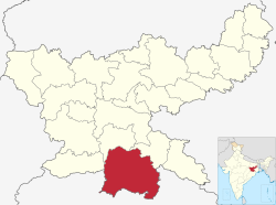
West Singhbhum district

Last updated
West Singhbhum district
Kuju river.jpg
Bank of sanjay river.jpg
Kuju River near Chaibasa
Bottom: Sanjay River near Chakradharpur
West Singhbhum in Jharkhand (India).svg
Location of West Singhbhum district in Jharkhand
CountryFlag of India.svg  India
State Government banner of Jharkhand.png Jharkhand
Division Kolhan
Headquarters Chaibasa
Government
   Lok Sabha constituencies Singhbhum (shared with Seraikela Kharsawan district)
   Vidhan Sabha constituencies 5
Area
  Total7,224 km2 (2,789 sq mi)
Population
 (2011)
  Total1,502,338
  Density210/km2 (540/sq mi)
Demographic
   Literacy rate 67.70 %
  Sex ratio958
Language
  Official Hindi and English
  Regional Ho, Mundari, Odia and Santali
Time zone UTC+05:30 (IST)
Vehicle registration JH-06
Average annual precipitation1422 mm
Website chaibasa.nic.in

West Singhbhum or Pashchimi Singhbhum is one of the 24 districts of Jharkhand state, India. It came into existence on 16 January 1990, when the old Singhbhum district (then in Bihar) was bifurcated. Chaibasa is the district headquarters. [1]

Contents

The district is bounded on north by Khunti district, on the east by Saraikela Kharsawan district of Jharkhand, on the southeast by Mayurbhanj district of Odisha, on the south by Kendujhar district of Odisha, and on the west by Simdega district of Jharkhand and Sundergarh district of Odisha.

History

Several Iron slags, microlith, Potsherds have been discovered from Singhbhum district which are from 1400 BCE according to Carbon dating age. [2]

Remains of a large city was excavated by Archaeological Survey of India in the village of Benisagar in West Singhbhum, suggesting continuous habitation in the region from 5th to the 16th-17th century. [3]

Singhbhum on James Rennell's Mid-18th Century Map. Mayurbhanj Midnapore border 1776.jpg
Singhbhum on James Rennell's Mid-18th Century Map.

West Singhbhum is one of the oldest districts of Jharkhand. After the British conquest of Kolhan in 1837, a new district was consequently constituted to be known as Singhbhum with Chaibasa as its headquarters. Subsequently, three districts, namely East Singhbhum, West Singhbhum and Seraikela Kharsawan have been carved out of erstwhile Singhbhum district. [1]

West Singhbhum district came into existence when the old Singhbhum District bifurcated in 1990. With 9 community development blocks the Eastern part became East Singhbhum district with Jamshedpur as its headquarters and with remaining 23 blocks the larger Western part became West Singhbhum district with Chaibasa as its headquarters. In 2001 West Singhbhum again divided into two parts. With 8 blocks Saraikela-Kharsawan district came into existence. At present West Singhbhum remains with 18 blocks and three administrative sub-divisions. [1]

There are several accounts relating to the origin of the name of the district:

It is currently a part of the Red Corridor. [6]

Geography

"The Singhbhum region is possibly Earth's earliest continental land exposed to the air...." Priyadarshi Chowdhury, a geologist at Australia's Monash University is an interesting recent discovery.

West Singhbhum district forms the Southern part of the newly created Jharkhand state and is the largest district in the state. The district spreads from 21.97°N to 23.60°N and from 85.00°E to 86.90°E. The district is situated at an average height of 244 metres above sea level and covers an area of 7629.679  km2.

The district is covered with hills alternating with valleys, steep mountains, and deep forests on the mountain slopes. It contains some of the best Sal tree forests and the famous Saranda forest. There are plenty of waterfalls and a large variety of wild life like elephants, bison, tigers, leopards, bear, wild dogs and wild boars. Sambar Deer and spotted deer are also found but their numbers are decreasing in the forests adjoining inhabited areas.

Rivers

Following are some of the rivers flowing in the West Singhbhum District: Koel, Karo-Koina, Kuju, Kharkai, Sanjai, Roro, Deo, and Baitarini. [7]

Flora and fauna

West Singhbhum district is full of dense forests and hills and harbors a variety of flora and fauna. Asia's largest Sal Forest Lies in This District

Mines and minerals

The greater part of West Singhbhum district is covered with deposits of iron-ore used for iron and steel industry. Other industrially important minerals including the following:

Administration

Blocks/Mandals

West Singhbhum district consists of 18 Blocks. The following are the list of the Blocks in West Singhbhum district:

Demographics

Historical population
YearPop.±%
1901356,991    
1911398,590+11.7%
1921421,587+5.8%
1931515,137+22.2%
1941614,298+19.2%
1951667,390+8.6%
1961765,128+14.6%
1971879,564+15.0%
1981922,491+4.9%
19911,080,780+17.2%
20011,233,945+14.2%
20111,502,338+21.8%
Source: Census of India [8]
A potter from Chaibasa Jharkhand people.jpg
A potter from Chaibasa

According to the 2011 census West Singhbhum district has a population of 1,502,338, [9] roughly equal to the nation of Gabon [10] or the US state of Hawaii. [11] This gives it a ranking of 335th in India (out of a total of 640). [9] The district has a population density of 209 inhabitants per square kilometre (540/sq mi). [9] Its population growth rate over the decade 2001-2011 was 21.69%. [9] Pashchimi Singhbhum has a sex ratio of 1004 females for every 1000 males, [9] and a literacy rate of 58.63%. 14.51% of the population lives in urban areas. The Scheduled Castes and Scheduled Tribes collectively account for 71.1% (3.79% SC and 67.39% ST) [9] of the district's total population. The prominent communities in this group, in terms of the district's total population, are Ho (51.52%), Munda (9.33%), Oraon (2.15%), Bhuiya (1.36%), Santal (1.01%), Gond (0.91%), Ghasi (0.8%), Bhumij (0.71%), Pan (0.51%), Mahli (0.29%), Dhobi (0.25%), Dom (0.25%), Lohra (0.22%), Chamar/Muchi (0.19%), and Kora (0.13%). Additionally, other notable communities include Kharia, Chik Baraik, Bhogta, Turi, Birhor, Kol, Hari/Mehtar/Bhangi, Pasi, Savar, and Lalbegi have populations ranging between one thousand to a hundred. [12]

Relegion

Religion in West Singhbhum district (2011) [13]
ReligionPercent
Sarna
62.96%
Hinduism
28.22%
Christianity
5.83%
Islam
2.54%
Not Stated
0.45%

Language

Languages of West Singhbhum district (2011) [14]

   Ho (54.37%)
   Odia (18.74%)
   Mundari (9.16%)
   Hindi (4.64%)
   Sadri (2.53%)
   Kurmali (2.08%)
   Urdu (1.96%)
   Bengali (1.80%)
   Kurukh (1.15%)
   Santali (1.03%)
  Others (2.54%)

At the time of the 2011 Census of India, 54.37% of the population in the district spoke Ho, 18.74% Odia, 9.16% Mundari, 4.64% Hindi, 2.53% Sadri, 2.08% Kurmali, 1.96% Urdu, 1.80% Bengali, 1.15% Kurukh and 1.03% Santali as their first language. [14]

Politics

DistrictNo.ConstituencyNamePartyAllianceRemarks
West Singhbhum 52 Chaibasa Deepak Birua Jharkhand Mukti Morcha Mahagathbandhan (Jharkhand)
53 Majhgaon Niral Purty Jharkhand Mukti Morcha Mahagathbandhan (Jharkhand)
54 Jaganathpur Sona Ram Sinku Indian National Congress Mahagathbandhan (Jharkhand)
55 Manoharpur Joba Majhi Jharkhand Mukti Morcha Mahagathbandhan (Jharkhand) Cabinet Minister
56 Chakradharpur Sukhram Oraon Jharkhand Mukti Morcha Mahagathbandhan (Jharkhand)


Related Research Articles

<span class="mw-page-title-main">Mayurbhanj district</span> District in Odisha, India

Mayurbhanj district is one of the 30 districts in the Odisha state of eastern India. It holds the distinction of being the largest district in Odisha by area. The district's headquarters is located in Baripada, with other major towns including Rairangpur, Karanjia, and Bahalda. As of 2011, Mayurbhanj ranks as the third-most populous district in Odisha, following Ganjam and Cuttack.

<span class="mw-page-title-main">East Singhbhum district</span> District of Jharkhand in India

East Singhbhum is one of the 24 districts of Jharkhand, India. It was created on 16 January 1990. More than 50% of the district is covered by dense forests and mountains, where wild animals once roamed freely. It is known for being a centre of industry since Jamshedpur, the most populous city in Jharkhand, is located here.

<span class="mw-page-title-main">Seraikela Kharsawan district</span> District of Jharkhand in India

Seraikela-Kharsawan district or Saraikella and Kharaswan district is one of the twenty-four districts of Jharkhand state in eastern India. Seraikela town is the district headquarters of Saraikela Kharsawan district. The district is well known for Seraikela Chhau, one of the three distinctive styles of the chhau dance. This district was carved out from West Singhbhum district in 2001. The district was formed from the princely states of Seraikela and Kharaswan, after the independence of India.

<span class="mw-page-title-main">Singhbhum district</span> District of British India of Bengal Presidency

Singhbhum was a district of India during the British Raj, part of the Chota Nagpur Division of the Bengal Presidency. It was located in the present-day Indian state of Jharkhand. Chaibasa was the district headquarters. Located in the southern limit of the Chota Nagpur Plateau, Singhbhum included the Kolhan estate located in its southeastern part. The district has been segmented into two smaller districts, East Singhbhum and West Singhbhum.

Saraikela is the district headquarters and a nagar panchayat in the Seraikela Sadar subdivision of the Seraikela Kharsawan district in the Indian state of Jharkhand. It was formerly the capital of Saraikela State, a princely state. The town is a road junction, an agricultural trade centre and upcoming industrial centre. It is situated between Jamshedpur and Chaibasa.

Mundari (Munɖari) is a Munda language of the Austroasiatic language family spoken by the Munda tribes in eastern Indian states of Jharkhand, Odisha and West Bengal. It is closely related to Santali. Mundari Bani, a script specifically to write Mundari, was invented by Rohidas Singh Nag. It has also been written in the Devanagari, Odia, Bengali, and Latin writing systems.

<span class="mw-page-title-main">Bhumij people</span> Ethnic group of India

Bhumij is a Munda ethnic group of India. They primarily live in the Indian states of West Bengal, Odisha, Assam and Jharkhand, mostly in the old Singhbhum district. Also in states like Bihar and Assam. There is also a sizeable population found in Bangladesh. Bhumijas speak the Bhumij language, an Austroasiatic language, and use Ol Onal script for writing.

<span class="mw-page-title-main">Bhumij language</span> Endangered Austroasiatic language of India

Bhumij is an Austroasiatic language belonging to the Munda subfamily, related to Ho, Mundari, and Santali, primarily spoken by Bhumij peoples in the Indian states Jharkhand, Odisha and West Bengal. As per the 2011 census, only 27,506 people out of 9,11,349 Bhumij people spoke Bhumij as their mother tongue, as most Bhumijas have shifted to one of the regional dominant languages. Thus the language is considered an extremely endangered language.

Kuchai block is a CD block that forms an administrative division in the Seraikela Sadar subdivision of Seraikela Kharsawan district, in the Indian state of Jharkhand.

Kharsawan block is a CD block that forms an administrative division in the Seraikela Sadar subdivision of Seraikela Kharsawan district, in the Indian state of Jharkhand.

<span class="mw-page-title-main">Chandil block</span> Community development block in Jharkhand, India

Chandil block is a CD block that forms an administrative division in the Chandil subdivision of Seraikela Kharsawan district, in the Indian state of Jharkhand.

Ichagarh block is a CD block that forms an administrative division in the Chandil subdivision of Seraikela Kharsawan district, in the Indian state of Jharkhand.

Kukru block is a CD block that forms an administrative division in the Chandil subdivision of Seraikela Kharsawan district, in the Indian state of Jharkhand.

Nimdih block is a CD block that forms an administrative division in the Chandil subdivision of Seraikela Kharsawan district, in the Indian state of Jharkhand.

Adityapur block is a CD block that forms an administrative division in the Seraikela Sadar subdivision of Seraikela Kharsawan district, in the Indian state of Jharkhand.

<span class="mw-page-title-main">Seraikela block</span> Community development block in Jharkhand, India

Seraikela block is a CD block that forms an administrative division in the Seraikela Sadar subdivision of Seraikela Kharsawan district, in the Indian state of Jharkhand.

<span class="mw-page-title-main">Gobindpur block</span> Community development block in Jharkhand, India

Gobindpur block is a CD block that forms an administrative division in the Seraikela Sadar subdivision of Seraikela Kharsawan district, in the Indian state of Jharkhand.

Golmuri-cum-Jugsalai block is a CD block that forms an administrative division in the Dhalbhum subdivision of East Singhbhum district, in the Indian state of Jharkhand.

Potka block is a CD block that forms an administrative division in the Dhalbhum subdivision of East Singhbhum district, in the Indian state of Jharkhand.

References

  1. 1 2 3 "About District | District West SinghBhum, Government of Jharkhand | India" . Retrieved 2020-05-06.
  2. Singh, Upinder (2008). A History of Ancient and Early Medieval India: From the Stone Age to the 12th Century. Pearson Education India. p. 220. ISBN   9788131711200.
  3. "Archaeologists dig up 5th-century city at Jharkhand's Benisagar village". The Economic Times. 2023-07-30. ISSN   0013-0389 . Retrieved 2023-08-05.
  4. "NationStates | The Rajah of Singhbhum | Factbook". www.nationstates.net. Retrieved 2022-11-07.
  5. "Saraikela Chhau Kendra | Art & Culture". jharkhandculture.com. Retrieved 2022-11-07.
  6. "83 districts under the Security Related Expenditure Scheme". IntelliBriefs. 2009-12-11. Retrieved 2011-09-17.
  7. "West Singhbhum district of Jharkhand". River Systempublisher = District administration. Retrieved 2010-04-20.
  8. "Table A-02 Decadal Variation in Population Since 1901: Jharkhand" (PDF). census.gov.in. Registrar General and Census Commissioner of India.
  9. 1 2 3 4 5 6 "District Census Handbook: West Singhbum" (PDF). censusindia.gov.in. Registrar General and Census Commissioner of India. 2011.
  10. US Directorate of Intelligence. "Country Comparison:Population". Archived from the original on June 13, 2007. Retrieved 2011-10-01. Gabon 1,576,665
  11. "2010 Resident Population Data". U. S. Census Bureau. Retrieved 2011-09-30. Hawaii 1,360,301
  12. "Table C-01 Population By Religion: Jharkhand". census.gov.in. Registrar General and Census Commissioner of India.
  13. 1 2 "Table C-16 Population by Mother Tongue: Jharkhand". censusindia.gov.in. Registrar General and Census Commissioner of India.

22°34′00″N85°49′00″E / 22.5667°N 85.8167°E / 22.5667; 85.8167

Politics

|}

DistrictNo.ConstituencyNamePartyAllianceRemarks
West Singhbhum 52 Chaibasa Deepak Birua Jharkhand Mukti Morcha Mahagathbandhan (Jharkhand)
53 Majhgaon Niral Purty Jharkhand Mukti Morcha Mahagathbandhan (Jharkhand)
54 Jaganathpur Sona Ram Sinku Indian National Congress Mahagathbandhan (Jharkhand)
55 Manoharpur Joba Majhi Jharkhand Mukti Morcha Mahagathbandhan (Jharkhand) Cabinet Minister
56 Chakradharpur Sukhram Oraon Jharkhand Mukti Morcha Mahagathbandhan (Jharkhand)