Lyon Mountain is a hamlet and census-designated place located in the town of Standish in Clinton County, New York, United States. The population was 423 at the 2010 census.

Lohardaga is a town and the district headquarters of Lohardaga district in the Indian state of Jharkhand, west of Ranchi, the state capital. Earlier Lohardaga was the commissionary headquarters for Chotanagpur. It was only later that the commissionary of Chotanagpur was shifted to Ranchi. The commissioner's office still exists and it houses the Lohardaga Municipality office.

Jamui is a town and a municipality in Jamui district in the Indian state of Bihar. It is the district headquarter of Jamui district. Jamui was formed as a district on 21 February 1991 as a result of its separation from Munger.

Vijayanagara / Hosapete, also known as Hospet, is a District in Karnataka, India. It is located on the banks of Tungabhadra River, 12 km from Hampi. The present day Hampi is a World Heritage site containing the ruins of the former capital of the Vijayanagara Empire.

Rairangpur is a city and a Tehsil of Mayurbhanj district in the state of Odisha, India. It is based at about 287 Kilometres from the state capital Bhubaneswar and 82 kilometres from the district headquarters of Baripada and about 73 kilometres from Jamshedpur. The Kharkhai (Suleipat) Dam and the Simlipal Tiger Reserve are the nearby local attraction at the approachable distance, attracting many foreign tourists here.This is a notable mining area of Odisha, comprises iron-ores from Gorumahisani, Badampahar, Suleipat mines.It is Mayurbhanj's second largest city after Baripada.

Chakradharpur is a city with a municipality in West Singhbhum district in the state of Jharkhand, India. It is the railway divisional headquarters of Chakradharpur (CKP) division of the South Eastern Railway. The city stands at an elevation point of 227 metres and has urban area of 10 square kilometres bounded on the east by Jamshedpur (Tatanagar), on the west by Rourkela (Odisha), on the north by Ranchi and on the south by Chaibasa. Chakradharpur is close to boundaries of two neighbouring states, Odisha and West Bengal.

Noamundi is a census town in West Singhbhum district in the Indian state of Jharkhand. It is also an administrative block. It is a small mining town located close to the Odisha border. It lies near to Jamshedpur and 64 km (40 mi) from Chaibasa. Nearby towns include Padapahar, Barajamda, jagannathpur, Kharsawan, Gua and Kiriburu.

Barbil is a city and a municipality in the Kendujhar district of the state of Odisha, India. The region around Barbil has one of the largest deposit of iron ore and manganese ore in the world. It is a major source of revenue generation for both the Central and the State governments.

Bhuban is a town and a NAC, located in the subdivision of Kamakhyanagar, Dhenkanal district in the state of Odisha, India.

Champua is a notified area council in Kendujhar district in the state of Odisha, India. The suburb has its importance as it provides a major trade route for transport of iron ore and manganese from some of the major mines of the state to the nearest port & out-state depots. It is also known for its pre-independence truss bridge built by British rulers, the judicial buildings of the same period as well as a few educational institutes who have a good reputation in the state. The river Baitarani flows by Champua, which is one of the largest rivers of the state second only to Mahanadi.

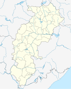
Dalli-Rajhara is a town and a municipality in Balod district in the state of Chhattisgarh, India. Dalli Rajhara is home of iron ore captive mines for Bhilai Steel Plant, the largest integrated steel plant in India. Dalli mines deposit was discovered by Pramatha Nath Bose, the first Indian graded officer of the Geological Survey of India around 1900.

Donimalai Township is a township in Bellary district in the state of Karnataka, India.

Hesla is a village in Bagodar CD Block in Bagodar-Saria subdivision of Giridih district in the Indian state of Jharkhand.

Kachu Pukur is a census town in Habibpur CD Block in Malda Sadar subdivision of Malda district in the Indian state of West Bengal.

Kendua is a census town in Habibpur CD Block in Malda Sadar subdivision of Malda district in the Indian state of West Bengal.

Kiriburu is a census town in Jharkhand. The town is mainly known for having big Iron-ore Mines KIOM & MIOM both governed by Steel Authority of India Limited (SAIL). The road connecting the township to the mines is divided by the border of Odisha and Jharkhand. It is also a famous hill station situated in the core of Saranda forest. Saranda forest is land of seven hundred hills. The name of the forest Saranda is due to the large number of elephants found in this forest. The forest has some good water falls and hill views.

Narnaul is a city, a municipal council, and location of headquarters of the Mahendragarh district in the Indian state of Haryana. It is located in the National Capital Region of India.

Salap is a census town in Domjur CD Block of Howrah Sadar subdivision in Howrah district in the Indian state of West Bengal. It is a part of Kolkata Urban Agglomeration.

Tensa is a Town Wonder Natural Hill Station in Sundargarh District in the Indian state of Odisha. Tensa has been declared the best mine by the Director General of Mines Safety, Govt. of India. The origins of Tensa are unknown but it is believed that Tensa used to be a tribal settlement prior to industrialization. Soon after the coming of Steel Authority of India Limited (SAIL) Iron Mines in 1960. The township and Ore Processing Plant was officially inaugurated by then Governor of Odisha, Hon'ble Shri Yeshwant Narayan Sukthankar on 25 April 1961.

Ukwa is a census town in Balaghat district in the Indian state of Madhya Pradesh.


