Baharagora

Last updated

Baharagora
Town
India Jharkhand location map.svg
Red pog.svg
Baharagora
Location in Jharkhand, India
India location map 3.png
Red pog.svg
Baharagora
Baharagora (India)
Coordinates: 22°17′N86°43′E / 22.28°N 86.72°E / 22.28; 86.72
CountryIndia
State Jharkhand
District East Singhbhum
Elevation
79 m (259 ft)
Population
 (2011)
  Total1,132
Languages*
   Official Hindi, Santali
Time zone UTC+5:30 (IST)
PIN
832101
Telephone code91-6594
Vehicle registration JH 05
Literacy89.54%
Lok Sabha constituency Jamshedpur
Vidhan Sabha constituency Baharagora
Website jamshedpur.nic.in

Baharagora is a town in the Baharagora CD block in the Ghatshila subdivision of the East Singhbhum district, in the Indian state of Jharkhand.

Contents

History

Baharagora CD block was established in 1956.

Geography

Baharagora
Cities, towns and locations in East Singhbhum district in Kolhan Division (Locations around Jamshedpur are shown in the Jamshedpur Urban Agglomeration map - see Bagbera Colony page)
M: municipality, R: rural/ urban centre, CT: census town, T: tourist centre
Owing to space constraints in the small map, the actual locations in a larger map may vary slightly

Location

Baharagora is located at 22°17′N86°43′E / 22.28°N 86.72°E / 22.28; 86.72 . [1] It has an average elevation of 79 m (259 ft). The Subarnarekha River flows along its adjoining areas (approx at a distance of 7 km [4.3 mi]).

It is situated on the south-east corner of Jharkhand. It is 60 km (37 mi) from Kharagpur, 90 km (56 mi) from Jamshedpur, 50 km (31 mi) from Ghatshila, 50 km (31 mi) from Baripada and 200 km (120 mi) from Kolkata

Baharagora is the entry point of Jharkhand from the two states, namely West Bengal and Odisha, as it is located at the border, West Bengal is approx 12 km (7.5 mi) and Odisha is approx 7 km (4.3 mi) from there.

Civic administration

There is a police station at Baharagora. [2]

The headquarters of Baharagora CD block is located at Baharagora village. [3]

Demographics

According to the 2011 Census of India, Baharagora had a total population of 1,132, of which 571 (50%) were males and 561 (50%) were females. Population in the age range 0-6 years was 128. The total number of literate persons in Baharagora was 899 (89.54% of the population over 6 years). [4]

(*For language details see Baharagora block#Language and religion)

Dialect spoken: Bahraagi [5]

Transport

Baharagora is a very important hub for transport as National Highway 6/Asian Highway 46 passes through here and almost all the Transport Companies have their transit hub here. National Highway 18 connects NH 6 at Baharagora and NH 2 at Barhi, Jharkhand. It is connected to Baripada in Odisha by NH 18.

The nearest railway stations are Chakulia 30.6 km (19.0 mi), Ghatsila 47 km (29 mi), Jhargram 50 km (31 mi), Kharagpur 60 km (37 mi), Tatanagar 90 km (56 mi) & Kolkata (Howrah) 189 km (117 mi).

Nearest International Airport Kolkata, Netaji Subhas Chandra Bose International Airport.

Education

Schools

Colleges

Culture

Related Research Articles

<span class="mw-page-title-main">East Singhbhum district</span> District of Jharkhand in India

East Singhbhum is one of the 24 districts of Jharkhand, India. It was created on 16 January 1990. More than 50% of the district is covered by dense forests and mountains, where wild animals once roamed freely. It is known for being a centre of industry since Jamshedpur, the most populous city in Jharkhand, is located here.

<span class="mw-page-title-main">Chakulia</span> Notified Area Council in Jharkhand, India

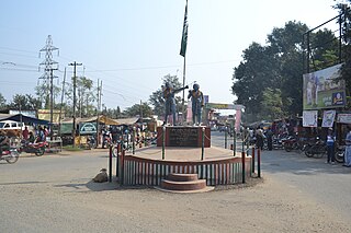
Chakulia or Chakuliya is a Notified Area Council (NAC) and 4th Municipal Corporation in the Ghatshila subdivision of the East Singhbhum district in the state of Jharkhand, India.It is 71 km from Jamshedpur City, the district headquarter.

<span class="mw-page-title-main">Ghatshila</span> Census Town in Jharkhand, India

Ghatshila is a census town in the Ghatshila CD block in the Ghatshila subdivision of the East Singhbhum district, in the Indian state of Jharkhand.

Musabani, also spelt as Mosabani or Mushabani, is a census town in the Musabani CD block in the Ghatshila subdivision of the East Singhbhum district in the Indian state of Jharkhand.

Mahulia is a village in the Ghatshila CD block in the Ghatshila subdivision of the East Singhbhum district, Jharkhand, India.

Kokpara is a village in the Dhalbhumgarh CD block in the Ghatshila subdivision of the East Singhbhum district, Jharkhand, India.

Betnoti is a small town in the Mayurbhanj district in the state of Odisha, India. It is the block headquarter of the Betnoti block. It is 26 kilometres (16 mi) from Baripada, the district headquarters of Mayurbhanj, and 194 kilometres (121 mi) from Bhubaneswar, the capital of Odisha.

Dhalbhumargh is a village in the Dhalbhumgarh CD block in the Ghatshila subdivision of the East Singhbhum District in the Indian state of Jharkhand.

Patamda block is a CD block that forms an administrative division in the Dhalbhum subdivision of East Singhbhum district, in the Indian state of Jharkhand.

<span class="mw-page-title-main">Ghatshila block</span> Community development block in Jharkhand, India

Ghatshila block is a CD block that forms an administrative division in the Ghatshila subdivision of East Singhbhum district, in the Indian state of Jharkhand.

Potka block is a CD block that forms an administrative division in the Dhalbhum subdivision of East Singhbhum district, in the Indian state of Jharkhand.

<span class="mw-page-title-main">Musabani block</span> Community development block in Jharkhand, India

Musabani block is a CD block that forms an administrative division in the Ghatshila subdivision of East Singhbhum district, in the Indian state of Jharkhand.

Dumaria block is a CD block that forms an administrative division in the Ghatshila subdivision of East Singhbhum district, in the Indian state of Jharkhand.

Gurbandha block is a CD block that forms an administrative division in the Ghatshila subdivision of East Singhbhum district, in the Indian state of Jharkhand.

Chakulia block is a CD block that forms an administrative division in the Ghatshila subdivision of East Singhbhum district, in the Indian state of Jharkhand.

Baharagora block is a CD block that forms an administrative division in the Ghatshila subdivision of East Singhbhum district, in the Indian state of Jharkhand.

Hata is a village in the Potka CD block in the Dhalbhum subdivision of the East Singhbhum district in the Indian state of Jharkhand.

Galudih is a village in the Ghatshila CD block in the Ghatshila subdivision of the East Singhbhum district, Jharkhand, India.

Burudi is a village in the Ghatshila CD block in the Ghatshila subdivision of the East Singhbhum district, Jharkhand, India.

<span class="mw-page-title-main">Ghatshila subdivision</span> Subdivision in Jharkhand, India

Ghatshila subdivision is an administrative subdivision of the East Singhbhum district in the Kolhan division in the state of Jharkhand, India.

References

  1. Falling Rain Genomics, Inc - Baharagora
  2. "District Police Profile – East Singhbhum". Jharkhand Police. Archived from the original on 22 June 2022. Retrieved 18 December 2021.
  3. "District Census Handbook, Purbi Singhbhum, Series 21, Part XII A" (PDF). Page 119: Map of Baharagora CD block. Directorate of Census Operations Jharkhand. Retrieved 18 December 2021.
  4. "District Census Handbook, Purbi Singhbhum, Series 21, Part XII B" (PDF). Location code: 364876, Pages 320-321: District primary census abstract, 2011 census. Directorate of Census Operations Jharkhand. Retrieved 18 December 2021.
  5. Singh, Manish (April 2018). "TAM Analysis of Baharagora Dialect". ResearchGate. Retrieved 6 September 2020.
  6. baharagora.com Archived 2014-02-24 at the Wayback Machine