Chakuliya

Last updated

Chakuliya
Nagar Panchayat
Nickname(s): 
CKU
India Jharkhand location map.svg
Red pog.svg
Chakuliya
Location in Jharkhand, India
India location map 3.png
Red pog.svg
Chakuliya
Chakuliya (India)
Coordinates: 22°29′N86°43′E / 22.48°N 86.72°E / 22.48; 86.72 Coordinates: 22°29′N86°43′E / 22.48°N 86.72°E / 22.48; 86.72
CountryFlag of India.svg  India
State Jharkhand
District Purbi Singhbhum
Government
  TypeNagar Panchayat
  BodyChakuliya Nagar Panchayat
Area
  Total20.1 km2 (7.8 sq mi)
Elevation
115 m (377 ft)
Population
 (2011)
  Total16,306
  Density810/km2 (2,100/sq mi)
Languages *
   Official Hindi, Urdu
Time zone UTC+5:30 (IST)
Pincode
832301
Telephone code06594
Vehicle registration JH 05
Website udhd.jharkhand.gov.in/ulb/Chakuliya/Chakuliya.aspx/

Chakuliya is a nagar panchayat in the Ghatshila subdivision of the Purbi Singhbhum district in the state of Jharkhand, India. [1]

Contents

History

An airfield was built here by the British in 1942 to conduct raids against the advancing Japanese in Burma and also for operations to transport aid to parts of China. Also, in 1971, during the war of independence of Bangladesh, a guerrilla training camp was set up and used for training volunteers.

Geography

Cities, towns and locations in East Singhbhum district in Kolhan Division (Locations around Jamshedpur are shown in the Jamshedpur Urban Agglomeration map - see Bagbera Colony page)
M: municipality, R: rural/ urban centre, CT: census town, T: tourist centre
Owing to space constraints in the small map, the actual locations in a larger map may vary slightly

Location

Chakulia is located at 22°29′N86°43′E / 22.48°N 86.72°E / 22.48; 86.72 . [2] It has an average elevation of 115 metres (377 feet).[ citation needed ]

Area overview

The area shown in the map “forms a part of the Chota Nagpur Plateau and is a hilly upland tract”. The main rivers draining the district are the Subarnarekha and the Kharkai. [3] The area lying between Jamshedpur and Ghatshila is the main industrial mining zone. The rest of the district is primarily agricultural. In the district, as of 2011, 56.9% of the population lives in the rural areas and a high 43.1% lives in the urban areas. [4]

Note: The map alongside presents some of the notable locations in the district. All places marked in the map are linked in the larger full screen map.

Civic administration

There is a police station at Chakulia. [5] The headquarters of Chakulia CD block is located at Chakulia town. [6]

Demographics

According to the 2011 Census of India, Chakulia had a total population of 16,306, of which 8,352 (51%) were males and 7,954 (49%) were females. Population in the age range 0–6 years was 2,140. The total number of literate persons in Chakulia was 11,174 (78.88% of the population over 6 years). [7]

(*For language details see Chakulia block#Language and religion)

As of 2001 India census, [8] Chakulia had a population of 14,330. Males constitute 52% of the population and females 48%. Chakulia has an average literacy rate of 64%, higher than the national average of 59.5%; with male literacy of 73% and female literacy of 54%. 13% of the population is under 6 years of age.

Economy

Chakulia is famous for its detergent soap and powder manufactured by South East Chemical/Hindustan Soap Factory and also known for bamboo.

Transportation

Chakulia is connected by railway and road, and lies in the Howrah-Mumbai rail route. It is also among the major economic hubs which lie between Jamshedpur and Kharagpur. Trains and transport vehicles are easily available from major nearby cities, such as Kharagpur (West Bengal), Tatanagar (Jharkhand), Baripada (Orissa). Chakulia also has an airfield which was used heavily during the World War II.

Education

Shibu Ranjan Khan Memorial Degree College was established at Chakuliya in 2010. [9]

K.N.J High School, Chakulia

Ramkrishna Vivekanand International English High School, Chakulia

Shanti Devi Saraswati Shishu Vidya Mandir, Chakulia

Ananda Marga High School, Chakulia

N.D Rungta Girl's High School, Chakulia

Kasturba Gandhi Balika Vidyalaya, Chakulia

Model School, Chakulia

Manohar Lal High School, Chakulia

District Institute of Education and Training, Chakulia

Swami Vivekananda Pvt. ITI, Chakulia

Healthcare

Related Research Articles

Baharagora is a village in the Baharagora CD block in the Ghatshila subdivision of the East Singhbhum district, in the Indian state of Jharkhand.

Ghatshila Census Town in Jharkhand, India

Ghatshila is a census town in the Ghatshila CD block in the Ghatshila subdivision of the East Singhbhum district, in the Indian state of Jharkhand.

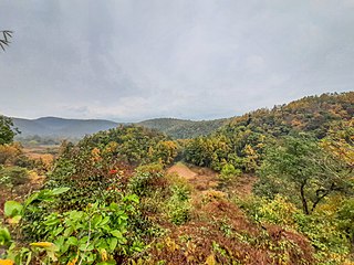
Musabani, also spelt as Mosabani or Mushabani, is a census town in the Musabani CD block in the Ghatshila subdivision of the Purbi Singhbhum district in the Indian state of Jharkhand.

Mahulia is a village in the Ghatshila CD block in the Ghatshila subdivision of the East Singhbhum district, Jharkhand, India.

Patamda block is a CD block that forms an administrative division in the Dhalbhum subdivision of East Singhbhum district, in the Indian state of Jharkhand.

Boram block Community development block in Jharkhand, India

Boram block is a CD block that forms an administrative division in the Dhalbhum subdivision of East Singhbhum district, in the Indian state of Jharkhand.

Golmuri-cum-Jugsalai block is a CD block that forms an administrative division in the Dhalbhum subdivision of East Singhbhum district, in the Indian state of Jharkhand.

Ghatshila block Community development block in Jharkhand, India

Ghatshila block is a CD block that forms an administrative division in the Ghatshila subdivision of East Singhbhum district, in the Indian state of Jharkhand.

Potka block is a CD block that forms an administrative division in the Dhalbhum subdivision of East Singhbhum district, in the Indian state of Jharkhand.

Musabani block Community development block in Jharkhand, India

Musabani block is a CD block that forms an administrative division in the Ghatshila subdivision of East Singhbhum district, in the Indian state of Jharkhand.

Dumaria block is a CD block that forms an administrative division in the Ghatshila subdivision of East Singhbhum district, in the Indian state of Jharkhand.

Dhalbhumgarh block is a CD block that forms an administrative division in the Ghatshila subdivision of East Singhbhum district, in the Indian state of Jharkhand.

Gurbandha block is a CD block that forms an administrative division in the Ghatshila subdivision of East Singhbhum district, in the Indian state of Jharkhand.

Chakulia block is a CD block that forms an administrative division in the Ghatshila subdivision of East Singhbhum district, in the Indian state of Jharkhand.

Baharagora block is a CD block that forms an administrative division in the Ghatshila subdivision of East Singhbhum district, in the Indian state of Jharkhand.

Boram' is a village in the Boram CD block in the Dhalbhum subdivision of the Purbi Singhum district in the Indian state of Jharkhand.

Gurbandha is a village in the Gurbandha CD block in the Ghatshila subdivision of the Purbi Singhum district in the Indian state of Jharkhand.

Galudih is a village in the Ghatshila CD block in the Ghatshila subdivision of the East Singhbhum district, Jharkhand, India.

Burudi is a village in the Ghatshila CD block in the Ghatshila subdivision of the East Singhbhum district, Jharkhand, India.

Ghatshila subdivision Subdivision in Jharkhand, India

Ghatshila subdivision is an administrative subdivision of the East Singhbhum district in the Kolhan division in the state of Jharkhand, India.

References

  1. "Chakuliya Nagar Panchayat". udhd.jharkhand.gov.in. Retrieved 23 December 2021.
  2. Falling Rain Genomics, Inc - Chakulia
  3. "District Census Handbook, Purbi Singhbhum, Series 21, Part XII A" (PDF). Page 7: Natural Divisions. Directorate of Census Operations Jharkhand. Retrieved 25 December 2021.
  4. "District Census Handbook, Purbi Singhbhum, Series 21, Part XII A" (PDF). Page 9: Industrialisation, Page 22: Census findings – Population and its Distribution. Directorate of Census Operations Jharkhand. Retrieved 25 December 2021.
  5. "District Police Profile – East Singhbhum". Jharkhand Police. Retrieved 8 December 2021.
  6. "District Census Handbook, Purbi Singhbhum, Series 21, Part XII A" (PDF). Page 112: Map of Chakulia CD block. Directorate of Census Operations Jharkhand. Retrieved 8 December 2021.
  7. "District Census Handbook, Purbi Singhbhum, Series 21, Part XII B" (PDF). Location code: 801783, Pages 32-33: District primary census abstract, 2011 census. Directorate of Census Operations Jharkhand. Retrieved 18 December 2021.
  8. "Census of India 2001: Data from the 2001 Census, including cities, villages and towns (Provisional)". Census Commission of India. Archived from the original on 16 June 2004. Retrieved 1 November 2008.
  9. "Our Journey in a Jiffy". Southeast Chemicals. Retrieved 30 December 2021.
  10. https://jamshedpur.nic.in/health/