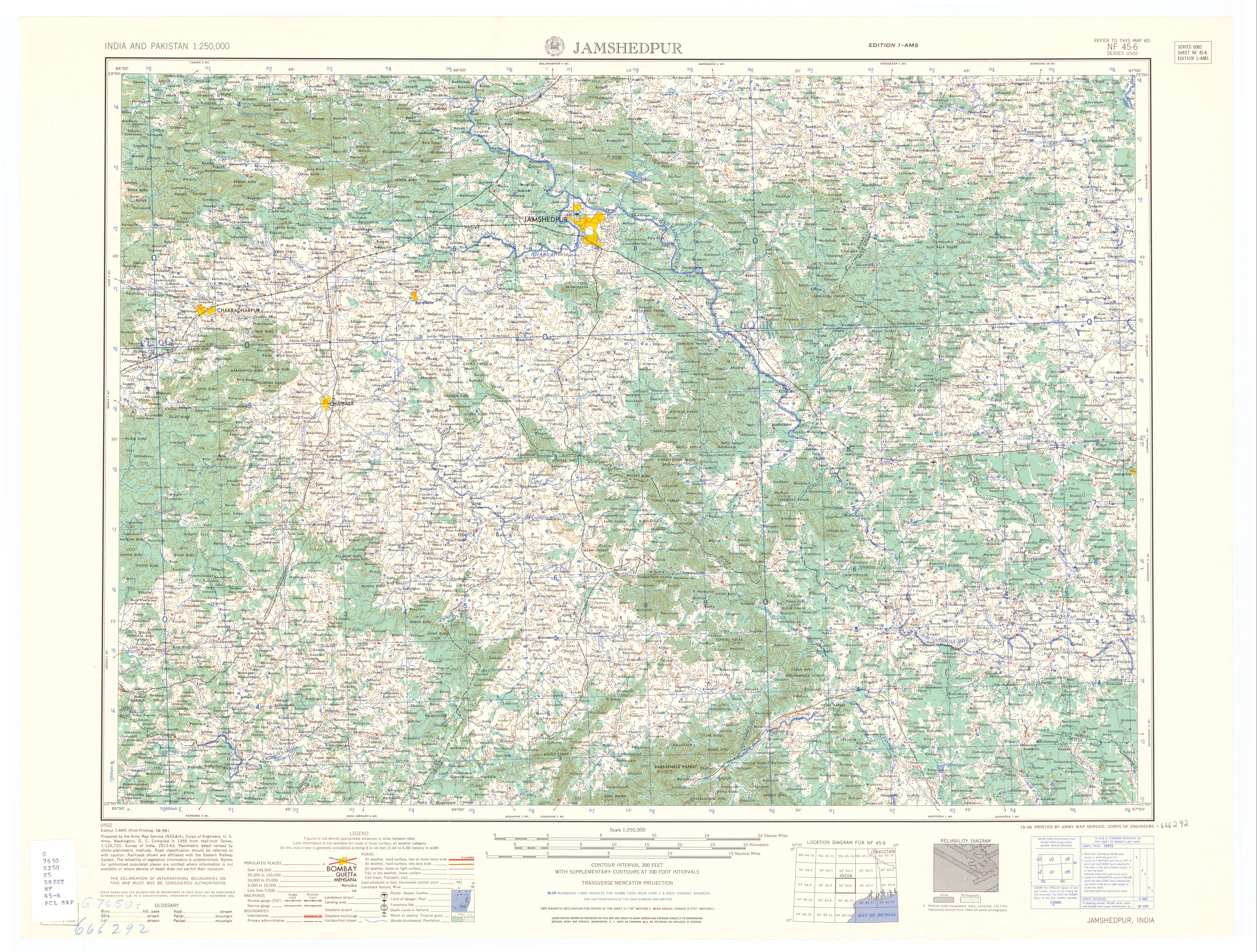
It arises in Mayurbhanj district, Odisha, on the north slopes of Darbarmela Parbat and the western slopes of Tungru Pahar,[1] of the Simlipal Massif.[2] It flows past Rairangpur and heads north to about Saraikela[3] and then east, entering the Subarnarekha in northwestern Jamshedpur. Its tributaries in Orissa include the Kardkai, on the left; the Kandria, Nusa and Barhai on the right; and the Karanjia on the left.[1] For about 9 kilometres (6mi) below the junction with the Karanjia, the Kharkai forms the boundary between Odisha and Jharkhand State.[1] After entering Jharkhand, its tributaries include the Torlo and Ili Gara on the left.[1] Its last major tributary is the Sanjai,[4] entering from the left, 17 kilometres (11mi), as the river flows, above its mouth.[1]
The valley of the lower Kharkai is quite wide and rice is the primary crop.[4] Iron ore is mined in the mountains of the headwaters of the Kharkai, and there is a steel plant at Jamshedpur.[3] The Kharkai Dam is located at Ichha, Odisha.[5]
Name
Some think that Kharkāi is derived from the Sanskrit word Kharakāyā meaning "fast flowing river" (khara means "fast" and kāyā means "body").[citation needed]
Jharkhand is a state in eastern India. The state shares its border with the states of West Bengal to the east, Chhattisgarh to the west, Uttar Pradesh to the northwest, Bihar to the north and Odisha to the south. It is the 15th largest state by area, and the 14th largest by population. Hindi is the official language of the state. The city of Ranchi is its capital and Dumka its sub-capital. The state is known for its waterfalls, hills and holy places; Baidyanath Dham, Parasnath, Dewri and Rajrappa are major religious sites. Jharkhand is primarily rural, with about 24% of its population living in cities as of 2011.
Jamshedpur, also known as Tatanagar, is a major industrial city in eastern India. It is largest city in the state of Jharkhand and stands as the third largest metropolitan area in the region. With a population of 629,658 in the city limits, the wider metropolitan area is home to around 1.3 million people. Located on the confluence of Swarnarekha and Kharkai rivers, Jamshedpur is surrounded by picturesque promenade Dalma Hills.
The Chota Nagpur Plateau is a plateau in eastern India, which covers much of Jharkhand state as well as adjacent parts of Chhattisgarh, Odisha, West Bengal and Bihar. The Indo-Gangetic plain lies to the north and east of the plateau, and the basin of the Mahanadi river lies to the south. The total area of the Chota Nagpur Plateau is approximately 65,000 square kilometres (25,000 sq mi).
The Subarnarekha River flows through the Indian states of Jharkhand, West Bengal and Odisha.
Adityapur is a city and suburb in Jamshedpur, Jharkhand, India. It is a nagar parishad in the Seraikela Sadar subdivision in the Seraikela Kharsawan district. Adityapur is part of the Greater Jamshedpur, under the Indian government's Jawaharlal Nehru National Urban Renewal Mission (JNNURM). It is separated from Jamshedpur by the Kharkai River.
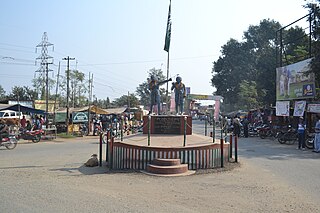
Jadugora is a census town in the Musabani CD block in the Ghatshila subdivision of the East Singhbhum district in the Indian state of Jharkhand.
Mahulia is a village in the Ghatshila CD block in the Ghatshila subdivision of the East Singhbhum district, Jharkhand, India.
Kokpara is a village in the Dhalbhumgarh CD block in the Ghatshila subdivision of the East Singhbhum district, Jharkhand, India.
Odisha is one of the 28 states in the Republic of India. Odisha is located in the eastern part of the Indian peninsula and the Bay of Bengal lies to its East while Chhattisgarh shares its border in the west and north-west. The state also shares geographic boundaries with West Bengal in the north-east, Jharkhand in the north and Andhra Pradesh in the south. The state is spread over an area of 1,55,707 km2 and extends for 700 km from north to south and 500 kilometres from east to west. Its coastline is 450 km long. The state is divided into 30 districts which are further subdivided into 314 blocks called tahasil.
South Koel River is a 285 kilometres (177 mi) long river which runs across Jharkhand and Odisha states in India. It originates on the Lawapani Waterfalls, near Lohardaga, Chota Nagpur Plateau a Lawapani Waterfalls, near Lohardaga, Chota Nagpur Plateau 82.5 kilometres (51 mi) from Ranchi, and conjoins the Belsiangar and Singbhum Rivers. The Koel is fed by three streams in Jharkhand, namely the North Karo, South Karo and Koina. The South Koel enters Odisha and joins with Sankh River at Vedavyas near Rourkela from where it is named as Brahmani.
Sakchi was a village in north eastern Indian territory of Singhbhum which was selected by Jamsetji Tata to be the location of a planned steel city, which in 1919 became Jamshedpur. Sakchi is now part of the city between the Tata Steel site and the river Subarnarekha. Then it was known as Kalimati. Due to the presence of iron ore, river water and sand, Jamsetji Tata decided to establish TISCO there. The company is now known as Tata Steel Ltd.
Chandil Dam was built across the Subarnarekha, in Bihar, as a part of the Subarnarekha Multipurpose Project.
Patamda is a small town in the Patamda CD block in the Dhalbhum subdivision of the East Singhbhum district in the Indian state of Jharkhand.
Boram is a village in the Boram CD block in the Dhalbhum subdivision of the East Singhbhum district in the Indian state of Jharkhand.
Potka is a village in the Potka CD block in the Dhalbhum subdivision of the East Singhum district in the Indian state of Jharkhand.
Dumaria is a village in the Dumaria CD block in the Ghatshila subdivision of the East Singhbhum district in the Indian state of Jharkhand.
Gurbandha is a village in the Gurbandha CD block in the Ghatshila subdivision of the East Singhbhum district in the Indian state of Jharkhand.
Hata is a village in the Potka CD block in the Dhalbhum subdivision of the East Singhbhum district in the Indian state of Jharkhand.
Galudih is a village in the Ghatshila CD block in the Ghatshila subdivision of the East Singhbhum district, Jharkhand, India.
Burudi is a village in the Ghatshila CD block in the Ghatshila subdivision of the East Singhbhum district, Jharkhand, India.
This page is based on this Wikipedia article Text is available under the CC BY-SA 4.0 license; additional terms may apply. Images, videos and audio are available under their respective licenses.


