Related Research Articles

Jharkhand is a state in eastern India. The state shares its border with the states of West Bengal to the east, Chhattisgarh to the west, Uttar Pradesh to the northwest, Bihar to the north and Odisha to the south. It has an area of 79,716 km2 (30,779 sq mi). It is the 15th largest state by area, and the 14th largest by population. Hindi is the official language of the state. The city of Ranchi is its capital and Dumka its sub-capital. The state is known for its waterfalls, hills and holy places; Baidyanath Dham, Parasnath, Dewri and Rajrappa are major religious sites.
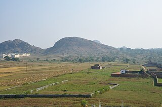
The Chota Nagpur Plateau is a plateau in eastern India, which covers much of Jharkhand state as well as adjacent parts of Chhattisgarh, Odisha, West Bengal and Bihar. The Indo-Gangetic plain lies to the north and east of the plateau, and the basin of the Mahanadi river lies to the south. The total area of the Chota Nagpur Plateau is approximately 65,000 square kilometres (25,000 sq mi).
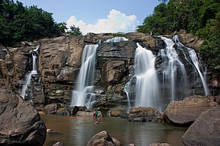
The Jonha Falls is a waterfall located in Ranchi district in the Indian state of Jharkhand.
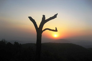
Netarhat is a hill station in Latehar district in the Indian state of Jharkhand. It is also referred to as the "Queen of Chotanagpur", and is a hill station. The town is also famous for Netarhat Residential School, set up in 1954.
Latehar is a town which is a headquarter of Latehar district of Jharkhand state, it is known for its natural environment, forest, forest products and mineral deposits. Latehar remained a part of Palamau District as a sub division since 1924. It was elevated from sub divisional status to a district on 4 April 2001, vide Jharkhand Government Notification No 946 dated 04.04.2001. Latehar is located on the north–west corner of Jharkhand in the Palamau Commissionary. It is surrounded by Ranchi, Lohardaga, Gumla, Palamu and Chatra district apart from Chhattisgarh state and district headquarters is situated at 84.51198 East Longitude and 23.741988 North Latitude.

Palamu district is one of the twenty-four districts of Jharkhand, India. It was formed in 1892. The administrative headquarters of the district is Medininagar, situated on the Koel River.

The Brahmani is a major seasonal river in the Odisha state of eastern India. The Brahmani is formed by the confluence of the Sankh and South Koel rivers, and flows through the districts of Sundargarh, Deogarh, Angul, Dhenkanal, Cuttack, Jajapur and Kendrapara. Also South Koel can be considered as upper reaches of Brahmani. Together with the river Baitarani, Brahmani forms a large delta before emptying into the Bay of Bengal at Dhamra. It is the second widest river in Odisha after Mahanadi.

Latehar district is one of the 24 districts of Jharkhand state in eastern India, and Latehar town is the administrative headquarters of this district. This district is part of Palamu division.
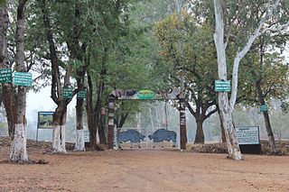
Betla National Park is a national park located on the Chota Nagpur Plateau in the Latehar and Palamu district of Jharkhand, India. The park hosts a wide variety of wildlife.

The Lodh Falls is a waterfall in a mid forest of Palamau Tiger Reserve, South division of Latehar district in Jharkhand state in India. It is the highest waterfall in Jharkhand and the 21st highest waterfall in India.

The Sankh River flows across Jharkhand, Chhattisgarh and Odisha states in India. The river flows for 240 kilometres (150 mi) before it meets the Koel River in Odisha.
South Koel River is a 285 kilometres (177 mi) long river which runs across Jharkhand and Odisha states in India. It originates on the Lawapani Waterfalls, near Lohardaga, Chota Nagpur Plateau a Lawapani Waterfalls, near Lohardaga, Chota Nagpur Plateau 82.5 kilometres (51 mi) from Ranchi, and conjoins the Belsiangar and Singbhum Rivers. The Koel is fed by three streams in Jharkhand, namely the North Karo, South Karo and Koina. The South Koel enters Odisha and joins with Sankh River at Vedavyas near Rourkela from where it is named as Brahmani.
The North Karo River drains the Indian state of Jharkhand.
North Koel River flows through the Indian state of Jharkhand.
The Auranga River flows through the Latehar and Palamu districts in the Indian state of Jharkhand.
The Amanat River flows through the Chatra and Palamu districts in the Indian state of Jharkhand.

The Punpun River is a tributary of the Ganges. It originates in Palamu district of Jharkhand and flows through Chatra, Aurangabad, Gaya and Patna districts of the Indian states of Jharkhand and Bihar. Punpun is a place named after the Punpun river in Patna which is situated on the bank of Punpun river. On the bank of Punpun people celebrate Chhath Puja.
The DIGALRiver is a tributary of the Son River and flows through the India states of Chhattisgarh, Jharkhand and Uttar Pradesh.
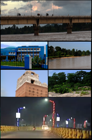
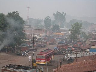
Medininagar, formerly Daltonganj, is a city municipal corporation in the Indian state of Jharkhand. It is the headquarters of Palamu division and Palamu district, as well as the subdivision and block of the same name. The city is situated on the banks of the North Koel River.
Tourism in Jharkhand refers to tourism in the Indian state of Jharkhand. Jharkhand is known for its waterfalls, hills and holy places.
References
- ↑ "Netarhat - In The Line of Fire". Archived from the original on 16 July 2011. Retrieved 29 April 2010.
- ↑ "Gazetteer of Palamu District". Archived from the original on 21 July 2011. Retrieved 29 April 2010.
- ↑ Bukhari, A. Z. (2005). Encyclopedia of nature of geography By A.Z. Bukhari. ISBN 9788126124435 . Retrieved 29 April 2010.
- ↑ "River System" (PDF). Archived from the original (PDF) on 13 July 2011. Retrieved 29 April 2010.
23°40′N84°06′E / 23.667°N 84.100°E
| | This article related to a location in Jharkhand is a stub. You can help Wikipedia by expanding it. |