Sidhi district

Last updated
Sidhi district
Shiva temple and monastery, Chandreh Rampur Naikin, Madhya Pradesh 13.jpg
Chandreh temple
MP Sidhi district map.svg
Location of Sidhi district in Madhya Pradesh
Coordinates(Sidhi): 24°25′N81°53′E / 24.42°N 81.88°E / 24.42; 81.88
CountryFlag of India.svg  India
State Madhya Pradesh
Division Rewa
Headquarters Sidhi
Tehsils 7
Government
   Lok Sabha constituencies Sidhi
Area
  Total4,851 km2 (1,873 sq mi)
Population
 (2011)
  Total1,127,033
  Density230/km2 (600/sq mi)
   Urban
93,121
Demographics
   Literacy 66.09per cent
  Sex ratio952
Time zone UTC+05:30 (IST)
Major highways NH-75
Average annual precipitationnormal mm
Website sidhi.nic.in

Sidhi District is one of the tribal districts of Madhya Pradesh state of India. The town of Sidhi is the district headquarters. The district is part of Rewa Division.

Contents

History

Sidhi is a part of Madhya Pradesh. It forms the northeastern boundary of the state. Sidhi is known for its natural environment, historical importance and cultural roots.[ citation needed ] Sidhi has a number of natural resources with the river Son draining the district, and with coal deposits which feed major industries across the country.

This is the birthplace of Birbal. Located in the area is the Sanjay Tiger Reserve or Sanjay National Park which tells the magnificence of the Lions here. There is also a park - Parasli.[ citation needed ]

Divisions

Sidhi district comprises seven tehsils: Bahari, Churhat, Gopad Banas, Rampur Naikin, Majhauli, Kusmi and Sihawal. There are four Madhya Pradesh Vidhan Sabha constituencies in this district, namely, Churhat, Sidhi, Sihawal and Dhauhani, all of which are part of Sidhi Lok Sabha constituency.

Economy

The Vindhyachal Super Thermal Power Station supplies electricity over a wide area. On one side the spectrum of its floristic socio-cultural diversity and ethnic history of tribal, the district has a panoramic view of the Kaimur, Kehejua and Ranimunda hills blazing with flowers of flame of forest and intoxicated by the sweet smell of mahua flowers. The whole of Sidhi district was part of Rewa state.The economy of this area mainly based on agriculture and allied activities.

In 2006 the Ministry of Panchayati Raj named Chamba one of the country's 250 most backward districts (out of a total of 640). [1] It is one of the 24 districts in Madhya Pradesh currently receiving funds from the Backward Regions Grant Fund Programme (BRGF). [1]

Rulers of Sidhi

In the 1800s, there were three separate rulers of Sidhi, ruling three parts of the territory:

After these came the Rajput Baghelas came from Kasauta, Rewa. They immigrated to Sidhi in the early 19th century. They ruled the western Sidhi territory (Churhat/Rampur) from then on till India gained independence. The last ruler of Churhat was Rao RanBahadur Singhji- elder brother of Arjun Singh.

Ambikehs Pratap Singh (Chhote Sarkar odani) younger brother of raja Tryambkesh Pratap Singh Bardi khatai he is a senior leader of the Madhyapradesh congress

Raja Kant Deo Singh of Bardi Khatai continues to live in the ancestral Haveli located on the banks of the river Sone. He is an active member of the Bharatiya Janata Party

Geography

Sidhi district is located on the Northeastern Boundary of the state between 22,475 and 24.4210 North Latitude and 81:1840 and 824830 East longitude. The district has Singrauli district in the north-east, and Uttar Pradesh Koriya district of Chhattisgarh on the east, and Rewa district on the west.

Sidhi District has a total population of 18,31,152 sharing almost 3.03% of the total population of erstwhile state of Madhya Pradesh in 2001.

Transportation

In town public facilities are easily available like auto rickshaw, bus, taxi there is no online public transport services are available since 2023 . The district currently didn't have its own railway station. The nearest railway is Rewa railway station or Joba railway station . Online couriers service are available. One runway is also present at pathar Village in Sidhi district (13km far).

Air

Closest airport to Sidhi is in Allahabad which is 147 kilometers (91 miles).

Demographics

Historical population
YearPop.±% p.a.
1901180,233    
1911209,968+1.54%
1921180,804−1.48%
1931207,401+1.38%
1941243,103+1.60%
1951266,111+0.91%
1961332,774+2.26%
1971440,669+2.85%
1981532,098+1.90%
1991709,436+2.92%
2001910,983+2.53%
20111,127,033+2.15%
source: [2]
Religions in Sidhi district (2011) [3]
ReligionPercent
Hinduism
95.61%
Islam
3.05%
Other (tribal)
1.11%
Other or not stated
0.23%

According to the 2011 census, Sidhi District has a population of 1,127,033, [4] roughly equal to the nation of Cyprus [5] or the US state of Rhode Island. [6] This gives it a ranking of 411th in India (out of a total of 640). [4] The district has a population density of 232 inhabitants per square kilometre (600/sq mi). [4] Its population growth rate over the decade 2001-2011 was 23.66%. [4] Sidhi has a sex ratio of 952 females for every 1000 males, [4] and a literacy rate of 66.09%. 8.26% of the population lives in urban areas. Scheduled Castes and Tribes made up 11.55% and 27.80% of the population respectively. [4]

Languages

Languages of Sidhi district (2011) [7]

   Hindi (63.39%)
   Bagheli (35.65%)
  Others (0.96%)

At the time of the 2011 Census of India, 63.39% of the population in the district spoke Hindi, 35.65% Bagheli and 0.79% Gondi as their first language. [7]

Education

In 1980, at the time when Arjun Singh was the chief minister of Madhya Pradesh, a committee was formed to find out more about the educational system in Sidhi district. It was tasked to find out which was the first school in Sidhi district, and also, who was the first graduate.

It was popularly thought that Rajasahab Madhwas was the first graduate from Sidhi. The survey further revealed that Shri Divakar Bahadur Singh, village Jhalwar (Churhat), was the first graduate from Allahabad University. He had done his BA in 1924 and had proceeded to do his LLB also from Allahabd University in 1926. Thereafter he had come back to practice and settle in Jhalwar (Churaht) in Sidhi district. His successors are still present in Jhalwar. Among them, Batuk Pratap Singh (Jhalwar) is the source of information regarding the history events in the district.

It was also found that the first school in Sidhi was in Bardi. This school had started around 100 years before the survey, i.e. around the year 1880.

Tehsils of Sidhi

  1. Churhat
  2. Gopadbanas
  3. Kusmi
  4. Majhauli
  5. Rampur Naikin
  6. Sihawal

Notable people

Tourist places

Related Research Articles

<span class="mw-page-title-main">Bagheli language</span> Indo-Aryan language spoken in India

Bagheli or Baghelkhandi is a Central Indo-Aryan language spoken in the Baghelkhand region of central India.

<span class="mw-page-title-main">Vindhya Pradesh</span> Former State of India

Vindhya Pradesh was a former state of India. It occupied an area of 61,131.5 km2. It was created in 1948 as Union of Baghelkhand and Bundelkhand States, shortly after Indian independence, from the territories of the princely states in the eastern portion of the former Central India Agency. It was named as Vindhya Pradesh on 25 January 1950 after the Vindhya Range, which runs through the centre of the province. The capital of the state was the former princely state of Rewa. It lays between Uttar Pradesh to the north and Madhya Pradesh to the south, and the enclave of Datia, which lay a short distance to the west, was surrounded by the state of Madhya Bharat.

<span class="mw-page-title-main">Rewa, Madhya Pradesh</span> City in Madhya Pradesh, India

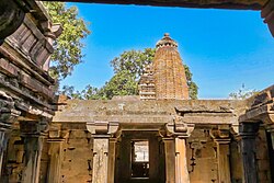
Rewa is a city in the north-eastern part of Madhya Pradesh state in India. It is the administrative center of Rewa District and Rewa Division. The city lies about 420 kilometres (261 mi) northeast of the state capital Bhopal and 230 kilometres (143 mi) north of the city of Jabalpur. The maximum length of Rewa district is 125 km from east to west and the length of Rewa from north to south is 96 km. This area is surrounded by Kaimur hills to the south Vindhyachal ranges pass through the middle of the district. It is famous for the founding of the world's first white tiger safari and beetle nut toys.

<span class="mw-page-title-main">Mahendragarh district</span> District in Haryana, India

Mahendragarh district is one of the 22 districts of Haryana state in northern India. The district occupies an area of 1,899 km² and has a population of 922,088 (2021census). District have 3 Sub-divisions : Narnaul, Mahendragarh and Kanina

<span class="mw-page-title-main">Pratapgarh district, Uttar Pradesh</span> District of Uttar Pradesh in India

The Pratapgarh district is one of the districts of Uttar Pradesh state of India, and Pratapgarh city is the district headquarters. Pratapgarh district is a part of Prayagraj division. The total area of Pratapgarh district is 3730 Sq. km.

<span class="mw-page-title-main">Sheopur district</span> District of Madhya Pradesh in India

Sheopur District is a district of Madhya Pradesh state in central India. The district is located in the north of the state and forms part of Chambal division. It is situated on the periphery of Rajasthan, which shows in the influence of Rajasthani culture in this district.

<span class="mw-page-title-main">Rewa district</span> City and district of Madhya Pradesh in India

Rewa district is a district of the Madhya Pradesh state in central India. The city of Rewa is the district headquarter. Rewa is sometimes called – 'Land of White Tigers' as the first White Tiger was discovered here in 1951 by Maharaja of the province, Martand Singh in the nearby jungle of Govindgarh. Rewa was the capital city of once a state – Vindhya Pradesh.

<span class="mw-page-title-main">Shahdol district</span> District of Madhya Pradesh in India

Shahdol District is a district of Madhya Pradesh state in east central India. It old name was Matsya raj or Virat kingdom in the name of great king Maharaja Virata. With a total area of 6,205 km2 (2,396 sq mi) and a population of 10,66,063. Shahdol is an important district of Madhya Pradesh. The town of Shahdol is the district headquarters. The district formerly comprised Shahdol division.

Satna is a city in the Indian state of Madhya Pradesh. It serves as the headquarters of Satna district. It is 7th largest city and 8th most populous city of the state. The city is 500 km east of the state capital Bhopal. The city is distributed over a land area of 111.9 square kilometres.

<span class="mw-page-title-main">Tikamgarh district</span> District of Madhya Pradesh in India

Tikamgarh district is one of the 52 districts of Madhya Pradesh state in central India. Tikamgarh town is the district headquarters. The district is part of Sagar Division.

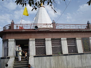
Sidhi is a town and a municipality in Sidhi district in the Indian state of Madhya Pradesh. It is the headquarters of the Sidhi district.

<span class="mw-page-title-main">Banswara district</span> District of Rajasthan in India

Banswara District has an area of 5,037 km2 (1,945 sq mi), which is 1.47% of Rajasthan state, India. The city of Banswara is the district headquarters. It is bounded on the north by Udaipur District, on the northeast by Pratapgarh District, on the east and southeast by Madhya Pradesh state, on the southwest by Gujarat state, and on the west by Dungarpur District.

Churhat is a town, near the town of Sidhi and a nagar panchayat in Sidhi district in the state of Madhya Pradesh, India.

<span class="mw-page-title-main">Satna district</span> District of Madhya Pradesh in India

Satna District is a district of Madhya Pradesh state in central India. The city of Satna is the district headquarters. The district has an area of 7,502 km², and a population of 22,28,935(2011 census), 20.63% of which is urban. The district has a population density of 249 persons per km².

<span class="mw-page-title-main">Singrauli district</span> City and district of Madhya Pradesh in India

Singrauli district is one of the districts in the Indian state of Madhya Pradesh.

<span class="mw-page-title-main">Awadhesh Pratap Singh University</span> State University in Madhya Pradesh

Awadhesh Pratap Singh University is a public university in Rewa city, Madhya Pradesh. The university was named after Captain Awadhesh Pratap Singh, a politician and an activist. Awadhesh Pratap Singh University is a non-profit public higher education institution located in the urban setting of the small city of Rewa, Madhya Pradesh. Officially recognized by the University Grants Commission of India, Awadhesh Pratap Singh University is a co-educational Indian higher education institution. It offers courses and programs leading to officially recognized higher education degrees such as bachelor degrees, master degrees in several areas of study. The university also provides several academic and non-academic facilities and services to students including a library, online courses and distance learning opportunities, as well as administrative services.

<span class="mw-page-title-main">Amethi district</span> District of Uttar Pradesh in India

Amethi district is the 72nd district of the state of Uttar Pradesh in northern India. This district is a part of Ayodhya division in the Awadh region of the Uttar Pradesh. It covers an area of 2329.11 km2. Gauriganj is the administrative headquarters of the district.

Kunwar Singh Tekam is the Bharatiya Janata Party Member of the Madhya Pradesh Legislative Assembly for Dhauhani constituency in Sidhi district. He gained 60704 (54.58%) votes in the 2008 election. He gained 60130 votes in the 2013 election and was reelected in the 2018 election.

Riti Pathak is a member of the Lower House of Parliament in India from Sidhi in Madhya Pradesh who belongs to Bharatiya Janata Party. She was first elected to the Lok Sabha in the 2014 Lok Sabha elections as a candidate of the Bharatiya Janata Party from Sidhi seat of Madhya Pradesh, and won seat by defeating the INC candidate by a margin of 1,08,046 votes. She was re-elected to the 17th Loksabha in 2019. She won the Sidhi seat again by defeating the Congress candidate Shri Ajay Singh by a margin of 2,86,520 votes.

<span class="mw-page-title-main">Political families of Madhya Pradesh</span>

The Political families of Madhya Pradesh are a group of older families that exert considerable influence throughout the region.

References

  1. 1 2 Ministry of Panchayati Raj (September 8, 2009). "A Note on the Backward Regions Grant Fund Programme" (PDF). National Institute of Rural Development. Archived from the original (PDF) on April 5, 2012. Retrieved September 27, 2011.
  2. "Table A-02 Decadal Variation in Population Since 1901: Madhya Pradesh" (PDF). census.gov.in. Registrar General and Census Commissioner of India.
  3. "Table C-01 Population By Religion: Madhya Pradesh". census.gov.in. Registrar General and Census Commissioner of India.
  4. 1 2 3 4 5 6 "District Census Handbook: Sidhi" (PDF). Census of India . Registrar General and Census Commissioner of India. 2011.
  5. US Directorate of Intelligence. "Country Comparison:Population". Archived from the original on June 13, 2007. Retrieved 2011-10-01. Cyprus 1,120,489 July 2011 est.
  6. "2010 Resident Population Data". U. S. Census Bureau. Retrieved 2011-09-30. Rhode Island 1,052,567
  7. 1 2 "Table C-16 Population by Mother Tongue: Madhya Pradesh". censusindia.gov.in. Registrar General and Census Commissioner of India.